More From Contributor
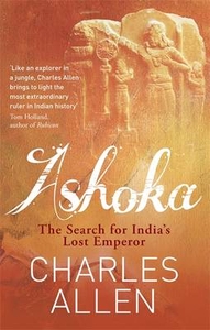
£3.50
Ashington in 1896 in a fascinating series of reproductions of old Ordnance Survey plans in the Alan Godfrey Editions, ideal for anyone interested in the history of their neighbourhood or family. The map shows the mining village of Ashington, considered a model pit village when founded in the 1860s. Ashington Colliery is in the centre & below this are the neat rows of terraces, named ` First Row` up to ` Ninth Row`. These all faced south & had long gardens. South of them are St Sepulchre`s church, Portland Arms Hotel, Miners Hall & Market Place. To the east is the NER line with Ashington station, & beyond this the map covers part of New Hirst. However, the notable feature of this map is the tramway system, a network of track which was ultimately around ten miles long & served virtually every street & house. These tracks are shown here in detail, both in Ashington & New Hirst. On the reverse is part of sheet 65.09, extending coverage eastward to Woodhorn Colliery. About the Alan Godfrey Editions of the 25” OS Series: Selected towns in Great Britain & Ireland are covered by maps showing the extent of urban development in the last decades of the 19th & early 20th century. The plans have been taken from the Ordnance Survey mapping & reprinted at about 15 inches to one mile (1:4, 340). On the reverse most maps have historical notes & many also include extracts from contemporary directories. Most maps cover about one mile (1.6kms) north/south, one & a half miles (2.4kms) across; adjoining sheets can be combined to provide wider coverage.FOR MORE INFORMATION & A COMPLETE LIST OF ALL AVAILABLE TITLES PLEASE CLICK ON THE SERIES LINK. ...
Archived Product
£3.99
Ashland & Southern Oregon in the Moon Spotlight guide series; covering a range of specific local cities, districts, areas & regions in North, Central & South America & targeted at those seeking to travel to a specific area within a country. Each of the guides has been extracted in full from the relevant country Moon Handbook & individual titles focus on a particular city, region or notable area of the destination. Many of the guides in the series are unique in their coverage, although are limited in putting the destination into its wider geographical context that a more comprehensive guide would provide. Stylistically, Moon ...
Archived Product
£8.99
Kate, a grieving, semi-alcoholic film student, invites an elderly woman to take part in an oral-history documentary. Jean declines, but makes her a bizarre counter-offer: if Kate can stay sober for four days, she will tell her a story. If she can stay sober beyond that, there will be another, & then another, amounting to the entire history of one family`s life. Gradually, Jean offers a heart-breaking account, not only of her own history
- a lost lover, a family scarred by war
- but of the American century itself; as a deep connection emerges between the women which will transform both of their lives.

...
Archived Product
£16.99
It is 1999. Kate Lambert, a grieving, semi-alcoholic film student, invites an elderly woman to take part in an oral-history documentary. The woman, Jean Culver, declines, but makes her a bizarre counter-offer: if Kate can stay sober for four days, she will tell her a story. & if she can stay sober beyond that, there will be another, & then another, amounting to the entire history of one family`s life. Though still shattered by the death of her father, & by the desultory abuse imposed by Laurits, her enigmatic collaborator & erstwhile lover
- Kate is soon drawn into a Scheherazade-like matrix of tales, some painfully final, some still unfinished, in which Jean gradually offers a heartbreaking account, not only of one family, but of the American century itself, from World War II to Vietnam & the Weather Underground. A profound, mysterious, deeply moving novel
- a meeting of love & grief, like water on arid soil
- Ashland & Vine is the story of an unlikely friendship that transcends time, age & the limits of narrative to reveal the unexpected grace that comes of listening to another`s history, while telling, as carefully as we can, what we know of our own.


...
Archived Product
£25.00
India's lost emperor Ashoka Maurya has a special place in history. In his quest to govern India by moral force alone Ashoka turned Buddhism from a minor sect into a world religion & set up a new yardstick for government which had huge implications for Asia. But his brave experiment ended in tragedy & his name was cleansed from the record so effectively that he was forgotten for almost two thousand years. But a few mysterious stone monuments & inscriptions survived, & the story of how these keystones to the past were discovered by British Orientalists & their mysterious lettering deciphered is every bit as remarkable as their author himself. Bit by bit, fragments of the Ashokan story were found & in the process India's ancient history was itself recovered. In a wide-ranging, multi-layered journey of discovery that is as much about Britain's entanglement with India as it as about India's distant past, Charles Allen tells the story of the man who was arguably the greatest ruler India has ever known. ...
Archived Product
£17.99
One of the titles in a series of maps from the Israeli Survey, in Hebrew
- with some Roman alphabet equivalents, providing coverage
...
Archived Product
£3.50
Ashton & Dukinfield in 1907 in a fascinating series of reproductions of old Ordnance Survey plans in the Alan Godfrey Editions, ideal for anyone interested in the history of their neighbourhood or family. Two versions have been published for this area: The 1896 map is blank north of the zigzagging county boundary. However, the Cheshire area, covering much of Dukinfield, is full of interest. Features here include Market Place area, Dukinfield Lodge, Cemetery, Oxford Road Mills, Sandy Vale Print Works, Wellington Mills, Tame Valley Mills, stretches of railway crossing & re-crossing the county boundary, two Dukinfield stations, St Mark`s church, Chapel Pits, Bridge Eye Mills, etc. On the reverse is a commercial directory of Dukinfield in 1898. This title, the 1907 version, also

Includes::
much of Ashton under Lyne, with coverage extending northward to Ashton Market Place & westward to St Peter`s church. Features in Ashton include Empire Hippodrome, tramways, numerous mills, St Michael`s church, Albion School, Park Parade station, good stretches of the GCR, LNWR & L&Y railways, Henry Square area, etc. About the Alan Godfrey Editions of the 25” OS Series: Selected towns in Great Britain & Ireland are covered by maps showing the extent of urban development in the last decades of the 19th & early 20th century. The plans have been taken from the Ordnance Survey mapping & reprinted at about 15 inches to one mile (1:4, 340). On the reverse most maps have historical notes & many also include extracts from contemporary directories. Most maps cover about one mile (1.6kms) north/south, one & a half miles (2.4kms) across; adjoining sheets can be combined to provide wider coverage.FOR MORE INFORMATION & A COMPLETE LIST OF ALL AVAILABLE TITLES PLEASE CLICK ON THE SERIES LINK.

...
Archived Product
£3.50
Ashton in Makerfield in 1906 in a fascinating series of reproductions of old Ordnance Survey plans in the Alan Godfrey Editions, ideal for anyone interested in the history of their neighbourhood or family. The map covers most of the small town of Ashton in Makerfield, once an urban district but today part of Wigan MBC. Features include St Thomas church, St Oswald RC church, Market, tramways, St Oswald`s Schools, Town Bridge, Jubilee Parks, Old Road, Garswood Hall Colliery Institute, Home Farm, Garswood Hall, Barrow Lane Colliery, etc. Coverage extends west to Park Collieries, the LNWR Lancashire Union Line with Garswood station (at margin of map), Birchenheds Colliery, Hinge & Lock Factory, Ashton Cross, etc. On the reverse is a timetable for the Liverpool-Wigan line. About the Alan Godfrey Editions of the 25” OS Series: Selected towns in Great Britain & Ireland are covered by maps showing the extent of urban development in the last decades of the 19th & early 20th century. The plans have been taken from the Ordnance Survey mapping & reprinted at about 15 inches to one mile (1:4, 340). On the reverse most maps have historical notes & many also include extracts from contemporary directories. Most maps cover about one mile (1.6kms) north/south, one & a half miles (2.4kms) across; adjoining sheets can be combined to provide wider coverage.FOR MORE INFORMATION & A COMPLETE LIST OF ALL AVAILABLE TITLES PLEASE CLICK ON THE SERIES LINK. ...
Archived Product
£3.50
Ashton in Makerfield East & Edge Green in 1906 in a fascinating series of reproductions of old Ordnance Survey plans in the Alan Godfrey Editions, ideal for anyone interested in the history of their neighbourhood or family. The map covers the eastern part of Ashton in Makerfield, now part of Wigan MBC. Coverage stretches from Town Green & York Road eastward to Dam Lane & Edge Green Colliery. Features include the eastern part of Ashton, incl Record Cotton Mill, Town Green Farm, Cookson`s Farm, Bolton Road & tramway. Further east the map

Includes::
Golborne Road, Edge Green Colliery, a stretch of the GCR St Helen`s Branch, Garswood Hall Collieries Shaft 9, Harrow Hotel, & several mineral lines around Edge Green. On the reverse is a list of private residents in Ashton from a 1918 directory. About the Alan Godfrey Editions of the 25” OS Series: Selected towns in Great Britain & Ireland are covered by maps showing the extent of urban development in the last decades of the 19th & early 20th century. The plans have been taken from the Ordnance Survey mapping & reprinted at about 15 inches to one mile (1:4, 340). On the reverse most maps have historical notes & many also include extracts from contemporary directories. Most maps cover about one mile (1.6kms) north/south, one & a half miles (2.4kms) across; adjoining sheets can be combined to provide wider coverage.FOR MORE INFORMATION & A COMPLETE LIST OF ALL AVAILABLE TITLES PLEASE CLICK ON THE SERIES LINK.

...
Archived Product
£2.95
Ashton upon Mersey in 1908 in a fascinating series of reproductions of old Ordnance Survey plans in the Alan Godfrey Editions, ideal for anyone interested in the history of their neighbourhood or family. Selected towns in Great Britain & Ireland are covered by maps showing the extent of urban development in the last decades of the 19th & early 20th century. In this title: this detailed map covers much of Ashton upon Mersey, with coverage extending from Park Road & Washway Road westward to the parish boundary, & from Ashton New Hall southward to Woodheys Farm & Hesketh Road. Features include tramway, Oaklee Farm, St Mary Madgalene church, Macum Farm, graveyard of St Martin's church (church itself just off to the north), Ivy Farm, Ingestre, Green Lane area, Ashton Lane, Moss Lane, numerous streets of housing
- terraced, semi & detached
- shown in detail. On the reverse are extracts from a 1906 street directory for Barker's Lane, Beech Grove, Carlton Road, Green Lane, Harboro' Road, Moss Lane, Urban Road. About the Alan Godfrey Editions of the 25

...
Archived Product

Ashoka

India`s lost emperor Ashoka Maurya has a special place in history. In his quest to govern India by moral force alone he turned Buddhism from a minor sect into a world religion, and set up a new yardstick for government. But Ashoka`s bold experiment ended in tragedy and he was forgotten for almost two thousand years. In this beautifully written, multi-layered journey Charles Allen describes how fragments of the Ashokan story were gradually discovered, pieced together by a variety of British Orientalists: antiquarians, archaeologists and epigraphists. In doing so, they did much to recover India`s ancient history itself. The Lost Emperor tells the story of the man who was arguably the greatest ruler India has ever known.
RIP - This product is no longer available on our network. It was last seen on 25.09.2019

This page now acts as a permanent archive for this product. Add more information using the comments box below to ensure it can still be found by future generations.

Use our search facility to see if it is available from an alternative contributor.
  • External links may include paid for promotion
  • Availability: Out Of Stock
  • Supplier: Stanfords
  • SKU: 9780349122380
Availability: In Stock
£12.99

Product Description

India`s lost emperor Ashoka Maurya has a special place in history. In his quest to govern India by moral force alone he turned Buddhism from a minor sect into a world religion, & set up a new yardstick for government. But Ashoka`s bold experiment ended in tragedy & he was forgotten for almost two thousand years. In this beautifully written, multi-layered journey Charles Allen describes how fragments of the Ashokan story were gradually discovered, pieced together by a variety of British Orientalists: antiquarians, archaeologists & epigraphists. In doing so, they did much to recover India`s ancient history itself. The Lost Emperor tells the story of the man who was arguably the greatest ruler India has ever known.

Reviews/Comments

Add New

Intelligent Comparison

Oooops!
We couldn't find anything!
Perhaps this product's unique.... Or perhaps we are still looking for comparisons!
Click to bump this page and we'll hurry up.

Price History

Vouchers

No voucher codes found.
Do you know a voucher code for this product or supplier? Add it to Insights for others to use.

Facebook

Jargon Buster

India - A subcontinent in Asia
History - Anything that happens in the past. An acedemic subject.
World - A physical grouping, commonly used to describe earth and everything associated with ti
Set - a group of items usually related to one another. Some objects cannot function without the complete set of items.
Experiment - A procedure that is undergone to clarify facts and discover new unknown facts

Supplier Information

Stanfords
Stanfords was established in 1853 and opened their iconic Covent Garden flagship store in 1901. They have become the top retailer of maps, travel books and accessories in the UK and arguably offer the largest selection of maps and travel books worldwide. Famous names such as Captain Robert Falcon Scott, Ranulph Fiennes and Michael Palin have purchased from Stanfords. They now have a shop in Bristol and both stores together with other venues operate a calendar of events including talks, book signings and exhibitions. As a specialist map retailer, the map selection is comprehensive and includes road maps, street maps and walking maps from worldwide destinations, as well as a selection of world atlases and wall maps. Books include travel guides and travel literature. Stanfords also stock globes, from miniatures made of blue marble to magnificent floor-standing globes. The website features a selection of interesting articles on travel topics.
Page Updated: 2023-11-12 20:15:36

Community Generated Product Tags

Oh No! The productWIKI community hasn't generated any tags for this product yet!
Menu