
 United Kingdom
 France
 Germany
 Netherlands
 Sweden
 USA
USA
 Italy
Italy
 Spain
Spain
More From Contributor


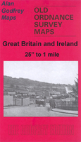
Ashford North 1934
Ashford North in 1934 in a fascinating series of reproductions of old Ordnance Survey plans in the Alan Godfrey Editions, ideal for anyone interested in the history of their neighbourhood or family. Selected towns in Great Britain and Ireland are covered by maps showing the extent of urban development in the last decades of the 19th and early 20th century.In this title: the map covers northern part of Ashford, with the station, the western part of Feltham and the southern part of Stanwell and East Bedfont parishes, including the London Road and Staines Road. Features include railway with Ashford station, Welsh School, several sand and gravel works with tramways, Royal Oak pub, left boundary of borstal, etc. On the reverse is a list of private residents for Ashford from a 1933
directory. About the Alan Godfrey Editions of the 25
directory. About the Alan Godfrey Editions of the 25
Product Description
Reviews/Comments
Add New
Intelligent Comparison
Archived Product

Ashford North 1934 Stanfords
£3.50
Archived Product

Bedford North 1924 Stanfords
£3.50
Archived Product

Deptford North 1914 Stanfords
£3.50
Archived Product

Deptford North 1894 Stanfords
£3.50
Archived Product
Knutsford North 1908 Stanfords
£3.50
Archived Product

Hertford North 1897 Stanfords
£3.50
Archived Product

Bradford North 1906 Stanfords
£3.50
Archived Product

Aberdare North 1914 Stanfords
£3.50
Vouchers
No voucher codes found.
Do you know a voucher code for this product or supplier? Add it to Insights for others to use.
Do you know a voucher code for this product or supplier? Add it to Insights for others to use.
 Denmark