
 United Kingdom
 France
 Germany
 Netherlands
 Sweden
 USA
USA
 Italy
Italy
 Spain
Spain
More From Contributor


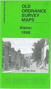
Alston 1898
Alston in 1898 in a fascinating series of reproductions of old Ordnance Survey plans in the Alan Godfrey Editions, ideal for anyone interested in the history of their neighbourhood or family. Selected towns in Great Britain and Ireland are covered by maps showing the extent of urban development in the last decades of the 19th and early 20th century.In this title: this detailed map gives good coverage of the small town of Alston, with coverage extending from the town centre eastward to High Skelgill. Features include town centre with individual buildings neatly shown; railway terminus with coal depot, St Augustine's church, Alston with Garrigill Workhouse, Alston Bridge, Hosiery Works, Market Place, Butts, Jollybeard House, Clitheroe, River Nent, Woollen Mill (disused), old
quarries, Middle Skelgill, Townhead, Townfoot, etc. On the reverse we include extracts from a 1901 trade directory for Alston. About the Alan Godfrey Editions of the 25
quarries, Middle Skelgill, Townhead, Townfoot, etc. On the reverse we include extracts from a 1901 trade directory for Alston. About the Alan Godfrey Editions of the 25
Product Description
Reviews/Comments
Add New
Intelligent Comparison
Archived Product
Alston 1898 Stanfords
£3.50
Archived Product

Dalston 1894 Stanfords
£3.50
Archived Product
Bidston 1898 Stanfords
£2.95
Archived Product

Bidston 1898 Stanfords
£3.50
Archived Product
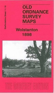
Wolstanton 1898 Stanfords
£3.50
Archived Product

Neilston 1895 Stanfords
£3.50
Archived Product

Heston 1894 Stanfords
£3.50
Archived Product
Ashington 1896 Stanfords
£2.95
Vouchers
No voucher codes found.
Do you know a voucher code for this product or supplier? Add it to Insights for others to use.
Do you know a voucher code for this product or supplier? Add it to Insights for others to use.
 Denmark