
 United Kingdom
 France
 Germany
 Netherlands
 Sweden
 USA
USA
 Italy
Italy
 Spain
Spain
More From Contributor
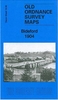


Bidston 1898
Bidston in 1898 in a fascinating series of reproductions of old Ordnance Survey plans in the Alan Godfrey Editions, ideal for anyone interested in the history of their neighbourhood or family. Selected towns in Great Britain and Ireland are covered by maps showing the extent of urban development in the last decades of the 19th and early 20th century.In this title: this detailed map covers the village of Bidston, with extending northward to Wallasey Pool and eastward to Ilchester Road. Features include St Oswald's church, Bidston Hall, Birkenhead & Wirral Agricultural Show Ground, Wallasey Pool Bridge, Anglo American Oil Depot, graving docks. Stretches of the Wirral Railway are shown, including Docks station, Bidston station, Seacombe Junctions, Goods Line, engine shed, goods
station. On the reverse is part of adjacent sheet 7.13, extending coverage eastward to Fenderlane Farm, New Farm, Reeds Farm. About the Alan Godfrey Editions of the 25
station. On the reverse is part of adjacent sheet 7.13, extending coverage eastward to Fenderlane Farm, New Farm, Reeds Farm. About the Alan Godfrey Editions of the 25
Product Description
Reviews/Comments
Add New
Intelligent Comparison
Archived Product

Bidston 1898 Stanfords
£3.50
Archived Product
Alston 1898 Stanfords
£2.95
Archived Product
Alston 1898 Stanfords
£3.50
Archived Product

Bilston 1901 Stanfords
£3.50
Archived Product

Neilston 1895 Stanfords
£3.50
Vouchers
No voucher codes found.
Do you know a voucher code for this product or supplier? Add it to Insights for others to use.
Do you know a voucher code for this product or supplier? Add it to Insights for others to use.
 Denmark