
 United Kingdom
 France
 Germany
 Netherlands
 Sweden
 USA
USA
 Italy
Italy
 Spain
Spain
More From Contributor

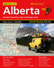


Alberta Pocket Road Atlas
Pocket road atlas of Alberta presenting the whole province at 1:1, 325, 000, with numerous enlargement showing in more detail most visited areas, including Banff, Jasper, Canmore, Calgary, Edmonton, etc. The index includes a listing of the province’s national and provincial parks.Road network indicates loose surface and unimproved roads, showing driving distances on main and on many local roads. National and provincial parks and other protected areas are prominently indicated by colouring, with numerous rivers and lakes also named. Symbols highlight locations of campgrounds, travel information centres, recreational areas, etc. The maps have no geographical coordinates.Street plans at scales around 1:50, 000 cover Banff, Jasper, Brooks, Airdrie, Camrose, Canmore,
Drumheller, Fort Saskatchewan, Fort McMurray, Grande Prairie, Okotoks, Leduc, Lethbridge, Lloydminster, Medicin Hat, and Wetaskiwin; maps at 1:250, 000 show Calgary, Edmonton and the Red Deer area, with downtown Calgary and Edmonton also presented on more detailed plans at 1:25, 000.To see the list of the currently available provincial or regional road atlases from the MapArt / Canadian Cartographics Corporation / JDM Géo publishing group, please click on the series link.
Drumheller, Fort Saskatchewan, Fort McMurray, Grande Prairie, Okotoks, Leduc, Lethbridge, Lloydminster, Medicin Hat, and Wetaskiwin; maps at 1:250, 000 show Calgary, Edmonton and the Red Deer area, with downtown Calgary and Edmonton also presented on more detailed plans at 1:25, 000.To see the list of the currently available provincial or regional road atlases from the MapArt / Canadian Cartographics Corporation / JDM Géo publishing group, please click on the series link.
Product Description
Reviews/Comments
Add New
Intelligent Comparison
Archived Product

Alberta Back Road Atlas Stanfords
£23.99
Archived Product

Bulgaria Pocket Road Atlas Stanfords
£9.99
Archived Product

Ontario MapArt Pocket Road Atlas Stanfords
£12.99
Archived Product
Quebec Province Pocket Road Atlas Stanfords
£10.95
Archived Product

British Columbia Pocket Road Atlas Stanfords
£12.99
Vouchers
No voucher codes found.
Do you know a voucher code for this product or supplier? Add it to Insights for others to use.
Do you know a voucher code for this product or supplier? Add it to Insights for others to use.
 Denmark