
 United Kingdom
 France
 Germany
 Netherlands
 Sweden
 USA
USA
 Italy
Italy
 Spain
Spain
More From Contributor

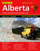


Alberta FastTrack
Waterproof and tear-resistant FastTrack map presenting in a handy-size format a road map of Alberta, plus enlargement of the environs of Calgary and Edmonton, and street plans Banff, Jasper, Fort McMurray, Grande Prairie, Lethbridge, Medicine Hat and Red Deer.The province is presented at 1:1, 500, 000 divided north/south with a small overlap between the sides. Its famous Banff and Jasper National Parks, as well as other protected areas are prominently highlighted, with topography shown by names of mountain ranges, peaks with their heights, and mountain passes. Road network indicates loose surface, unimproved or seasonal roads, with driving distances on main routes. Railway lines are not included but locations with scheduled air service are marked. Symbols indicate locations of
campsites, tourist information offices, various places of interest, etc. The map shows no geographical coordinates and has an index of place names.Environs of Calgary and Edmonton are presented on an enlargement at 1:250, 000; the seven street plans are at scales between 50K and 110K.To see the list of currently available Canadian province and regional maps form the MapArt / Canadian Cartographics Corporation / JDM Géo publishing group, including waterproof and tear-resistant FastTrack titles, please click on the series link.
campsites, tourist information offices, various places of interest, etc. The map shows no geographical coordinates and has an index of place names.Environs of Calgary and Edmonton are presented on an enlargement at 1:250, 000; the seven street plans are at scales between 50K and 110K.To see the list of currently available Canadian province and regional maps form the MapArt / Canadian Cartographics Corporation / JDM Géo publishing group, including waterproof and tear-resistant FastTrack titles, please click on the series link.

Product Description
Reviews/Comments
Add New
Vouchers
No voucher codes found.
Do you know a voucher code for this product or supplier? Add it to Insights for others to use.
Do you know a voucher code for this product or supplier? Add it to Insights for others to use.
 Denmark