
 United Kingdom
 France
 Germany
 Netherlands
 Sweden
 USA
USA
 Italy
Italy
 Spain
Spain
More From Contributor

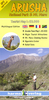
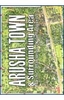
Arusha National Park
Arusha National Park at 1:40, 000 on a map from Veronica Roodt Publications presenting the area on a base derived from satellite imagery. An enlargement shows trekking routes on Mount Meru. Plus numerous photos of mammals and birds.On one side is a map of the whole park showing its network of roads and tracks both for viewing animals and for hiking. A panel provides GPS waypoints for 28 junctions and driving distances are marked. Symbols indicate locations of lodges, rest houses, ranger posts, campsites, picnic sites, look-out points, etc.On the reverse the western part of the park is shown on greater detail at 1:20, 000 and with contour lines at 100m intervals, with trekking routes on Mount Meru and the road to the Kitoto viewpoint. The map is accompanied by panorama drawing of the
summit as viewed from the eastern and the northern side. Also provided are notes about climbing Mount Meru.The title includes general information about the area and tips for the visitors, photos of 37 local mammals with details of their size, habitat, etc, plus 44 photos of common local birds.This title is part of a series of maps from Veronica Roodt Publications covering Tanzania
summit as viewed from the eastern and the northern side. Also provided are notes about climbing Mount Meru.The title includes general information about the area and tips for the visitors, photos of 37 local mammals with details of their size, habitat, etc, plus 44 photos of common local birds.This title is part of a series of maps from Veronica Roodt Publications covering Tanzania
Product Description
Reviews/Comments
Add New
Intelligent Comparison
Archived Product
Tatra National Park Stanfords
£6.95
Archived Product
Gaujas National Park Stanfords
£5.95
Archived Product
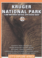
Kruger National Park Stanfords
£13.99
Archived Product
Sareks National Park Stanfords
£14.95
Archived Product
Sareks National Park Stanfords
£14.95
Archived Product
Kruger National Park Stanfords
£4.99
Archived Product

Triglav National Park Stanfords
£9.95
Archived Product

Chobe National Park Stanfords
£9.99
Vouchers
No voucher codes found.
Do you know a voucher code for this product or supplier? Add it to Insights for others to use.
Do you know a voucher code for this product or supplier? Add it to Insights for others to use.
 Denmark