
 United Kingdom
 France
 Germany
 Netherlands
 Sweden
 USA
USA
 Italy
Italy
 Spain
Spain
More From Contributor


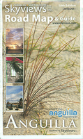
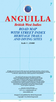
Anguilla
Anguilla in a series of tourist maps of the Caribbean islands from the Barbados-based Skyview Inc combining a map of the island, a plan of The Valley and extensive tourist information on various services and facilities.Rather than providing conventional mapping with topography, detailed road network, etc., Skyview maps give a more generalize picture of main roads and access to the numerous facilities highlighted on their maps. On the Anguilla map colouring indicates the island’s taxi zones and symbols show beaches, snorkeling/diving and kite surfing sites, bird watching and horse riding sites, golf courses, and many other local facilities. An enlargement shows in greater detail The Valley (taxi zones 5 and 6) including the Clayton Lloyd International Airport.Colour coded icons
cross-referenced to the information on the reverse show locations of over sixty selected services, grouped into hotels and resorts, real estate and villa rentals, small inns, car/taxi/bicycle hire, shopping and services, restaurants, land and sea activities, sailing, spas, weddings, plus art galleries.
cross-referenced to the information on the reverse show locations of over sixty selected services, grouped into hotels and resorts, real estate and villa rentals, small inns, car/taxi/bicycle hire, shopping and services, restaurants, land and sea activities, sailing, spas, weddings, plus art galleries.

Product Description
Reviews/Comments
Add New
Intelligent Comparison
Archived Product
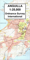
Anguilla Stanfords
£19.95
Archived Product
Anguilla Stanfords
£13.99
Archived Product
Aurillac Stanfords
£11.50
Archived Product

Angola Stanfords
£9.50
Archived Product

Angola Stanfords
£8.99
Vouchers
No voucher codes found.
Do you know a voucher code for this product or supplier? Add it to Insights for others to use.
Do you know a voucher code for this product or supplier? Add it to Insights for others to use.
 Denmark