
 United Kingdom
 France
 Germany
 Netherlands
 Sweden
 USA
USA
 Italy
Italy
 Spain
Spain
More From Contributor


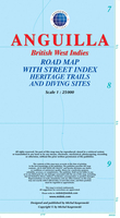
Anguilla
Anguilla at 1:25, 000 on an indexed map from the Caribbean-based cartographer Michal Kasprowski highlighting beaches and water sports sites, plus an enlargement at 1:15, 000 of The Valley area including the island’s airport. Main roads are highlighted and named and the map also shows names of many smaller local roads and indicates locations of petrol stations. Also marked are cart tracks and footpaths. Symbols show beaches and water sport sites, lighthouses, places of worship, ferry ports, etc. The map has contours at 20m intervals, with a few spot heights, plus colouring to show woodlands. Along the coast reefs are marked. Latitude and longitude lines are marked at 1’ intervals. An enlargement at 1:15, 000 presents The Valley area in greater detail.

Product Description
Reviews/Comments
Add New
Vouchers
No voucher codes found.
Do you know a voucher code for this product or supplier? Add it to Insights for others to use.
Do you know a voucher code for this product or supplier? Add it to Insights for others to use.
 Denmark