
 United Kingdom
 France
 Germany
 Netherlands
 Sweden
 USA
USA
 Italy
Italy
 Spain
Spain
More From Contributor


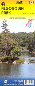
Algonquin Park ITMB
Waterproof and tear-resistant topographic survey map of Algonquin Park at 1:250, 000 from ITMB, with an 1:50, 000 enlargement of the Haliburton County and Nipissing District on the reverse. Both maps show highways with differentiation of the number of lanes indicated, loose surface roads, cart tracks, and trails are marked. Points of interest are highlighted such as camp sites, snowmobiling areas, viewpoints, RV areas, downhill and cross country skiing, and portage points along rivers. Contour lines at 50m intervals denote topography. Each map has a UTM grid and margin ticks for latitude and longitude - 1;250, 000 mapping at 30’ intervals, 1:50, 000 at 5’.Whilst the Canadian Department of Natural Resources (previously Canada Map Office) decides whether to provide updated
pre-printed editions of its survey mapping or switch to print-on-demand only, in 2007 it began co-operating with ITMB on a new series of maps with cartography of the Canadian topographic survey and additional tourist and recreational information provided by ITMB.
pre-printed editions of its survey mapping or switch to print-on-demand only, in 2007 it began co-operating with ITMB on a new series of maps with cartography of the Canadian topographic survey and additional tourist and recreational information provided by ITMB.

Product Description
Reviews/Comments
Add New
Vouchers
No voucher codes found.
Do you know a voucher code for this product or supplier? Add it to Insights for others to use.
Do you know a voucher code for this product or supplier? Add it to Insights for others to use.
 Denmark