
 United Kingdom
 France
 Germany
 Netherlands
 Sweden
 USA
USA
 Italy
Italy
 Spain
Spain
More From Contributor
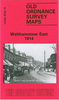


Walthamstow West 1894 (Colour Edition)
Walthamstow West in 1894 in a fascinating series of reproductions of old Ordnance Survey plans in the Alan Godfrey Editions, ideal for anyone interested in the history of their neighbourhood or family. Three versions have been published for this area, covering the western part of Walthamstow from the River Lea Navigation and Ferry Boat Inn eastward to Colebrook Road and Brookdale Road, and from Shakespeare Road, Higham Hill southward to St James Street station. Features include Blackhorse Road station, tramways, several reservoirs, Tottenham Lock, busy western area of Walthamstow and industries off Blackhorse Lane, etc. This 1894 version is in colour.About the Alan Godfrey Editions of the 25” OS Series:Selected towns in Great Britain and Ireland are covered by maps showing the
extent of urban development in the last decades of the 19th and early 20th century. The plans have been taken from the Ordnance Survey mapping and reprinted at about 15 inches to one mile (1:4, 340). On the reverse most maps have historical notes and many also include extracts from contemporary directories. Most maps cover about one mile (1.6kms) north/south, one and a half miles (2.4kms) across; adjoining sheets can be combined to provide wider coverage.FOR MORE INFORMATION AND A COMPLETE LIST OF ALL AVAILABLE TITLES PLEASE CLICK ON THE SERIES LINK.
extent of urban development in the last decades of the 19th and early 20th century. The plans have been taken from the Ordnance Survey mapping and reprinted at about 15 inches to one mile (1:4, 340). On the reverse most maps have historical notes and many also include extracts from contemporary directories. Most maps cover about one mile (1.6kms) north/south, one and a half miles (2.4kms) across; adjoining sheets can be combined to provide wider coverage.FOR MORE INFORMATION AND A COMPLETE LIST OF ALL AVAILABLE TITLES PLEASE CLICK ON THE SERIES LINK.
 "Pin It")
Product Description
Reviews/Comments
Add New
Intelligent Comparison
Archived Product
Walthamstow East 1894 (Colour Edition) Stanfords
£4.50
Archived Product
Cheltenham West 1883 (Colour Edition) Stanfords
£3.50
Archived Product

Cheltenham West 1883 (Colour Edition) Stanfords
£4.50
Archived Product
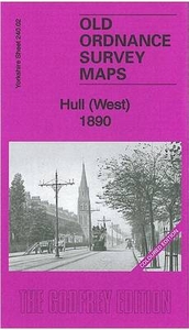
Hull West 1890 (Colour Edition) Stanfords
£4.50
Archived Product
Cheltenham East 1884 (Colour Edition) Stanfords
£2.95
Archived Product
Cheltenham East 1884 (Colour Edition) Stanfords
£4.50
Archived Product
Salford West 1889 Colour Edition Stanfords
£2.95
Archived Product
Salford West 1889 Colour Edition Stanfords
£4.50
Vouchers
No voucher codes found.
Do you know a voucher code for this product or supplier? Add it to Insights for others to use.
Do you know a voucher code for this product or supplier? Add it to Insights for others to use.
 Denmark