
 United Kingdom
 France
 Germany
 Netherlands
 Sweden
 USA
USA
 Italy
Italy
 Spain
Spain
More From Contributor
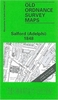


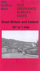


Salford West 1889 Colour Edition
Salford West in 1889 in a fascinating series of reproductions of old Ordnance Survey plans in the Alan Godfrey Editions, ideal for anyone interested in the history of their neighbourhood or family. Selected towns in Great Britain and Ireland are covered by maps showing the extent of urban development in the last decades of the 19th and early 20th century.In this title: two versions have been published for this area. Each covers much of western Salford, stretching from Windsor Bridge westward to Weaste Lane, and from Liverpool Street northward to Pendleton station. The many features show railways with Seedley station, Pendleton station, Pendleton (Broad St) station, Windsor Bridge cattle station; other features include tramways, Hayfield Mills, cattle market, Christ Church,
Wallness, St Barnabas church, Leaf Square, St Thomas church, Langworthy Park, Scotia Iron Foundry, St Luke's church, Victoria Mills, Seedley Bleach Works, Buile Hill Park, Brindle Heath, Pendleton Mills, many streets of terraces with a scattering of detached houses off Eccles Old Road, etc. A selection of entries from a 1915 street directory is on the reverse. The 1889 version is in colour taken from the beautiful OS hand-coloured 1st edition. About the Alan Godfrey Editions of the 25
Wallness, St Barnabas church, Leaf Square, St Thomas church, Langworthy Park, Scotia Iron Foundry, St Luke's church, Victoria Mills, Seedley Bleach Works, Buile Hill Park, Brindle Heath, Pendleton Mills, many streets of terraces with a scattering of detached houses off Eccles Old Road, etc. A selection of entries from a 1915 street directory is on the reverse. The 1889 version is in colour taken from the beautiful OS hand-coloured 1st edition. About the Alan Godfrey Editions of the 25
Product Description
Reviews/Comments
Add New
Vouchers
No voucher codes found.
Do you know a voucher code for this product or supplier? Add it to Insights for others to use.
Do you know a voucher code for this product or supplier? Add it to Insights for others to use.
 Denmark