
 United Kingdom
 France
 Germany
 Netherlands
 Sweden
 USA
USA
 Italy
Italy
 Spain
Spain
More From Contributor


South America From Space Wall Map
Several hundred satellite photos taken by the American NOAA satellite were used to build this map. The resulting image of the continent is both beautiful and breathtaking. For technophiles, the NOAA craft orbits the earth at a height of 840km and has five sensors with a ground resolution of 1x1km.

Product Description
Reviews/Comments
Add New
Intelligent Comparison
Archived Product
North America From Space Wall Map Stanfords
£16.95
Archived Product
South America F&B Wall Map Stanfords
£13.99
Archived Product
Asia From Space Wall Map Stanfords
£16.95
Archived Product
Europe From Space Wall Map Stanfords
£16.00
Archived Product
South America NGS Classic Syle Wall Map Stanfords
£14.95
Archived Product
South America NGS Classic Wall Map PAPER Stanfords
£12.99
Archived Product
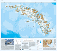
South Georgia BAS Wall Map Stanfords
£9.99
Archived Product
South America Political/Physical Wall Map Stanfords
£21.50
Vouchers
No voucher codes found.
Do you know a voucher code for this product or supplier? Add it to Insights for others to use.
Do you know a voucher code for this product or supplier? Add it to Insights for others to use.
 Denmark