
 United Kingdom
 France
 Germany
 Netherlands
 Sweden
 USA
USA
 Italy
Italy
 Spain
Spain
More From Contributor


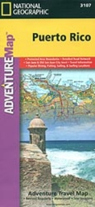
Puerto Rico Adventure Map
Puerto Rico at 1: 125, 000 on a detailed, double-sided map from the National Geographic Society Adventure series, printed on light, waterproof and tear-resistant plastic paper. A street plan of San Juan is included.The map divides the island east/west with a small overlap between the sides. Topography is shown by contours at 50 m intervals enhanced by relief shading. Protected areas are highlighted and graded into national parks, national forests, national wildlife refuges, state forests an natural reserves, wilderness areas, marine protected areas, military zones, plus other protected areas/reserves. Road network includes selected paved and improved roads, clearly showing where appropriate road numbers but not indicating driving distances. Ferry routes are also marked. A range
of symbols indicate various places of interest and tourist facilities, including beaches, snorkelling and scuba diving sites, whale watching places, sailing/surfing or kayaking sites, etc. The map has a UTM grid, plus latitude and longitude margin ticks at intervals of 15
of symbols indicate various places of interest and tourist facilities, including beaches, snorkelling and scuba diving sites, whale watching places, sailing/surfing or kayaking sites, etc. The map has a UTM grid, plus latitude and longitude margin ticks at intervals of 15
Product Description
Reviews/Comments
Add New
Intelligent Comparison
Archived Product
Puerto Rico Adventure Map Stanfords
£9.99
Archived Product
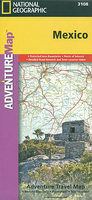
Mexico Adventure Map Stanfords
£9.99
Archived Product
Peru Adventure Map Stanfords
£9.99
Archived Product
Morocco Adventure Map Stanfords
£9.99
Archived Product

Costa Rica Adventure Map Stanfords
£9.99
Archived Product
Puerto Rico Flexi Map Stanfords
£4.99
Archived Product
Corsica Adventure Map Stanfords
£9.99
Archived Product
Austria Adventure Map Stanfords
£9.99
Vouchers
No voucher codes found.
Do you know a voucher code for this product or supplier? Add it to Insights for others to use.
Do you know a voucher code for this product or supplier? Add it to Insights for others to use.
 Denmark