
 United Kingdom
 France
 Germany
 Netherlands
 Sweden
 USA
USA
 Italy
Italy
 Spain
Spain
More From Contributor


Costa Rica Adventure Map
Costa Rica on a double-sided, waterproof and tear-resistant map with a street plan of central San José, produced by the National Geographic Society in cooperation with the Instituto Geográfico Nacional, Costa Rica’s national survey organization.The country is divided east/west, with a generous overlap between the two sides. Topography is shown by contours at 100m intervals, enhanced by relief shading and spot heights. Along the coast reefs, rocks and shallow water areas are marked. The map indicates various types of vegetation: forests, palm forest, mangrove, and fresh or salt water swamps. Road network includes gravel tracks and indicates roads passable only in summer. Railways and local airstrips are marked, as well as the country’s internal administrative boundaries
together with names of the provinces. The map highlights seven different types of protected areas: national wildlife refuges, protection zones, wetlands, national parks, forest reserves, biological reserves, and absolute nature reserves, plus national monuments, all listed in a special index. A UTM grid is printed on the map, plus latitude and longitude margin ticks at 10` intervals.The map includes a street plan of central San José, naming principal streets and districts, and highlighting various places of interest to visitors. Also included are enlargements for Isla del Coco, Isla del Caño, an overview map of Central America, and an index of selected towns.
together with names of the provinces. The map highlights seven different types of protected areas: national wildlife refuges, protection zones, wetlands, national parks, forest reserves, biological reserves, and absolute nature reserves, plus national monuments, all listed in a special index. A UTM grid is printed on the map, plus latitude and longitude margin ticks at 10` intervals.The map includes a street plan of central San José, naming principal streets and districts, and highlighting various places of interest to visitors. Also included are enlargements for Isla del Coco, Isla del Caño, an overview map of Central America, and an index of selected towns.

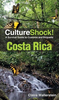
Product Description
Reviews/Comments
Add New
Vouchers
No voucher codes found.
Do you know a voucher code for this product or supplier? Add it to Insights for others to use.
Do you know a voucher code for this product or supplier? Add it to Insights for others to use.
 Denmark