
 United Kingdom
 France
 Germany
 Netherlands
 Sweden
 USA
USA
 Italy
Italy
 Spain
Spain
More From Contributor

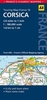
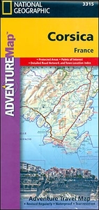
Corsica Adventure Map
Corsica at 1:150, 000 approx. on a map from the National Geographic Society printed on light, waterproof and tear-resistant synthetic paper. The map is double-sided with a very generous overlap between the two sides.The map is an adaptation of cartography prepared by the German publishers Reise Know-How and published in Britain under the Rough Guides imprint. The original altitude colouring has been replaced here by bolder relief shading, with contours interval adjusted to 200m. Boundaries of the Parc Naturel Régional de Corse are clearly marked, as are those of other protected areas.Road network includes selected local county tracks. Driving distances are marked on main routes and scenic roads are highlighted. The map also shows the course of the island’s famous GR 20 long-distance
hiking path. Symbols indicate various places of interest, including locations of campsites and mountain huts. The map is indexed and has latitude and latitude lines at intervals of 5’.PLEASE NOTE: to ensure regular supplies and faster delivery to our customers we keep as regular stock the original Reise Know-How edition in the Rough Guides imprint whilst the NGS version can be ordered on request.
hiking path. Symbols indicate various places of interest, including locations of campsites and mountain huts. The map is indexed and has latitude and latitude lines at intervals of 5’.PLEASE NOTE: to ensure regular supplies and faster delivery to our customers we keep as regular stock the original Reise Know-How edition in the Rough Guides imprint whilst the NGS version can be ordered on request.

Product Description
Reviews/Comments
Add New
Vouchers
No voucher codes found.
Do you know a voucher code for this product or supplier? Add it to Insights for others to use.
Do you know a voucher code for this product or supplier? Add it to Insights for others to use.
 Denmark