
 United Kingdom
 France
 Germany
 Netherlands
 Sweden
 USA
USA
 Italy
Italy
 Spain
Spain
More From Contributor
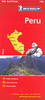


Peru, Bolivia & Ecuador
Linked by the sinuous spine of the Andes, Peru, Bolivia & Ecuador are born of a synthesis of ancient America and medieval Europe. Footprint`s Peru, Bolivia & Ecuador Handbook will guide you from the unforgettably unique Galapagos Islands, through the awe-inspiring citadel of Machu Picchu, to the shimmering turquoise waters of Lake Titicaca. Great coverage of the top activities and sights in the region, including the colonial treasures of Quito; spectacular costumed festivals; sacred pyramids and temples; the incredible salt flats of Salar de Uyunia Loaded with information and suggestions on how to get off the beaten track, from where to find the best artesania to seeking jaguars in the rainforest.Includes comprehensive information on everything from transport and racticalities to
history, culture & landscape Plus all the usual accommodation, eating and drinking listings for every budget Full-colour planning section to inspire travellers and help them find the best experiences From the mysterious Nazca lines to bustling indigenous markets, Footprint`s fully updated 5th edition will help you navigate this breathtaking destination.
history, culture & landscape Plus all the usual accommodation, eating and drinking listings for every budget Full-colour planning section to inspire travellers and help them find the best experiences From the mysterious Nazca lines to bustling indigenous markets, Footprint`s fully updated 5th edition will help you navigate this breathtaking destination.

Product Description
Reviews/Comments
Add New
Vouchers
No voucher codes found.
Do you know a voucher code for this product or supplier? Add it to Insights for others to use.
Do you know a voucher code for this product or supplier? Add it to Insights for others to use.
 Denmark