
 United Kingdom
 France
 Germany
 Netherlands
 Sweden
 USA
USA
 Italy
Italy
 Spain
Spain
More From Contributor


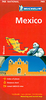

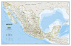

Mexico NGS Classic Style Wall Map PAPER
Mexico NGS Classic Style Wall Map from the National Geographic Society, paper version, presenting the country at 1:4, 580, 000 with internal administrative boundaries, surrounded by the blue colouring for the Pacific and the Gulf of Mexico.Internal administrative boundaries are easy to see on the light shading which provides the topographic background. Graphics show deserts, swamps, lava, etc, with names of mountain ranges, bays, and other geographical features. Heights are given in feet.47 national parks or other protected areas are highlighted and cross-referenced to a list included on the map. The map shows Mexico
Product Description
Reviews/Comments
Add New
Intelligent Comparison
Archived Product
China NGS Classic Style Wall Map PAPER Stanfords
£13.95
Archived Product
Brazil NGS Classic Style Wall Map PAPER Stanfords
£15.95
Archived Product
Iraq NGS Classic Style Wall Map PAPER Stanfords
£13.95
Archived Product
Cuba NGS Classic Style Wall Map PAPER Stanfords
£14.95
Archived Product
Caribbean NGS Classic Style Wall Map PAPER Stanfords
£14.95
Archived Product
Mexico NGS Executive Style Wall Map PAPER Stanfords
£13.95
Archived Product

World NGS Classic Wall Map PAPER Stanfords
£14.99
Archived Product

Mexico NGS Classic Wall Map ENCAPSULATED Stanfords
£17.99
Vouchers
No voucher codes found.
Do you know a voucher code for this product or supplier? Add it to Insights for others to use.
Do you know a voucher code for this product or supplier? Add it to Insights for others to use.
 Denmark