More From Contributor
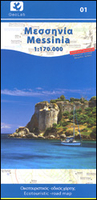
£29.99
Map No. 2230, Messina, in South Africa’s official topographic survey at 1:250, 000 from the country’s national survey organization, the Chief Directorate of Surveys & Mapping. The maps have altitude colouring & contours at 50m or 100m intervals, depending on the map edition, plus spot heights. Deserts, marshes, dry pans, perennial & seasonal water features, etc, as well as protected areas are shown. The maps present the country’s road & rail networks & include the usual information expected on topographic mapping at this scale, although in more rapidly developing areas road information may not necessarily be up to date. Also indicated are magisterial district & provincial boundaries. Latitude & longitude values are shown in the margins at 5` intervals together with South African grid co-ordinates. Typically, each sheet covers an area of one degree of latitude & two degrees of longitude. The projection used is Gauss Conformal. The legend is in English & Afrikaans. ...
Archived Product
£7.95
Messina Province in a series of handy size road maps from Litografia Artistica Cartografica (LAC) with more minor local roads & tracks than can be found on most regional maps. The series is gradually being changed to a new style of digitally derived cartography, so presentation of adjoining titles may vary. All the maps have hill shading to represent the general relief with spot heights for selected peaks, & show a few more local roads & rough tracks than the other road map series. Intermediate road distances are indicated. Regional, provincial & communal borders are marked, & railways, funiculars, airports, sea ferry links & campsites are shown. The legend is in Italian only. The new, digitally produced editions are indexed & have enhanced, more finely drawn cartography: the hill-shading is less bold, motorway service areas are marked, natural parks are highlighted & an expanded range of symbols indicates various landmarks & sites, e.g. antiquities, churches, etc. Two styles of the new cartography are produced, differing only in the colour of the predominant background shading: grey or yellow/green. Some of the new editions include geographical coordinates for the map corners. The index of localities is on the reverse. This title is still produced in the traditional cartographic style. ...
Archived Product
£12.99
Messina Province at 1:150, 000 in a series of handy size provincial road maps from Litografia Artistica Cartografica (LAC) with more minor local roads & country tracks than can be found on most regional maps from other publishers. This title is published with the traditional style LAC cartography. Coverage include Reggio di Calabria & Villa San Giovanni with ferry connections from the mainl&, & insets at 1:200, 000 cover the Aeolian (Lipari) Islands showing ferry connections between the islands & Milazzo, Messina & Reggio di Calabria LAC’s provincial series is gradually being changed to a new style of digitally derived cartography, so presentation of adjoining titles may vary. All the maps have hill shading to represent the general relief with spot heights for selected peaks, & show a few more local roads & rough tracks than the other road map series. Intermediate road distances are indicated. Regional, provincial & communal borders are marked, & railways, funiculars, airports, sea ferry links & campsites are shown. The legend is in Italian only. The new, digitally produced editions are indexed & have enhanced, more finely drawn cartography: the hill-shading is less bold, motorway service areas are marked, natural parks are highlighted & an expanded range of symbols indicates various landmarks & sites, e.g. antiquities, churches, etc. Two styles of the new cartography are produced, differing only in the colour of the predominant background shading: grey or yellow/green. Some of the new editions include geographical coordinates for the map corners. The index of localities is on the reverse. To see all the titles in this series please click on the series link. ...
Archived Product
£12.00
Inexplicably out of print since the late 1940s, Messing About in Boats is one of the most charming & evocative accounts of work & leisure afloat in the years either side of the Great War. John Muir describes with humanity & humour the perils of boat acquisition & ownership by the impecunious, & the somewhat mixed talents of the Paid H&. But his account is more than balanced by the interest & pleasure he took in working & sailing in English waters, from the North Sea to the Bristol Channel, in an age long before the marina, GPS & radio. Muir provides two valuable first-hand accounts of work afloat under steam & sail before the War, while he was on half-paid leave between assignments in the Royal Navy: In the North Sea `boxing` fleet of trawlers which remained on station for weeks on end, where he served in his medical capacity, & later in the Bristol Channel Pilot service, where he crewed on a cutter, delivering the pilot to incoming ships in all weathers. His unfavourable views of the qualities of the Bristol Channel Pilot Cutter as a yacht may surprise its aficionados today, but he relented sufficiently to own two of them, Maud & Freda, which feature in the book. ...
Archived Product
£8.99
Messinia province on a waterproof & tear-resistant map at 1:80, 000 in a series from Anavasi presenting selected popular areas of central mainland Greece & the Peloponnese on GPS compatible, detailed topographic road maps. The map has contours at 100m intervals, enhanced by relief shading & altitude colouring. Road network

Includes::
minor unsurfaced roads, indicating those in poor condition. Intermediate distances are marked on main & secondary routes. Archaeological or historical sites & other places of interest are highlighted, with symbols marking mountain refuges, campsites, beaches, etc. Ten best sights have photos & brief descriptions. Names of town, villages, & most geographical features & places of interest are in both Greek & Latin alphabet. The map has both UTM grid lines & ticks plus crosshairs for latitude & longitude lines at 1’ intervals. Map legend

Includes::
English. The index is on the detachable map cover.


...
Archived Product
£5.00
The Messy Monsters are on the loose in this gross & giggle-inducing sticker & doodling book for children everywhere. With fiendishly funny pictures to finish, children can have fun with the pages of stick-on eyes, tails, horns & splats or simply scribble fun drawings to make this monstrous party complete. ...
Archived Product
£9.95
Mestia
- Ushguli
- Lashkheti area at 1:50, 000 in a series of detailed, double-sided, GPS compatible, contoured topographic

...
Archived Product
£9.95
Mestia
- Ushguli
- Lashkheti area at 1:50, 000 in a series of detailed, double-sided, GPS compatible, contoured topographic

...
Archived Product
£9.99
Mestia
- Ushguli
- Lashkheti area of the Caucasus Mountains in Georgia at 1:50, 000 on a double-sided, contoured & GPS compatible

...
Archived Product

Messinia

Greek province on Messina on the Peloponnese on a detailed, GPS compatible, waterproof and tear-resistant road map 1:170, 000 from Geopsis with a particularly vivid presentation of the Taygetos Mountains. All place names are in both Greek and Latin alphabet; locations of historical or natural interest are prominently highlighted.Coverage extends to include Tripoli in the north-eastern corner of the map. Bold relief shading provides an almost 3-D picture of the Taygetos range, with many spot heights. The map also shows the region’s protected hunting areas. Road classification indicates local dirt roads and shows locations of petrol stations. Symbols highlight various places of interest including campsites, beaches, various sport and recreational locations and facilities, etc. The
map has a 10-km UTM grid plus crosshairs for latitude and longitude at 10’. Map legend includes English. On the reverse are bilingual Greek and English notes about the province, including its castles and archaeological sites, museums, beaches and natural sites.
RIP - This product is no longer available on our network. It was last seen on 25.09.2019

This page now acts as a permanent archive for this product. Add more information using the comments box below to ensure it can still be found by future generations.

Use our search facility to see if it is available from an alternative contributor.
  • External links may include paid for promotion
  • Availability: Out Of Stock
  • Supplier: Stanfords
  • SKU: 9786188008809
Availability: In Stock
£8.99

Product Description

Greek province on Messina on the Peloponnese on a detailed, GPS compatible, waterproof & tear-resistant road map 1:170, 000 from Geopsis with a particularly vivid presentation of the Taygetos Mountains. All place names are in both Greek & Latin alphabet; locations of historical or natural interest are prominently highlighted. Coverage extends to include Tripoli in the north-eastern corner of the map. Bold relief shading provides an almost 3-D picture of the Taygetos range, with many spot heights. The map also shows the region’s protected hunting areas. Road classification indicates local dirt roads & shows locations of petrol stations. Symbols highlight various places of interest including campsites, beaches, various sport & recreational locations & facilities, etc. The map has a 10-km UTM grid plus crosshairs for latitude & longitude at 10’. Map legend

Includes::
English. On the reverse are bilingual Greek & English notes about the province, including its castles & archaeological sites, museums, beaches & natural sites.

Reviews/Comments

Add New

Intelligent Comparison

Oooops!
We couldn't find anything!
Perhaps this product's unique.... Or perhaps we are still looking for comparisons!
Click to bump this page and we'll hurry up.

Price History

Vouchers

No voucher codes found.
Do you know a voucher code for this product or supplier? Add it to Insights for others to use.

Facebook

Jargon Buster

GPS - Global Positioning System - Global position using satellites
Waterproof - Resistant to water, usualy specified by depth in metres
Natural - not manmade
Km - Kilometre. A unit of measurement equal to 1000 metres.
Road - a manmade lane or a path that is used to speed up travel.
Resistant - Something that can repel against something.

Supplier Information

Stanfords
Stanfords was established in 1853 and opened their iconic Covent Garden flagship store in 1901. They have become the top retailer of maps, travel books and accessories in the UK and arguably offer the largest selection of maps and travel books worldwide. Famous names such as Captain Robert Falcon Scott, Ranulph Fiennes and Michael Palin have purchased from Stanfords. They now have a shop in Bristol and both stores together with other venues operate a calendar of events including talks, book signings and exhibitions. As a specialist map retailer, the map selection is comprehensive and includes road maps, street maps and walking maps from worldwide destinations, as well as a selection of world atlases and wall maps. Books include travel guides and travel literature. Stanfords also stock globes, from miniatures made of blue marble to magnificent floor-standing globes. The website features a selection of interesting articles on travel topics.
Page Updated: 2023-11-12 20:15:36

Community Generated Product Tags

Oh No! The productWIKI community hasn't generated any tags for this product yet!
Menu