
 United Kingdom
 France
 Germany
 Netherlands
 Sweden
 USA
USA
 Italy
Italy
 Spain
Spain
More From Contributor

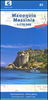


Mestia - Ushguli - Lashkheti
Mestia - Ushguli - Lashkheti area at 1:50, 000 in a series of detailed, double-sided, GPS compatible, contoured topographic maps from the locally based Geoplan, with extensive tourist information. The maps have contours at 20m intervals, with additional relief shading and numerous spot heights, plus colouring and graphics to indicate different types of terrain (e.g. glaciers, passable or impassable swamps, moraine, sand) and vegetation (woodland, orchards, vineyards, grassy cover, etc). Road network distinguished between local paved or unpaved roads, dirt tracks, forest roads and footpaths. Railways, cable car lines and funiculars are also included.A very extensive range of small unobtrusive icons indicate local services, tourist facilities and places of interest,
including accommodation (hotels, B&Bs, campgrounds), different places of worship and historical sights, sport and recreational grounds and areas, medical facilities, etc. Each map has a UTM grid, plus latitude and longitude margin ticks at intervals of 1
including accommodation (hotels, B&Bs, campgrounds), different places of worship and historical sights, sport and recreational grounds and areas, medical facilities, etc. Each map has a UTM grid, plus latitude and longitude margin ticks at intervals of 1
Product Description
Reviews/Comments
Add New
Vouchers
No voucher codes found.
Do you know a voucher code for this product or supplier? Add it to Insights for others to use.
Do you know a voucher code for this product or supplier? Add it to Insights for others to use.
 Denmark