
 United Kingdom
 France
 Germany
 Netherlands
 Sweden
 USA
USA
 Italy
Italy
 Spain
Spain
More From Contributor


Birkenhead 1909
Birkenhead in 1909 in a fascinating series of reproductions of old Ordnance Survey plans in the Alan Godfrey Editions, ideal for anyone interested in the history of their neighbourhood or family. The map is double-sided. The main map covers a major central area of Birkenhead, stretching from Manor Hill eastward to Hamilton Square, and from Grange Road northward to Vittoria Dock. Features include Birkenhead Park, Claughton, Manor House, St John`s church, tramways, Haymarket, St Lawrence`s RC church, Egerton Dock, Morpeth Dock, Wallasey Dock, Vittoria Dock, railways into and around docks, LNWR Goods station, Birkenhead Warehouses, Duke Street Wharf, Cavendish Wharf, Cavendish Wharf Sidings, Birkenhead Park football ground, Mersey Cabinet Works, tram depot, Birkenhead
Park station, St Ann`s church, Borough Hospital, etc. On the reverse is the adjacent map 13.04 which extends coverage eastward to the waterfront; features here include Birkenhead Iron Works, St Mary`s church, Clovers Graving Docks, Woodside Ferry, Woodside station, Woodside Ferry, Morpeth Branch Dock, GWR goods station, Wallasey Landing Stage, Wallasey Lairage, Woodside Lairage, etc. A street directory for Conway Street is also included. About the Alan Godfrey Editions of the 25” OS Series:Selected towns in Great Britain and Ireland are covered by maps showing the extent of urban development in the last decades of the 19th and early 20th century. The plans have been taken from the Ordnance Survey mapping and reprinted at about 15 inches to one mile (1:4, 340). On the
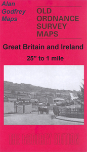
reverse most maps have historical notes and many also include extracts from contemporary directories. Most maps cover about one mile (1.6kms) north/south, one and a half miles (2.4kms) across; adjoining sheets can be combined to provide wider coverage.FOR MORE INFORMATION AND A COMPLETE LIST OF ALL AVAILABLE TITLES PLEASE CLICK ON THE SERIES LINK.
Park station, St Ann`s church, Borough Hospital, etc. On the reverse is the adjacent map 13.04 which extends coverage eastward to the waterfront; features here include Birkenhead Iron Works, St Mary`s church, Clovers Graving Docks, Woodside Ferry, Woodside station, Woodside Ferry, Morpeth Branch Dock, GWR goods station, Wallasey Landing Stage, Wallasey Lairage, Woodside Lairage, etc. A street directory for Conway Street is also included. About the Alan Godfrey Editions of the 25” OS Series:Selected towns in Great Britain and Ireland are covered by maps showing the extent of urban development in the last decades of the 19th and early 20th century. The plans have been taken from the Ordnance Survey mapping and reprinted at about 15 inches to one mile (1:4, 340). On the
reverse most maps have historical notes and many also include extracts from contemporary directories. Most maps cover about one mile (1.6kms) north/south, one and a half miles (2.4kms) across; adjoining sheets can be combined to provide wider coverage.FOR MORE INFORMATION AND A COMPLETE LIST OF ALL AVAILABLE TITLES PLEASE CLICK ON THE SERIES LINK.

Product Description
Reviews/Comments
Add New
Intelligent Comparison
Archived Product

Hillhead 1909 Stanfords
£3.50
Archived Product
Birkdale 1909 Stanfords
£2.95
Archived Product

Birkdale 1909 Stanfords
£3.50
Vouchers
No voucher codes found.
Do you know a voucher code for this product or supplier? Add it to Insights for others to use.
Do you know a voucher code for this product or supplier? Add it to Insights for others to use.
 Denmark