
 United Kingdom
 France
 Germany
 Netherlands
 Sweden
 USA
USA
 Italy
Italy
 Spain
Spain
More From Contributor


Bermuda Wall Map
Attractive 93x71cm topographical wallmap of the island, with street maps of Hamilton and St George included. On the main map general relief is shown by hill-shading, spot heights and contours at 50ft intervals. The principal road network is marked and some road names are shown. Marsh areas, beaches, golf courses and built-up areas are shown and scattered buildings are marked. In particular, selected buildings are identified eg. schools, churches, major hotels. Ferry routes across Great Sound are marked, lighthouses are marked and many islands, beaches and bays are named. Latitude and longitude values are shown at the sheet corners only, and there are no grid lines. Parish, municipal and USAF boundaries are indicated. Street plans of Hamilton and St George at 1:7040 are included
in insets. These show street names and identify many notable buildings and landmarks.
in insets. These show street names and identify many notable buildings and landmarks.
Product Description
Reviews/Comments
Add New
Intelligent Comparison
Archived Product

Iraq Wall Map Stanfords
£13.50
Archived Product

Iran Wall Map Stanfords
£13.50
Archived Product

Bali Wall Map Stanfords
£14.99
Archived Product

Cuba Wall Map Stanfords
£13.50
Archived Product

Red Sea Wall Map Stanfords
£13.50
Archived Product

Brittany Wall Map Stanfords
£17.99
Archived Product
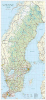
Sweden Wall Map Stanfords
£24.95
Archived Product
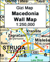
Macedonia Wall Map Stanfords
£13.50
Vouchers
No voucher codes found.
Do you know a voucher code for this product or supplier? Add it to Insights for others to use.
Do you know a voucher code for this product or supplier? Add it to Insights for others to use.
 Denmark