More From Contributor

£33.58
The Pembrokeshire Coast National Park is made up of a relatively narrow strip of coastline in south-west Wales. With a varied landscape of rugged cliffs, sandy beaches, low wooded estuaries & rolling hills, it contains a large number of Sites of Special Scientific Interest & Nature Reserves. As well as walking on footpaths & National Trails, you can enjoy surfing, coasteering, sea angling & wildlife watching This map bundle contains all 3 OS Landranger Maps for the National Park with a discount of 20% compared to the cost of buying them individually, & is available in both standard & weatherproof ' Active' versions. Whatever activities you plan on your visit, you can make the most of it with Ordnance Survey maps. Official site: www.pembrokeshirecoast.org.uk ...
Available
£19.18
The Pembrokeshire Coast National Park is made up of a relatively narrow strip of coastline in south-west Wales. With a varied landscape of rugged cliffs, sandy beaches, low wooded estuaries & rolling hills, it contains a large number of Sites of Special Scientific Interest & Nature Reserves. As well as walking on footpaths & National Trails, you can enjoy surfing, coasteering, sea angling & wildlife watching This map bundle contains all 3 OS Landranger Maps for the National Park with a discount of 20% compared to the cost of buying them individually, & is available in both standard & weatherproof ' Active' versions. Whatever activities you plan on your visit, you can make the most of it with Ordnance Survey maps. Official site: www.pembrokeshirecoast.org.uk ...
Available
£21.57
OS Landranger Maps 145, 157 & 158 The Pembrokeshire Coast National Park is made up of a relatively narrow strip of coastline in south-west Wales. With a varied landscape of rugged cliffs, sandy beaches, low wooded estuaries & rolling hills, it contains a large number of Sites of Special Scientific Interest & Nature Reserves. As well as walking on footpaths & National Trails, you can enjoy surfing, coasteering, sea angling & wildlife watching This map bundle contains all 3 OS Landranger Maps for the National Park with a discount of 20% compared to the cost of buying them individually, & is available in both standard & weatherproof ' Active' versions. Whatever activities you plan on your visit, you can make the most of it with Ordnance Survey maps. ...
Archived Product
£35.97
OS Landranger Maps 145, 157 & 158 The Pembrokeshire Coast National Park is made up of a relatively narrow strip of coastline in south-west Wales. With a varied landscape of rugged cliffs, sandy beaches, low wooded estuaries & rolling hills, it contains a large number of Sites of Special Scientific Interest & Nature Reserves. As well as walking on footpaths & National Trails, you can enjoy surfing, coasteering, sea angling & wildlife watching This map bundle contains all 3 OS Landranger Maps for the National Park with a discount of 20% compared to the cost of buying them individually, & is available in both standard & weatherproof ' Active' versions. Whatever activities you plan on your visit, you can make the most of it with Ordnance Survey maps. ...
Archived Product
£25.57
Snowdonia National Park in North Wales contains Snowdon, which at 1085 m (3560 ft.) is the tallest mountain in England & Wales. However, it is also the largest National Park, with the largest lake in Wales, Bala Lake, plus other peaks & paths to explore. This map bundle contains all 4 OS Landranger Maps for the National Park with a discount of 20% compared to the cost of buying them individually, & is available in both standard & weatherproof ' Active' versions. Whatever activities you plan on your visit, you can make the most of it with Ordnance Survey maps. Official site: www.snowdonia-npa.gov.uk ...
Archived Product
£28.76
OS Landranger Maps 115, 124, 125 & 135 Snowdonia National Park in North Wales contains Snowdon, which at 1085 m (3560 ft.) is the tallest mountain in England & Wales. However, it is also the largest National Park, with the largest lake in Wales, Bala Lake, plus other peaks & paths to explore. This map bundle contains all 4 OS Landranger Maps for the National Park with a discount of 20% compared to the cost of buying them individually, & is available in both standard & weatherproof ' Active' versions. Whatever activities you plan on your visit, you can make the most of it with Ordnance Survey maps. ...
Archived Product
£47.96
OS Landranger Maps 115, 124, 125 & 135 Snowdonia National Park in North Wales contains Snowdon, which at 1085 m (3560 ft.) is the tallest mountain in England & Wales. However, it is also the largest National Park, with the largest lake in Wales, Bala Lake, plus other peaks & paths to explore. This map bundle contains all 4 OS Landranger Maps for the National Park with a discount of 20% compared to the cost of buying them individually, & is available in both standard & weatherproof ' Active' versions. Whatever activities you plan on your visit, you can make the most of it with Ordnance Survey maps. ...
Archived Product
£38.35
Fully open in 2011, the South Downs National Park is Britain’s newest. It covers from Winchester to Eastbourne along the south & south-east coast. Close to major cities like London, Brighton, Southampton & Portsmouth, it’s one of the most populated National Parks in the UK & already attracts a large amount of visitors for walks & sporting activities. This map bundle contains all 6 OS Landranger Maps for the National Park with a discount of 20% compared to the cost of buying them individually, & is available in both standard & weatherproof ' Active' versions. Whatever activities you plan on your visit, you can make the most of it with Ordnance Survey maps. Official site: www.southdowns.gov.uk ...
Archived Product
£67.15
Fully open in 2011, the South Downs National Park is Britain's newest. It covers from Winchester to Eastbourne along the south & south-east coast. Close to major cities like London, Brighton, Southampton & Portsmouth, it's one of the most populated National Parks in the UK & already attracts a large amount of visitors for walks & sporting activities. This map bundle contains all 6 OS Landranger Maps for the National Park with a discount of 20% compared to the cost of buying them individually, & is available in both standard & weatherproof ' Active' versions. Whatever activities you plan on your visit, you can make the most of it with Ordnance Survey maps. ...
Archived Product

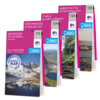
OS Landranger Snowdonia Map Set

Snowdonia National Park in North Wales contains Snowdon, which at 1085 m (3560 ft.) is the tallest mountain in England and Wales. However, it is also the largest National Park, with the largest lake in Wales, Bala Lake, plus other peaks and paths to explore. This map bundle contains all 4 OS Landranger Maps for the National Park with a discount of 20% compared to the cost of buying them individually, and is available in both standard and weatherproof 'Active' versions. Whatever activities you plan on your visit, you can make the most of it with Ordnance Survey maps. Official site: www.snowdonia-npa.gov.uk
RIP - This product is no longer available on our network. It was last seen on 14.11.2020

This page now acts as a permanent archive for this product. Add more information using the comments box below to ensure it can still be found by future generations.

Use our search facility to see if it is available from an alternative contributor.
Availability: In Stock
£44.77

Product Description

Snowdonia National Park in North Wales contains Snowdon, which at 1085 m (3560 ft.) is the tallest mountain in England & Wales. However, it is also the largest National Park, with the largest lake in Wales, Bala Lake, plus other peaks & paths to explore. This map bundle contains all 4 OS Landranger Maps for the National Park with a discount of 20% compared to the cost of buying them individually, & is available in both standard & weatherproof ' Active' versions. Whatever activities you plan on your visit, you can make the most of it with Ordnance Survey maps. Official site: www.snowdonia-npa.gov.uk

Reviews/Comments

Add New

Price History

Vouchers

No voucher codes found.
Do you know a voucher code for this product or supplier? Add it to Insights for others to use.

Facebook

Jargon Buster

UK - United Kingdom - An island nation in Europe
England - A country within the United Kingdom.
Set - a group of items usually related to one another. Some objects cannot function without the complete set of items.

Supplier Information

Ordnance Survey
Navigate your world with confidence with Ordnance Survey (https://shop.ordnancesurvey.co.uk/)! Explore our extensive range of maps, guides, and outdoor gear designed to help you explore the great outdoors with ease. From detailed maps for hiking and cycling to innovative GPS devices, we've got everything you need to plan your next adventure. With our heritage of accuracy and reliability, Ordnance Survey is your trusted companion for exploring the UK's landscapes, whether you're a seasoned explorer or a weekend wanderer. Gear up and discover new horizons with Ordnance Survey today!
Page Updated: 2024-03-04 13:47:34

Community Generated Product Tags

Oh No! The productWIKI community hasn't generated any tags for this product yet!
Menu