More From Contributor

£38.35
The Cairngorms National Park covers a substantial area of central mainland Scotl&. It is very mountainous
- five of the UK's highest
...
Archived Product
£67.15
The Cairngorms National Park covers a substantial area of central mainland Scotl&. It is very mountainous
- five of the UK's highest
...
Archived Product
£43.13
Cornwall's scenic beauty has long been a draw for visitors. With hugely variable coastline, dramatic landscapes, miles of sandy beaches, & a rich cultural & industrial heritage, it's one of the top tourist destinations in the UK. You can find wild & remote moorlands such as Bodmin Moor, fishing harbours, pretty villages, bustling towns & peaceful woodlands. Key towns & villages include: Bodmin, Tintagel, Penzance, Land's End, Mevagissey, Falmouth, Newquay, Padstow, Perranporth, Porthleven, St Ives, St Austell & the county capital of Truro.. There are also 12 separate Areas of Outstanding Natural Beauty in the county, as well as 10 World Heritage Sites & the ground-breaking Eden Project. This map bundle contains all six OS Landranger Maps for the Cornwall with a discount of 20% compared to the cost of buying them individually, & is available in both standard & weatherproof ' Active' versions. Whatever activities you plan on your visit, you can make the most of it with Ordnance Survey maps. ...
Archived Product
£71.95
Cornwall's scenic beauty has long been a draw for visitors. With hugely variable coastline, dramatic landscapes, miles of sandy beaches, & a rich cultural & industrial heritage, it's one of the top tourist destinations in the UK. You can find wild & remote moorlands such as Bodmin Moor, fishing harbours, pretty villages, bustling towns & peaceful woodlands. Key towns & villages include: Bodmin, Tintagel, Penzance, Land's End, Mevagissey, Falmouth, Newquay, Padstow, Perranporth, Porthleven, St Ives, St Austell & the county capital of Truro.. There are also 12 separate Areas of Outstanding Natural Beauty in the county, as well as 10 World Heritage Sites & the ground-breaking Eden Project. This map bundle contains all six OS Landranger Maps for the Cornwall with a discount of 20% compared to the cost of buying them individually, & is available in both standard & weatherproof ' Active' versions. Whatever activities you plan on your visit, you can make the most of it with Ordnance Survey maps. ...
Archived Product
£19.18
Dartmoor is 954 square kilometres (368 square miles) of moorland punctuated by exposed granite tors. Although parts are a military firing range, there are still ample opportunities for walking, running, cycling, riding & climbing. This map bundle contains all 3 OS Landranger Maps for the National Park with a discount of 20% compared to the cost of buying them individually, & is available in both standard & weatherproof ' Active' versions. Whatever activities you plan on your visit, you can make the most of it with Ordnance Survey maps. Official site: http://www.dartmoor-npa.gov.uk/ ...
Archived Product
£35.97
OS Landranger Maps 191, 201 & 202 Dartmoor is 954 square kilometres (368 square miles) of moorland punctuated by exposed granite tors. Although parts are a military firing range, there are still ample opportunities for walking, running, cycling, riding & climbing. This map bundle contains all 3 OS Landranger Maps for the National Park with a discount of 20% compared to the cost of buying them individually, & is available in both standard & weatherproof ' Active' versions. Whatever activities you plan on your visit, you can make the most of it with Ordnance Survey maps. ...
Archived Product
£21.57
OS Landranger Maps 191, 201 & 202 Dartmoor is 954 square kilometres (368 square miles) of moorland punctuated by exposed granite tors. Although parts are a military firing range, there are still ample opportunities for walking, running, cycling, riding & climbing. This map bundle contains all 3 OS Landranger Maps for the National Park with a discount of 20% compared to the cost of buying them individually, & is available in both standard & weatherproof ' Active' versions. Whatever activities you plan on your visit, you can make the most of it with Ordnance Survey maps. ...
Archived Product
£22.38
Exmoor National Park in Somerset & Devon has a variety of terrain from dramatic sea cliffs to gentle valleys. With 55 km (34 miles) of coastline, there are opportunities for fishing as well as walking & cycling. Like the Brecon Beacons it is designated as an International Dark Sky Reserve & runs regular stargazing events. This map bundle contains both OS Landranger Maps for the National Park with a discount of 20% compared to the cost of buying them individually, & is available in both standard & weatherproof ' Active' versions. Whatever activities you plan on your visit, you can make the most of it with Ordnance Survey maps. Official site: http://www.exmoor-nationalpark.gov.uk/ ...
Archived Product
£12.78
Exmoor National Park in Somerset & Devon has a variety of terrain from dramatic sea cliffs to gentle valleys. With 55 km (34 miles) of coastline, there are opportunities for fishing as well as walking & cycling. Like the Brecon Beacons it is designated as an International Dark Sky Reserve & runs regular stargazing events. This map bundle contains both OS Landranger Maps for the National Park with a discount of 20% compared to the cost of buying them individually, & is available in both standard & weatherproof ' Active' versions. Whatever activities you plan on your visit, you can make the most of it with Ordnance Survey maps. Official site: http://www.exmoor-nationalpark.gov.uk/ ...
Archived Product
£23.38
OS Landranger Maps 180 & 181 Exmoor National Park in Somerset & Devon has a variety of terrain from dramatic sea cliffs to gentle valleys. With 55 km (34 miles) of coastline, there are opportunities for fishing as well as walking & cycling. Like the Brecon Beacons it is designated as an International Dark Sky Reserve & runs regular stargazing events. This map bundle contains both OS Landranger Maps for the National Park with a discount of 20% compared to the cost of buying them individually, & is available in both standard & weatherproof ' Active' versions. Whatever activities you plan on your visit, you can make the most of it with Ordnance Survey maps. ...
Archived Product

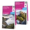
OS Landranger Dartmoor Map Set

Dartmoor is 954 square kilometres (368 square miles) of moorland punctuated by exposed granite tors. Although parts are a military firing range, there are still ample opportunities for walking, running, cycling, riding and climbing. This map bundle contains all 3 OS Landranger Maps for the National Park with a discount of 20% compared to the cost of buying them individually, and is available in both standard and weatherproof 'Active' versions. Whatever activities you plan on your visit, you can make the most of it with Ordnance Survey maps. Official site: http://www.dartmoor-npa.gov.uk/
RIP - This product is no longer available on our network. It was last seen on 14.11.2020

This page now acts as a permanent archive for this product. Add more information using the comments box below to ensure it can still be found by future generations.

Use our search facility to see if it is available from an alternative contributor.
Availability: In Stock
£33.58

Product Description

Dartmoor is 954 square kilometres (368 square miles) of moorland punctuated by exposed granite tors. Although parts are a military firing range, there are still ample opportunities for walking, running, cycling, riding & climbing. This map bundle contains all 3 OS Landranger Maps for the National Park with a discount of 20% compared to the cost of buying them individually, & is available in both standard & weatherproof ' Active' versions. Whatever activities you plan on your visit, you can make the most of it with Ordnance Survey maps. Official site: http://www.dartmoor-npa.gov.uk/

Reviews/Comments

Add New

Price History

Vouchers

No voucher codes found.
Do you know a voucher code for this product or supplier? Add it to Insights for others to use.

Facebook

Jargon Buster

UK - United Kingdom - An island nation in Europe
running - A sport or hobbie of moving rapidly on foot. Can also refer to the running of equipment or run time refering to the length of time an applicance can run or the quiet running of an applicance.
Set - a group of items usually related to one another. Some objects cannot function without the complete set of items.

Supplier Information

Ordnance Survey
Navigate your world with confidence with Ordnance Survey (https://shop.ordnancesurvey.co.uk/)! Explore our extensive range of maps, guides, and outdoor gear designed to help you explore the great outdoors with ease. From detailed maps for hiking and cycling to innovative GPS devices, we've got everything you need to plan your next adventure. With our heritage of accuracy and reliability, Ordnance Survey is your trusted companion for exploring the UK's landscapes, whether you're a seasoned explorer or a weekend wanderer. Gear up and discover new horizons with Ordnance Survey today!
Page Updated: 2024-03-04 13:47:34

Community Generated Product Tags

Oh No! The productWIKI community hasn't generated any tags for this product yet!
Menu