
 United Kingdom
 France
 Germany
 Netherlands
 Sweden
 USA
USA
 Italy
Italy
 Spain
Spain
More From Contributor


OS Explorer Lake District Map Set
OS Explorer Maps OL4, OL5, OL6 & OL7 The Lake District National Park (or just 'The Lakes') contains 19 major lakes and some significant mountains or fells, including Scafell Pike, the tallest mountain in England at 978 m. The dramatic scenery of the Lake District is credited with inspiring writers and poets such as Wordsworth, Coleridge and Keats. This map bundle contains all 4 OS Explorer Maps for the National Park with a discount of 20% compared to the cost of buying them individually, and is available in both standard and weatherproof 'Active' versions. Whether you're a seasoned outdoor expert or a leisurely sightseer, with the OS Explorer Lake District map set to hand, you'll be on the right track no matter where your adventure takes you. Trusted by outdoor enthusiasts these
easy-to-follow fold-up maps are your perfect companion in the great outdoors. With each map in this set you will receive a code for use on your iOS or Android smartphone or tablet.
easy-to-follow fold-up maps are your perfect companion in the great outdoors. With each map in this set you will receive a code for use on your iOS or Android smartphone or tablet.

Product Description
Reviews/Comments
Add New
Intelligent Comparison
Archived Product

OS Explorer Lake District Map Set Ordnance Survey
£47.97
Archived Product
OS Explorer Peak District Map Set Ordnance Survey
£23.98
Archived Product

OS Explorer Peak District Map Set Ordnance Survey
£14.38
Archived Product
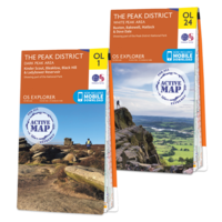
OS Explorer Peak District Map Set Ordnance Survey
£23.98
Archived Product

OS Landranger Lake District Map Set Ordnance Survey
£35.97
Archived Product

OS Landranger Lake District Map Set Ordnance Survey
£21.57
Archived Product
OS Explorer Ben Nevis Map Set Ordnance Survey
£35.98
Available

OS Explorer Ben Nevis Map Set Ordnance Survey
£21.58
Vouchers
No voucher codes found.
Do you know a voucher code for this product or supplier? Add it to Insights for others to use.
Do you know a voucher code for this product or supplier? Add it to Insights for others to use.
 Denmark