
 United Kingdom
 France
 Germany
 Netherlands
 Sweden
 USA
USA
 Italy
Italy
 Spain
Spain
More From Contributor


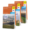


OS Explorer Peak District Map Set
In central England, the Peak District National Park was the first in Britain and is still one of the most popular. With both numerous footpaths and large open access areas, it’s popular for hiking and hillwalking and the natural rocks and caves make it ideal for climbers and potholers. The spa town of Buxton provides an excellent base for longer stays. This map bundle contains both OS Explorer Maps for the National Park with a discount of 20% compared to the cost of buying them individually, and is available in both standard and weatherproof 'Active' versions. Whatever activities you plan on your visit, you can make the most of it with Ordnance Survey maps. With all maps in this set you will receive a code for use on your iOS or Android smartphone or tablet. Find our more at Mobile
Download FAQ. About the Peak District National Park Official site: www.peakdistrict.gov.uk The Dark Peak area of the Peak District contains high gritstone hills, steep-sided valleys and moorland plateau, with striking edges rising above the eastern side of the Derwent Valley. One of the highlights of the Dark Peak area is Kinder Scout, now a Site of Special Scientific Interest because of its blanket peat bogs and close by lies the one of the most spectacular sights in the Peak District, Kinder Downfall, one of the only natural waterfalls in the Peak District National Park. The route starting at Edale, to Kinder and back via Jacob's Ladder is a favourite round walk. With the peaks of Blackhill and Bleaklow, the high moorlands, and picturesque valleys all covered on the map, walkers
and climbers are spoilt for choice. Clearly pinpointed – along with every pub, house, viewpoint, river and right of way – you’ll have no trouble plotting and navigating your route. For those who fancy something more challenging, why not walk a few sections of the Pennine Way or take the 55-mile Derwent Valley Heritage Way. With its outcrops of light-coloured limestone rock, the White Peak is surrounded on three sides by the gritstones of the Dark Peak. The White Peak has pastures and hay fields dominating the land, and the Peak District's classic limestone dry-stone walls. A perfect contrast to the wildness and wilderness of it's dark neighbour. But the White Peak also includes some tougher terrain such as the limestone gorge of Middleton Dale which contains some of the most
impressive caves in the area including the dramatic Castle Rock. As an example of the strange disappearing rivers of the limestone peak, at Waterfall Swallet the water disappears into potholes underground, before reappearing near Stoney Middleton village as thermal springs. One of the most beautiful places in all of the Peak District is the landscape of Dovedale, Manifold and the Hamps Valley, also on the White Peak map. As the gritstone has been worn away by erosion, the ancient sea floor has been revealed. Whatever outdoor pursuits you’re planning, from cycling and sightseeing, to riding and rambling, you’ll find something to cater for every outdoor interest on the OS Explorer map bundle of the Peak District. Highlights: Castle rock, Middleton Dale, Waterfall Swallet,
Thermal spring at Middleton Stoney, Kinder Scout, The Pennine Way, Edale, and the Derwent Valley Heritage Way. Buy both maps as a set and save 20%.
Product Description
Reviews/Comments
Add New
Intelligent Comparison
Archived Product
OS Explorer Lake District Map Set Ordnance Survey
£47.97
Available
OS Landranger Peak District Map Set Ordnance Survey
£19.18
Available

Petzl Actik Core Headlamp Ordnance Survey
£72.00
Archived Product
OS Explorer Ben Nevis Map Set Ordnance Survey
£35.98
Archived Product
OS Explorer Ben Nevis Map Set Ordnance Survey
£21.58
Archived Product
OS Landranger Lake District Map Set Ordnance Survey
£19.18
Archived Product
OS Landranger Lake District Map Set Ordnance Survey
£33.58
Archived Product
OS Explorer Dartmoor Map Set Ordnance Survey
£21.58
Vouchers
No voucher codes found.
Do you know a voucher code for this product or supplier? Add it to Insights for others to use.
Do you know a voucher code for this product or supplier? Add it to Insights for others to use.
 Denmark