
 United Kingdom
 France
 Germany
 Netherlands
 Sweden
 USA
USA
 Italy
Italy
 Spain
Spain
More From Contributor


Ordnance Survey Map Of Grantham
Grantham (inc. Sleaford & Bourne) map - OS Landranger 130 Format: Folded map Physical Size: 1000 x 890 mm (134 x 227 mm folded) Publication Date: 29/08/2018


Product Description
Reviews/Comments
Add New
Intelligent Comparison
Available

The Adventure Patch Company Yorkshire Three Peaks Challenge Patch Ordnance Survey
£5.00
Available
The Adventure Patch Company Welsh 3000s Challenge Patch Ordnance Survey
£5.00
Available

Ordnance Survey Map Of Grantham Ordnance Survey
£16.99
Available

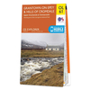
Ordnance Survey Map Of Girvan Ordnance Survey
£12.99
Available

Ordnance Survey Map Of Birmingham Ordnance Survey
£12.99
Available

Ordnance Survey Map Of Birmingham Ordnance Survey
£16.99
Available

Ordnance Survey Map Of Coll & Tiree Explorer Ordnance Survey
£12.99
Available
Map Of Langholm Ordnance Survey
£6.99
Vouchers
No voucher codes found.
Do you know a voucher code for this product or supplier? Add it to Insights for others to use.
Do you know a voucher code for this product or supplier? Add it to Insights for others to use.
 Denmark