-
Home
-
Contributors
-
International
-
Account
-
Information
More From Contributor
£16.99
The Landranger map of Berwick-upon-Tweed, including Holy Island & Wooler is a must-have for your next trip to the area. Located close to the Scottish border, Berwick-upon-Tweed is the Northern-most town in Engl&. There is an abundance of attractions & things to do. The vast expanse of surrounding Northumberland Countryside features rolling hills, beaches, historical landmarks, & interesting museums. Holy Island & the Farne Island are situated off the coastline in the North Sea, & the town of Wooler sits inland close to the Northumberland National Park. Our Landranger maps come in standard or Weatherproof Active, you'll also receive a free download for your devices — making for a convenient companion. Publication Date: 24/02/2016 ...
Available
£12.99
Map of Bideford, Ilfracombe & Barnstaple
- OS Explorer Map 139 (Woolacombe & Lundy) Publication Date: 16/09/2015 ...
- OS Explorer Map 139 (Woolacombe & Lundy) Publication Date: 16/09/2015 ...
Available
£16.99
Map of Bideford, Ilfracombe & Barnstaple
- OS Explorer Map 139 (Woolacombe & Lundy) Publication Date: 16/09/2015 ...
- OS Explorer Map 139 (Woolacombe & Lundy) Publication Date: 16/09/2015 ...
Available
£16.99
Map of Biggar & Broughton
- OS Explorer Map 336 (Culter Fell & Dollar Law ) Format: Folded map Physical
Size: ...
- OS Explorer Map 336 (Culter Fell & Dollar Law ) Format: Folded map Physical
Size: ...
Available
£12.99
Map of Biggar & Broughton
- OS Explorer Map 336 (Culter Fell & Dollar Law ) Format: Folded map Physical
Size: ...
- OS Explorer Map 336 (Culter Fell & Dollar Law ) Format: Folded map Physical
Size: ...
Available
£16.99
Map of Birmingham
- OS Explorer Map 220 (Walsall, Solihull & Redditch) Publication Date: 16/09/2015 ...
- OS Explorer Map 220 (Walsall, Solihull & Redditch) Publication Date: 16/09/2015 ...
Available
£12.99
Birmingham & Wolverhampton (inc. including The Black Country) map
- OS Landranger 139 Publication Date: 18/05/2018 ...
- OS Landranger 139 Publication Date: 18/05/2018 ...
Available
£16.99
Birmingham & Wolverhampton (inc. including The Black Country) map
- OS Landranger 139 Publication Date: 18/05/2018 ...
- OS Landranger 139 Publication Date: 18/05/2018 ...
Available
£16.99
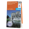
Map of Bishop Auckland
- OS Explorer Map 305 (Spennymoor, Newton Aycliffe, Sedgefield & Crook) Format: Folded map Physical
...
- OS Explorer Map 305 (Spennymoor, Newton Aycliffe, Sedgefield & Crook) Format: Folded map Physical
...
Available
£12.99
Map of Bishop Auckland
- OS Explorer Map 305 (Spennymoor, Newton Aycliffe, Sedgefield & Crook) Format: Folded map Physical
...
- OS Explorer Map 305 (Spennymoor, Newton Aycliffe, Sedgefield & Crook) Format: Folded map Physical
...
Available
Ordnance Survey Map Of Birmingham
Map of Birmingham - OS Explorer Map 220 (Walsall, Solihull & Redditch) Publication Date: 16/09/2015
- External links may include paid for promotion
- Availability: In Stock
- Supplier: Ordnance Survey
- SKU: 2032
Availability: In Stock
£12.99
Product Description
Map of Birmingham
- OS Explorer Map 220 (Walsall, Solihull & Redditch) Publication Date: 16/09/2015
Reviews/Comments
Add New
Intelligent Comparison
Price History
Vouchers
No voucher codes found.
Do you know a voucher code for this product or supplier? Add it to Insights for others to use.
Facebook
Do you know a voucher code for this product or supplier? Add it to Insights for others to use.
Jargon Buster
Date - A day on a calendar
Date - A social activity whith a current or potential partner
Supplier Information
Ordnance Survey
Navigate your world with confidence with Ordnance Survey (https://shop.ordnancesurvey.co.uk/)! Explore our extensive range of maps, guides, and outdoor gear designed to help you explore the great outdoors with ease. From detailed maps for hiking and cycling to innovative GPS devices, we've got everything you need to plan your next adventure. With our heritage of accuracy and reliability, Ordnance Survey is your trusted companion for exploring the UK's landscapes, whether you're a seasoned explorer or a weekend wanderer. Gear up and discover new horizons with Ordnance Survey today!
Page Updated: 2024-03-04 13:47:34
Community Generated Product Tags
Oh No! The productWIKI community hasn't generated any tags for this product yet!


 United Kingdom
 France
 Germany
 Netherlands
 Sweden
 USA
USA
 Italy
Italy
 Spain
Spain


 Denmark