The Landranger map of Aldershot & Guildford, including Camberley & Haslemere is a must-have for your next trip to the area. Landranger maps are perfect for extensive hikes, cycling, & driving holidays. Ideal for planning days out or holidays to the towns of Aldershot & Guildford. Further places to explore in the area with this map is the North Downs Way, Alton, & King John's Castle. Our Landranger maps come in standard or Weatherproof Active, you'll also receive a free download for your devices — making for a convenient companion. Publication Date: 24/02/2016 ...
The OS Explorer map of Alnwick & Amble, including Craster & Whittingham, is a must-have when visiting the area. This map covers the Northumbrian Coast from Embleton Bay to Amble & inland as far as the source of the River Aln. Places to visit include Craster, Alnwick Castle, Wakworth Castle, Dunstanburgh Castle, Long Crag, & Rothbury. Our OS Explorer maps are perfect for day-tripping, extensive hikes, & cycling. They come in both standard & Weatherproof Active, so you'll never get caught out in a storm. This map also comes with a free digital download, so you can access it across your devices — making for a more convenient companion. Publication Date: 16/09/2015 ...
OS Landranger map 81: Alnwick & Morpeth, including Rothbury & Amble. This is a single sided map with card cover in 1:50 000 scale, ideal for cycling, tourism & general outdoor activities. Publication Date: 24/02/2016 ...
Available
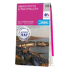
Ordnance Survey Map Of Aboyne, Alford & Strathdon
Purchase the Aboyne, Alford & Strathdon folded map OL 59 from the OS Explorer Map range Publication Date: 10/06/2015
Navigate your world with confidence with Ordnance Survey (https://shop.ordnancesurvey.co.uk/)! Explore our extensive range of maps, guides, and outdoor gear designed to help you explore the great outdoors with ease. From detailed maps for hiking and cycling to innovative GPS devices, we've got everything you need to plan your next adventure. With our heritage of accuracy and reliability, Ordnance Survey is your trusted companion for exploring the UK's landscapes, whether you're a seasoned explorer or a weekend wanderer. Gear up and discover new horizons with Ordnance Survey today!
Page Updated: 2024-03-04 13:47:34
Community Generated Product Tags
Oh No! The productWIKI community hasn't generated any tags for this product yet!