More From Contributor

£16.99
Purchase the Aberdeen & Banchory folded map: double-sided (boarded cover) from the OS Explorer Map range Format: Folded map Physical

Size:
890 x 1000 mm (134 x 227 mm folded) Publication Date: 06/04/2021

...
Available
£12.99
Purchase the Aberdeen & Banchory folded map: double-sided (boarded cover) from the OS Explorer Map range Format: Folded map Physical

Size:
890 x 1000 mm (134 x 227 mm folded) Publication Date: 06/04/2021

...
Available
£12.99
Purchase the Aberystwyth & Cwm Rheidol folded map: single-sided (boarded cover) from the OS Explorer Map range Format: Folded map Physical

Size:
1270 x 952 mm (133 x 240 mm folded) Publication Date: 16/09/2015

...
Available
£16.99
Purchase the Aberystwyth & Cwm Rheidol folded map: single-sided (boarded cover) from the OS Explorer Map range Format: Folded map Physical

Size:
1270 x 952 mm (133 x 240 mm folded) Publication Date: 16/09/2015

...
Available
£16.99
Aberystwyth & Machynlleth map
- OS Landranger 135 Publication Date: 24/02/2016 ...
Available
£12.99
OS Explorer map of Abingdon, Wantage & Vale of White Horse in 1: 25 000 scale Format: Folded map Physical

Size:


...
Available
£16.99
OS Explorer map of Abingdon, Wantage & Vale of White Horse in 1: 25 000 scale Format: Folded map Physical

Size:


...
Available
£12.99
Purchase the Aboyne, Alford & Strathdon folded map OL 59 from the OS Explorer Map range Publication Date: 10/06/2015 ...
Available
£16.99
Purchase the Aboyne, Alford & Strathdon folded map OL 59 from the OS Explorer Map range Publication Date: 10/06/2015 ...
Available
£12.99
The Landranger map of Aldershot & Guildford, including Camberley & Haslemere is a must-have for your next trip to the area. Landranger maps are perfect for extensive hikes, cycling, & driving holidays. Ideal for planning days out or holidays to the towns of Aldershot & Guildford. Further places to explore in the area with this map is the North Downs Way, Alton, & King John's Castle. Our Landranger maps come in standard or Weatherproof Active, you'll also receive a free download for your devices — making for a convenient companion. Publication Date: 24/02/2016 ...
Available

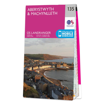
Ordnance Survey Map Of Aberystwyth & Machynlleth

Aberystwyth & Machynlleth map - OS Landranger 135 Publication Date: 24/02/2016
Availability: In Stock
£12.99

Product Description

Aberystwyth & Machynlleth map
- OS Landranger 135 Publication Date: 24/02/2016

Reviews/Comments

Add New

Price History

Vouchers

No voucher codes found.
Do you know a voucher code for this product or supplier? Add it to Insights for others to use.

Facebook

Jargon Buster

Date - A day on a calendar
Date - A social activity whith a current or potential partner

Supplier Information

Ordnance Survey
Navigate your world with confidence with Ordnance Survey (https://shop.ordnancesurvey.co.uk/)! Explore our extensive range of maps, guides, and outdoor gear designed to help you explore the great outdoors with ease. From detailed maps for hiking and cycling to innovative GPS devices, we've got everything you need to plan your next adventure. With our heritage of accuracy and reliability, Ordnance Survey is your trusted companion for exploring the UK's landscapes, whether you're a seasoned explorer or a weekend wanderer. Gear up and discover new horizons with Ordnance Survey today!
Page Updated: 2024-03-04 13:47:34

Community Generated Product Tags

Oh No! The productWIKI community hasn't generated any tags for this product yet!
Menu