More From Contributor

£8.99
Reproduction map of Bristol from the Revised New Edition, 1896 to 1904. Available flat (rolled) or framed. ...
Available
£6.99
This guide contains ten family-friendly & easy-paced short, circular walks covering the Chilterns AONB. You can find out about places of interest like the Whipsnade Tree Cathedral & sites to enjoy glades of bluebells in spring & the russet hues of ancient woodlands in autumn. Find wheelchair-friendly sections of the Thames Path, read about chair making, & identify some chalk downland wildflowers & insects. Between Bedfordshire’s Pegsdon Hills, via the Dunstable Downs, & across Buckinghamshire’s chalk downs to the Thames Valley, you can explore the glorious beech woodlands of the Chilterns, drink in the views over Alylesbury Vale, see wheeling red kites & enjoy waterside strolls at Tring, Goring & Cookham. Ten easy-to-follow leisurely walks Distance: 2 to 4 miles stunning scenery: downs, woods & riverside Navigate your way: simplified mapping, route profiles, turn-by-turn instructions, or walk photography Packed with essential information for easy planning: Public transport links & parking spots Terrain & footwear information Refreshment stops including pubs & cafes Public toilet markers Nature notes for the area Stories behind each walk Highlighted accessibility sections for wheelchair & pushchair users Dog friendly information ...
Available
£7.19
Reproduction map of Cirencester from the Revised New Edition, 1896 to 1903 ...
Available
£6.99
This guide contains ten family-friendly & easy-paced short walks covering the Gower Peninsula, around the coast & on the fine ridge of Cefn Bryn; at Swansea; with three circuits between Neath & Bridgend, & Ogmore’s Bristol Channel views. Visit the best marine & seabird wildlife watching spots, read about shipwrecks & smugglers, & seek out the best ice cream & café stops. Coast path walks give fabulous views over the dunes from Llanmadoc, out to Worms Head from Rhossili, along the clifftops at Pennard to mighty Pwlldu Head, & visit Mumbles seaside & the vibrant waterfront at Swansea. There are woodland trails & mining heritage in Afan Forest & at Parc Slip, with a fairytale castle at Margam. Ten easy-to-follow leisurely walks Distance: 2 to 5 miles stunning scenery: coast, forest & ridge top Navigate your way: simplified mapping, route profiles, turn-by-turn instructions, or walk photography Packed with essential information for easy planning: Public transport links & parking spots Terrain & footwear information Refreshment stops including pubs & cafes Public toilet markers Nature notes for the area Stories behind each walk Highlighted accessibility sections for wheelchair & pushchair users Dog friendly information ...
Available
£11.24
Whether your adventures are a stroll in the park or taking on some of Britain's highest peaks, the Ordnance Survey Great British Travel Journal will help you record your plans, routes, trips & inspirational ideas. The first section gives tips to make your time outdoor safer, more enjoyable & easier to plan, with equipment checklists, outdoors skills & information on rights of way & the Countryside Code. The remainder is blank lined & numbered pages for you to record your routes, favourite spots, wildlife encounters or memories. It even

Includes::
a blank index page at the front, so you can find your favourites. The journal (or notebook, if you prefer) is 160 A5 pages, with the first sixteen printed, & the remainder available for you. It also features an elastic closure band to keep it secure. It has been printed using recycled materials, & is also recyclable. The ideal gift for anyone who loves adventure in the Great British outdoors.

...
Archived Product
£7.19
Reproduction map of Hungerford from the Revised New Edition, 1896 to 1903 ...
Available
£6.99
Cornwall OS Tour map: 1:100, 000 tourist road map ...
Available
£16.99
Map of Llanidloes & Newtown
- OS Explorer Map 214 (Llyn Clywedog) Format: Folded map Physical

Size:
890


...
Available
£6.99
Scotland OS Tour map 12 in 1: 500 001 Format: Folded map Publication Date: 24/2/2016 ...
Available
£1.49
Got a present for an outdoor enthusiast but need the perfect way to wrap it? This is the new version of our limited edition ...
Archived Product

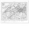
Ordnance Survey Harrogate 1896-1904

Reproduction map of Harrogate from the Revised New Edition, 1896 to 1904
Availability: In Stock
£7.19

Product Description

Reproduction map of Harrogate from the Revised New Edition, 1896 to 1904

Reviews/Comments

Add New

Intelligent Comparison

Oooops!
We couldn't find anything!
Perhaps this product's unique.... Or perhaps we are still looking for comparisons!
Click to bump this page and we'll hurry up.

Price History

Oooops!
We couldn't find any historical pricing!

Vouchers

No voucher codes found.
Do you know a voucher code for this product or supplier? Add it to Insights for others to use.

Facebook

Jargon Buster

Reproduction - A process of making a copy of something.

Supplier Information

Ordnance Survey
Navigate your world with confidence with Ordnance Survey (https://shop.ordnancesurvey.co.uk/)! Explore our extensive range of maps, guides, and outdoor gear designed to help you explore the great outdoors with ease. From detailed maps for hiking and cycling to innovative GPS devices, we've got everything you need to plan your next adventure. With our heritage of accuracy and reliability, Ordnance Survey is your trusted companion for exploring the UK's landscapes, whether you're a seasoned explorer or a weekend wanderer. Gear up and discover new horizons with Ordnance Survey today!
Page Updated: 2024-03-04 13:47:34

Community Generated Product Tags

Oh No! The productWIKI community hasn't generated any tags for this product yet!
Menu