More From Contributor

£3.99
Explore Secret Stories Old Sarum's Cathedral Chaos Tour, a self-guided interactive walking tour to enjoy whenever you want. Welcome to Old Sarum! A unique site & once one of the most important places in Engl&, home to kings & bishops. It was also really Salisbury before Salisbury even existed. In this tour, find out why Old Sarum fell out of favour & Salisbury took over. Discover Old Sarum’s part in securing William the Conqueror’s grip on the throne, & its role as a prison for a rebellious queen. Hear all about how it earned its reputation as England’s rottenest rotten borough, & the mysterious energy lines that may run through it. Total length: 1.2 miles; Suggested age range: 7+ Purchase this Tour (and more) in the Secret Stories App, available for free download from Android Play & Apple App store. You'll find more details of the tour & what it contains in the app! ...
Available
£9.99
This lightweight Tritan water flask is made by Lifeventure exclusively for Ordnance Survey. It's extremely strong with a high impact resistance, to withstand even the toughest adventures. It's been printed with an OS 'contours' design to make your bottle really stand out from the others.. It can hold 700ml of water or other flavoured drinks
- it doesn't retain tastes or odours. The wide screwtop makes filling & cleaning easy, while the flip-open drinking spout can be used with one h&. It even

Includes::
a carry strap to make it easier to hang on to. On the side of the bottle are markings in metric & imperial, so you can easily check if you are drinking enough. Tritan bottles were tested by explorers at the North Pole, making this ideal for all your adventures
- whether that's a multi-day hike or just out to the local gym.


...
Archived Product
£8.99
Reproduction map of Bristol from the Revised New Edition, 1896 to 1904. Available flat (rolled) or framed. ...
Available
£6.99
This guide contains ten family-friendly & easy-paced short, circular walks covering the Chilterns AONB. You can find out about places of interest like the Whipsnade Tree Cathedral & sites to enjoy glades of bluebells in spring & the russet hues of ancient woodlands in autumn. Find wheelchair-friendly sections of the Thames Path, read about chair making, & identify some chalk downland wildflowers & insects. Between Bedfordshire’s Pegsdon Hills, via the Dunstable Downs, & across Buckinghamshire’s chalk downs to the Thames Valley, you can explore the glorious beech woodlands of the Chilterns, drink in the views over Alylesbury Vale, see wheeling red kites & enjoy waterside strolls at Tring, Goring & Cookham. Ten easy-to-follow leisurely walks Distance: 2 to 4 miles stunning scenery: downs, woods & riverside Navigate your way: simplified mapping, route profiles, turn-by-turn instructions, or walk photography Packed with essential information for easy planning: Public transport links & parking spots Terrain & footwear information Refreshment stops including pubs & cafes Public toilet markers Nature notes for the area Stories behind each walk Highlighted accessibility sections for wheelchair & pushchair users Dog friendly information ...
Available
£7.19
Reproduction map of Cirencester from the Revised New Edition, 1896 to 1903 ...
Available
£11.24
Whether your adventures are a stroll in the park or taking on some of Britain's highest peaks, the Ordnance Survey Great British Travel Journal will help you record your plans, routes, trips & inspirational ideas. The first section gives tips to make your time outdoor safer, more enjoyable & easier to plan, with equipment checklists, outdoors skills & information on rights of way & the Countryside Code. The remainder is blank lined & numbered pages for you to record your routes, favourite spots, wildlife encounters or memories. It even

Includes::
a blank index page at the front, so you can find your favourites. The journal (or notebook, if you prefer) is 160 A5 pages, with the first sixteen printed, & the remainder available for you. It also features an elastic closure band to keep it secure. It has been printed using recycled materials, & is also recyclable. The ideal gift for anyone who loves adventure in the Great British outdoors.

...
Archived Product
£7.19
Reproduction map of Harrogate from the Revised New Edition, 1896 to 1904 ...
Available
£7.19
Reproduction map of Hungerford from the Revised New Edition, 1896 to 1903 ...
Available
£6.99
Cornwall OS Tour map: 1:100, 000 tourist road map ...
Available
£16.99
Map of Llanidloes & Newtown
- OS Explorer Map 214 (Llyn Clywedog) Format: Folded map Physical

Size:
890


...
Available

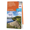
Ordnance Survey Gower And Swansea Bay - OS Short Walks Made Easy

This guide contains ten family-friendly and easy-paced short walks covering the Gower Peninsula, around the coast and on the fine ridge of Cefn Bryn; at Swansea; with three circuits between Neath and Bridgend, and Ogmore’s Bristol Channel views. Visit the best marine and seabird wildlife watching spots, read about shipwrecks and smugglers, and seek out the best ice cream and café stops. Coast path walks give fabulous views over the dunes from Llanmadoc, out to Worms Head from Rhossili, along the clifftops at Pennard to mighty Pwlldu Head, and visit Mumbles seaside and the vibrant waterfront at Swansea. There are woodland trails and mining heritage in Afan Forest and at Parc Slip, with a fairytale castle at Margam. Ten easy-to-follow leisurely walks Distance: 2 to 5 miles
Stunning scenery: coast, forest and ridge top Navigate your way: simplified mapping, route profiles, turn-by-turn instructions, or walk photography Packed with essential information for easy planning: Public transport links and parking spots Terrain and footwear information Refreshment stops including pubs and cafes Public toilet markers Nature notes for the area Stories behind each walk Highlighted accessibility sections for wheelchair and pushchair users Dog friendly information
Availability: In Stock
£6.99

Product Description

This guide contains ten family-friendly & easy-paced short walks covering the Gower Peninsula, around the coast & on the fine ridge of Cefn Bryn; at Swansea; with three circuits between Neath & Bridgend, & Ogmore’s Bristol Channel views. Visit the best marine & seabird wildlife watching spots, read about shipwrecks & smugglers, & seek out the best ice cream & café stops. Coast path walks give fabulous views over the dunes from Llanmadoc, out to Worms Head from Rhossili, along the clifftops at Pennard to mighty Pwlldu Head, & visit Mumbles seaside & the vibrant waterfront at Swansea. There are woodland trails & mining heritage in Afan Forest & at Parc Slip, with a fairytale castle at Margam. Ten easy-to-follow leisurely walks Distance: 2 to 5 miles stunning scenery: coast, forest & ridge top Navigate your way: simplified mapping, route profiles, turn-by-turn instructions, or walk photography Packed with essential information for easy planning: Public transport links & parking spots Terrain & footwear information Refreshment stops including pubs & cafes Public toilet markers Nature notes for the area Stories behind each walk Highlighted accessibility sections for wheelchair & pushchair users Dog friendly information

Reviews/Comments

Add New

Intelligent Comparison

Oooops!
We couldn't find anything!
Perhaps this product's unique.... Or perhaps we are still looking for comparisons!
Click to bump this page and we'll hurry up.

Price History

Oooops!
We couldn't find any historical pricing!

Vouchers

No voucher codes found.
Do you know a voucher code for this product or supplier? Add it to Insights for others to use.

Facebook

Jargon Buster

Forest - A area with a high density of trees
Ice - Frozen water, the solid state of water.
Ice - Frozen water, Ice is cold to the touch and forms when water reaches 0 degrees centigrade.
Instructions - An informative direction to take.
Cream - A warmer tone of white, also a thick white/yellow food liquid used in cooking.
Head - The upper part of a body typically separated by the neck.
Transport - Something that carries people or goods.
Family - A group of people that live together made up from parents and children.

Supplier Information

Ordnance Survey
Navigate your world with confidence with Ordnance Survey (https://shop.ordnancesurvey.co.uk/)! Explore our extensive range of maps, guides, and outdoor gear designed to help you explore the great outdoors with ease. From detailed maps for hiking and cycling to innovative GPS devices, we've got everything you need to plan your next adventure. With our heritage of accuracy and reliability, Ordnance Survey is your trusted companion for exploring the UK's landscapes, whether you're a seasoned explorer or a weekend wanderer. Gear up and discover new horizons with Ordnance Survey today!
Page Updated: 2024-03-04 13:47:34

Community Generated Product Tags

Oh No! The productWIKI community hasn't generated any tags for this product yet!
Menu