
 United Kingdom
 France
 Germany
 Netherlands
 Sweden
 USA
USA
 Italy
Italy
 Spain
Spain
More From Contributor


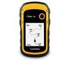
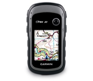
Garmin ETrex 30 Global Positioning Monitor
Garmin eTrex 30 Global Positioning Monitor
eTrex 30 takes one of the most popular and reliable GPS handhelds and makes it better. Enhanced ergonomics, an improved interface, paperless geocaching and expanded mapping capabilities makes eTrex more versatile and user-friendly, while maintaining its toughness and durability.
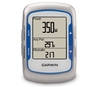
See The Way
eTrex 30 has an enhanced 2.2 in 65K colour, brilliant, sunlight-readable display. Durable and waterproof, eTrex 30 is built to withstand the elements. It has an upgraded interface and stands strong against the elements - be it dust, dirt, humidity or water, none of which are a match for this versatile navigator.
The Right Tools for your Adventure
eTrex 30 adds a built-in 3-axis tilt-compensated electronic compass, which shows your heading even when
you're standing still, without holding it level. Also added is a barometric altimeter which tracks changes in pressure to pinpoint your precise altitude, and you even can use it to plot barometric pressure over time, which can help you keep an eye on changing weather conditions. Get the Mapping You Want With its microSDTM card slot and 1.7 GB of internal memory, eTrex 30 lets you load our range of Ordnance Survey maps such as Garmin GB DiscovererTM and hit the trail, plug in BlueChart g2 preloaded cards for a great day on the water or City Navigator NT map data for turn-by-turn routing on roads (see maps tab for compatible maps). eTrex 30 also supports BirdsEyeTM Select map download service that lets you download premium raster maps to your device and integrate them with your existing
maps. Find Fun eTrex 30 supports geocaching GPX files for downloading geocaches and details straight to your unit. Visit OpenCaching.com to start your geocaching adventure. By going paperless, you're not only helping the environment but also improving efficiency. eTrex 30 stores and displays key information, including location, terrain, difficulty, hints and descriptions, which means no more manually entering coordinates and paper print outs. Simply upload the GPX file to your unit and start hunting for caches. Share Wirelessly eTrex 30 lets you share your waypoints, tracks, routes and geocaches wirelessly with other compatible Garmin GPS devices. So now your friends also can enjoy your favorite hike or cache - simply press "send" to transfer your information to similar
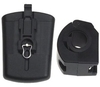
units, and let the games begin. Keep Your Fix With its high-sensitivity, EGNOS-enabled GPS receiver and HotFix satellite prediction, eTrex locates your position quickly and precisely and maintains its GPS location even in heavy cover and deep canyons. Go Anywhere With an array of compatible mounts, eTrex 20 can be used on your bicycle, boat, in your car or motorbike and off-road vehicle. You even get turn-by-turn directions with the auto mount and City Navigator NT maps. Wherever you think you might take eTrex, it has the mapping and mounts to get you there. Go Global The new eTrex series is the first-ever consumer-grade receivers that can track both GPS and GLONASS satellites simultaneously. GLONASS is a system developed by the Russian Federation that will be fully operational in
2012. When using GLONASS satellites, the time it takes for the receiver to "lock on" to a position is (on average) approximately 20 percent faster than using GPS. And when using both GPS and GLONASS, the receiver has the ability to lock on to 24 more satellites than using GPS alone. Features: Paperless Geocaching Spend more time in the field and less time fumbling with paper! The eTrex stores and displays key information, including location, terrain, difficulty, hints and descriptions, which means no more manually entering coordinates and paper print outs. Simply upload the geocaching GPX file to your unit and start hunting for caches. Track More Satellites Find your way with the first consumer-grade GPS receiver that tracks both GPS and Russian Federation GLONASS
satellites simultaneously. When using them together, the receiver has the ability to lock onto 24 more satellites than using GPS alone, ensuring you can "lock on" to a position more quickly. Pick Your Profile Customize eTrex for every occasion. Profiles allow eTrex to quickly switch into different configurations that you create, so when you're done geocaching and you need to drive home, your eTrex won't miss a beat. More Dashboards in More Places Bring more functionality into your frequently used applications with dashboards. Avoid switching between applications and display more information by customizing them with an altimeter, compass, configurable data fields and more. Advanced Tracking Whether following a saved route or planning a new one, eTrex has the tracking
features you need. Users can see high and low elevation points or store waypoints along a track (start, finish and high/low altitude) to estimate time and distance between points Extensive Map Support With its microSDTM card slot and large internal memory, eTrex lets you load a variety of maps, including TOPO 24K, BlueChart g2, City Navigator NT and BirdsEyeTM Satellite Imagery (subscription required) Specifications: Physical & Performance: Unit dimensions, WxHxD: 2.1" x 4.0" x 1.3" (5.4 x 10.3 x 3.3 cm) Display size, WxH: 1.4" x 1.7" (3.5 x 4.4 cm) 2.2" diag (5.6 cm) Display resolution, WxH: 176 x 220 pixels Display type: transflective, 65-K colour TFT Weight: 5 oz (141.7 g) with batteries Battery: 2 AA batteries (not included)
NiMH or Lithium recommended Battery life: 25 hours Waterproof: yes (IPX7) Floats: no High-sensitivity receiver: yes Interface: USB Maps & Memory: Basemap: yes Preloaded maps: no Ability to add maps: yes Built-in memory: 1.7 GB Accepts data cards: microSDTM card (not included) Waypoints/favorites/locations: 2000 Routes: 200 Track log: 10, 000 points, 200 saved tracks Features & Benefits: Automatic routing (turn by turn routing on roads): yes (with optional mapping for detailed roads) Electronic compass: yes (tilt-compensated, 3-axis) Touchscreen: no Barometric altimeter: yes Camera: no Geocaching-friendly: yes (paperless) Custom maps compatible: yes Photo navigation (navigate to geotagged photos): yes Outdoor GPS
games: no Hunt/fish calendar: yes Sun and moon information: yes Tide tables: Yes (with optional Bluechart) Area calculation: yes Custom POIs (ability to add additional points of interest): yes Unit-to-unit transfer (shares data wirelessly with similar units): yes Picture viewer: no Garmin ConnectTM compatible (online community where you analyze, categorize and share data): yes
you're standing still, without holding it level. Also added is a barometric altimeter which tracks changes in pressure to pinpoint your precise altitude, and you even can use it to plot barometric pressure over time, which can help you keep an eye on changing weather conditions. Get the Mapping You Want With its microSDTM card slot and 1.7 GB of internal memory, eTrex 30 lets you load our range of Ordnance Survey maps such as Garmin GB DiscovererTM and hit the trail, plug in BlueChart g2 preloaded cards for a great day on the water or City Navigator NT map data for turn-by-turn routing on roads (see maps tab for compatible maps). eTrex 30 also supports BirdsEyeTM Select map download service that lets you download premium raster maps to your device and integrate them with your existing
maps. Find Fun eTrex 30 supports geocaching GPX files for downloading geocaches and details straight to your unit. Visit OpenCaching.com to start your geocaching adventure. By going paperless, you're not only helping the environment but also improving efficiency. eTrex 30 stores and displays key information, including location, terrain, difficulty, hints and descriptions, which means no more manually entering coordinates and paper print outs. Simply upload the GPX file to your unit and start hunting for caches. Share Wirelessly eTrex 30 lets you share your waypoints, tracks, routes and geocaches wirelessly with other compatible Garmin GPS devices. So now your friends also can enjoy your favorite hike or cache - simply press "send" to transfer your information to similar
units, and let the games begin. Keep Your Fix With its high-sensitivity, EGNOS-enabled GPS receiver and HotFix satellite prediction, eTrex locates your position quickly and precisely and maintains its GPS location even in heavy cover and deep canyons. Go Anywhere With an array of compatible mounts, eTrex 20 can be used on your bicycle, boat, in your car or motorbike and off-road vehicle. You even get turn-by-turn directions with the auto mount and City Navigator NT maps. Wherever you think you might take eTrex, it has the mapping and mounts to get you there. Go Global The new eTrex series is the first-ever consumer-grade receivers that can track both GPS and GLONASS satellites simultaneously. GLONASS is a system developed by the Russian Federation that will be fully operational in
2012. When using GLONASS satellites, the time it takes for the receiver to "lock on" to a position is (on average) approximately 20 percent faster than using GPS. And when using both GPS and GLONASS, the receiver has the ability to lock on to 24 more satellites than using GPS alone. Features: Paperless Geocaching Spend more time in the field and less time fumbling with paper! The eTrex stores and displays key information, including location, terrain, difficulty, hints and descriptions, which means no more manually entering coordinates and paper print outs. Simply upload the geocaching GPX file to your unit and start hunting for caches. Track More Satellites Find your way with the first consumer-grade GPS receiver that tracks both GPS and Russian Federation GLONASS
satellites simultaneously. When using them together, the receiver has the ability to lock onto 24 more satellites than using GPS alone, ensuring you can "lock on" to a position more quickly. Pick Your Profile Customize eTrex for every occasion. Profiles allow eTrex to quickly switch into different configurations that you create, so when you're done geocaching and you need to drive home, your eTrex won't miss a beat. More Dashboards in More Places Bring more functionality into your frequently used applications with dashboards. Avoid switching between applications and display more information by customizing them with an altimeter, compass, configurable data fields and more. Advanced Tracking Whether following a saved route or planning a new one, eTrex has the tracking
features you need. Users can see high and low elevation points or store waypoints along a track (start, finish and high/low altitude) to estimate time and distance between points Extensive Map Support With its microSDTM card slot and large internal memory, eTrex lets you load a variety of maps, including TOPO 24K, BlueChart g2, City Navigator NT and BirdsEyeTM Satellite Imagery (subscription required) Specifications: Physical & Performance: Unit dimensions, WxHxD: 2.1" x 4.0" x 1.3" (5.4 x 10.3 x 3.3 cm) Display size, WxH: 1.4" x 1.7" (3.5 x 4.4 cm) 2.2" diag (5.6 cm) Display resolution, WxH: 176 x 220 pixels Display type: transflective, 65-K colour TFT Weight: 5 oz (141.7 g) with batteries Battery: 2 AA batteries (not included)
NiMH or Lithium recommended Battery life: 25 hours Waterproof: yes (IPX7) Floats: no High-sensitivity receiver: yes Interface: USB Maps & Memory: Basemap: yes Preloaded maps: no Ability to add maps: yes Built-in memory: 1.7 GB Accepts data cards: microSDTM card (not included) Waypoints/favorites/locations: 2000 Routes: 200 Track log: 10, 000 points, 200 saved tracks Features & Benefits: Automatic routing (turn by turn routing on roads): yes (with optional mapping for detailed roads) Electronic compass: yes (tilt-compensated, 3-axis) Touchscreen: no Barometric altimeter: yes Camera: no Geocaching-friendly: yes (paperless) Custom maps compatible: yes Photo navigation (navigate to geotagged photos): yes Outdoor GPS
games: no Hunt/fish calendar: yes Sun and moon information: yes Tide tables: Yes (with optional Bluechart) Area calculation: yes Custom POIs (ability to add additional points of interest): yes Unit-to-unit transfer (shares data wirelessly with similar units): yes Picture viewer: no Garmin ConnectTM compatible (online community where you analyze, categorize and share data): yes

Product Description
Reviews/Comments
Add New
Vouchers
No voucher codes found.
Do you know a voucher code for this product or supplier? Add it to Insights for others to use.
Do you know a voucher code for this product or supplier? Add it to Insights for others to use.
 Denmark