More From Contributor

£11.50
Topographic survey of France at 1:25, 000 in IGN`s excellent TOP25 / Série Bleue series. All the maps are GPS compatible, with a 1km UTM grid plus latitude & longitude lines at 5’ intervals. Contours are at 5m intervals except for mountainous areas where the maps have contours at 10m intervals, vividly enhanced by hill shading & graphics for rocky terrain. Colouring with graphics indicates different types of vegetation or land use (deciduous or coniferous forests, moors, orchards, vineyards, etc). PLEASE NOTE: coverage of France at this scale is currently being revised – the format & the presentation of each title are indicated by the letters at the end of its Sheet Reference number (e.g. 0416ET, 3531ETR, 1923SB, etc.)MAPS WITH FULL TOURIST OVERPRINT & AN ENGLISH MAP LEGEND: all TOP25 maps & the SB editions of Série Bleue have an overprint highlighting waymarked walking trails including long-distance GR routes &, where appropriate, ski routes. Symbols indicate campsites, gîtes d’etape, refuges, equestrian centres & other recreational facilities or sites, tourist information centres, cultural heritage, etc. Towns & locations of particular interest are highlighted.- ET or OT = single-sided TOP25 map covering approx. 29x 21 km / 18x 13 miles.- ETR or OTR = waterproof & tear resistant TOP25 map covering the same area as the corresponding ET or OT number, but double-sided, printed on a smaller size sheet with a good overlap between the sides.- SB = Série Bleue map with full tourist overprint; these maps, first introduced in summer 2014, each cover approx. 29x 24km / 18x 15 miles.SÉRIE BLEUE maps with numbers ending in E (Est) or O (Ouest): most editions now indicate the GR routes, but do not show any other tourist information. Map legend is in French only. Each map covers approx. 14x 20km / 9x 12 miles. ...
Archived Product
£13.99
Dolenjska (Lower Carniola) area at 1:50, 000 in a series of contoured, GPS compatible recreational maps from Planinska zveza Slovenie
-
...
Archived Product
£3.50
Dolgellau in 1900 in a fascinating series of reproductions of old Ordnance Survey plans in the Alan Godfrey Editions, ideal for anyone interested in the history of their neighbourhood or family. Dolgellau is in the top right of the map, with most of the surrounding areas covered by dense forest. Features include several wool mills, Dolgelly Union Workhouse, Cambrian Brewery, Eldon Square in the centre of the town, Upper Mill (corn) & a Congregational chapel to the very south of the map. On the reverse is the area to the north which shows the Cambian Railway & County Hall. About the Alan Godfrey Editions of the 25” OS Series: Selected towns in Great Britain & Ireland are covered by maps showing the extent of urban development in the last decades of the 19th & early 20th century. The plans have been taken from the Ordnance Survey mapping & reprinted at about 15 inches to one mile (1:4, 340). On the reverse most maps have historical notes & many also include extracts from contemporary directories. Most maps cover about one mile (1.6kms) north/south, one & a half miles (2.4kms) across; adjoining sheets can be combined to provide wider coverage.FOR MORE INFORMATION & A COMPLETE LIST OF ALL AVAILABLE TITLES PLEASE CLICK ON THE SERIES LINK. ...
Archived Product
£10.25
A 180km long cycle tour in East Friesland & northern Netherlands. Detailed maps show the route & its variants & extensive information is conveyed by symbols, indicating road surface, campsites & other accommodation, repair workshops, recreational facilities, places of interest, etc. A list of various types of accommodation facilities is included.IMPORTANT
- PLEASE NOTE: ALL THE TEXT IN THIS TITLE IS GERMAN & DUTCH ONLY. MAP LEGEND

Includes::
ENGLISH, please see our sample image, & the information provided on the maps is sufficient to use this title without any knowledge of German, particularly in the absence of a similar product in English from other publishers. There is currently no English edition this title available in this series. About the series: All the titles have been meticulously researched & are highly regarded in their native Germany. Most titles, as indicated in their individual descriptions, also include a separate section listing selected accommodation, from hotels to campsites, youth hostels & rooms in private houses, all with addresses, telephone numbers & price range. Information on towns along each route

Includes::
a list of places of interest, with opening hours, etc. Several of the guides also have street plans.


...
Archived Product
£6.99
Take a tour of the Majestic Theatre in this beautiful sticker book, from the glamorous foyer & auditorium to the dressing rooms, props & costume departments behind the scenes.

Includes::
stickers of scenery, actors, audience members & props to add to the beautiful theatre scenes & links to websites to see behind the scenes of a real theatre.

...
Archived Product
£8.50
Road map of the Dolomites at 1:200, 000 providing an excellent presentation of the topography of this mountainous region, plus on the reverse a panorama drawing, published by Tabacco to compliment their extensive series of detailed hiking maps. Coverage extends from the northern tip to Lake Garda to beyond the Austrian border, & from Bormio in the west to Pordenone & Lienz. The map provides a very clear picture of the region ...
Archived Product
£14.99
This comprehensive guide, covers all aspects of the area
- history, legends, customs, food, art & architecture, transport
...
Archived Product
£14.99
This comprehensive guide, covers all aspects of the area
- history, legends, customs, food, art & architecture, transport
...
Archived Product
£17.99
The heart of the Dolomites on four double-sided, contoured & GPS compatible. recreational maps at 1:35, 000 from Kompass highlighting hiking trails including the Alte Vie, mountain bike routes, various types of tourist accommodations, recreational facilities, etc. The set provides very wide coverage of the mountains, extending eastwards from Bolzano to well beyond Cortina d’ Ampezzo & from Brunico/ Bruneck in the north to Belluno, including the most popular of the High Routes (Alte Vie), Val Gardena, Marmolada massif, etc. Topography is vividly present by contours at 40m or 50m intervals enhanced by numerous spot heights, shading & graphic relief, plus colouring and/or graphics for different types of vegetation. National parks & other protected areas are marked. Extensive overprint highlights numerous hiking trails, indicating where appropriate difficult and/or via ferrata sections, also their waymarking numbers or symbols for the long-distance trails (including the Alte Vie, Sentiero Italia, Via Alpina, etc). Also marked are cycling & mountain biking routes (including Via Claudia Augusta), horse riding trails, plus cross-country & selected alpine ski routes. A very wide range of symbols indicates various accommodation options (hotels & inns, huts, campsites, youth hostels, etc), cycle hire & repair shops, sport & recreational facilities, etc. Road network shows toll routes, car parks & Park+ Ride facilites, & all forms of mountain transport are included (cable cars, chair lifts, etc). The maps have a 1km UTM grid. Map legend

Includes::
English. To see the list of other titles in this series please click on the series link.

...
Archived Product
£9.50
Dolomites – Lake Garda
- Venice region of north-eastern Italy on a road map at 1:200, 000 from Tabacco with excellent presentation
...
Archived Product

Dolomites

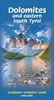
The Dolomites at 1:200, 000 from the Touring Club Italiano printed on light, waterproof and tear-resistant paper and presenting the same area on one side with its main sights and on the reverse highlighting national/natural parks.The map covers an area roughly from the northern tip of Lake Garda and Silandro in the west to beyond Belluno and Cortina d
RIP - This product is no longer available on our network. It was last seen on 25.09.2019

This page now acts as a permanent archive for this product. Add more information using the comments box below to ensure it can still be found by future generations.

Use our search facility to see if it is available from an alternative contributor.
  • Availability: Out Of Stock
  • Supplier: Stanfords
  • SKU: 9788836556489
Availability: In Stock
£7.95

Product Description

The Dolomites at 1:200, 000 from the Touring Club Italiano printed on light, waterproof & tear-resistant paper & presenting the same area on one side with its main sights & on the reverse highlighting national/natural parks. The map covers an area roughly from the northern tip of Lake Garda & Silandro in the west to beyond Belluno & Cortina d

Reviews/Comments

Add New

Price History

Vouchers

No voucher codes found.
Do you know a voucher code for this product or supplier? Add it to Insights for others to use.

Facebook

Jargon Buster

Paper - A thin sheet mainly used for writing. Available in a variety of colours. Made mainly from wood pulp.
Waterproof - Resistant to water, usualy specified by depth in metres
Natural - not manmade
Resistant - Something that can repel against something.

Supplier Information

Stanfords
Stanfords was established in 1853 and opened their iconic Covent Garden flagship store in 1901. They have become the top retailer of maps, travel books and accessories in the UK and arguably offer the largest selection of maps and travel books worldwide. Famous names such as Captain Robert Falcon Scott, Ranulph Fiennes and Michael Palin have purchased from Stanfords. They now have a shop in Bristol and both stores together with other venues operate a calendar of events including talks, book signings and exhibitions. As a specialist map retailer, the map selection is comprehensive and includes road maps, street maps and walking maps from worldwide destinations, as well as a selection of world atlases and wall maps. Books include travel guides and travel literature. Stanfords also stock globes, from miniatures made of blue marble to magnificent floor-standing globes. The website features a selection of interesting articles on travel topics.
Page Updated: 2023-11-12 20:15:36

Community Generated Product Tags

Oh No! The productWIKI community hasn't generated any tags for this product yet!
Menu