More From Contributor

£10.25
A 180km long cycle tour in East Friesland & northern Netherlands. Detailed maps show the route & its variants & extensive information is conveyed by symbols, indicating road surface, campsites & other accommodation, repair workshops, recreational facilities, places of interest, etc. A list of various types of accommodation facilities is included.IMPORTANT
- PLEASE NOTE: ALL THE TEXT IN THIS TITLE IS GERMAN & DUTCH ONLY. MAP LEGEND

Includes::
ENGLISH, please see our sample image, & the information provided on the maps is sufficient to use this title without any knowledge of German, particularly in the absence of a similar product in English from other publishers. There is currently no English edition this title available in this series. About the series: All the titles have been meticulously researched & are highly regarded in their native Germany. Most titles, as indicated in their individual descriptions, also include a separate section listing selected accommodation, from hotels to campsites, youth hostels & rooms in private houses, all with addresses, telephone numbers & price range. Information on towns along each route

Includes::
a list of places of interest, with opening hours, etc. Several of the guides also have street plans.


...
Archived Product
£6.99
Take a tour of the Majestic Theatre in this beautiful sticker book, from the glamorous foyer & auditorium to the dressing rooms, props & costume departments behind the scenes.

Includes::
stickers of scenery, actors, audience members & props to add to the beautiful theatre scenes & links to websites to see behind the scenes of a real theatre.

...
Archived Product
£7.95
The Dolomites at 1:200, 000 from the Touring Club Italiano printed on light, waterproof & tear-resistant paper & presenting the same area on one side with its main sights & on the reverse highlighting national/natural parks. The map covers an area roughly from the northern tip of Lake Garda & Silandro in the west to beyond Belluno & Cortina d ...
Archived Product
£8.50
Road map of the Dolomites at 1:200, 000 providing an excellent presentation of the topography of this mountainous region, plus on the reverse a panorama drawing, published by Tabacco to compliment their extensive series of detailed hiking maps. Coverage extends from the northern tip to Lake Garda to beyond the Austrian border, & from Bormio in the west to Pordenone & Lienz. The map provides a very clear picture of the region ...
Archived Product
£14.99
This comprehensive guide, covers all aspects of the area
- history, legends, customs, food, art & architecture, transport
...
Archived Product
£17.99
The heart of the Dolomites on four double-sided, contoured & GPS compatible. recreational maps at 1:35, 000 from Kompass highlighting hiking trails including the Alte Vie, mountain bike routes, various types of tourist accommodations, recreational facilities, etc. The set provides very wide coverage of the mountains, extending eastwards from Bolzano to well beyond Cortina d’ Ampezzo & from Brunico/ Bruneck in the north to Belluno, including the most popular of the High Routes (Alte Vie), Val Gardena, Marmolada massif, etc. Topography is vividly present by contours at 40m or 50m intervals enhanced by numerous spot heights, shading & graphic relief, plus colouring and/or graphics for different types of vegetation. National parks & other protected areas are marked. Extensive overprint highlights numerous hiking trails, indicating where appropriate difficult and/or via ferrata sections, also their waymarking numbers or symbols for the long-distance trails (including the Alte Vie, Sentiero Italia, Via Alpina, etc). Also marked are cycling & mountain biking routes (including Via Claudia Augusta), horse riding trails, plus cross-country & selected alpine ski routes. A very wide range of symbols indicates various accommodation options (hotels & inns, huts, campsites, youth hostels, etc), cycle hire & repair shops, sport & recreational facilities, etc. Road network shows toll routes, car parks & Park+ Ride facilites, & all forms of mountain transport are included (cable cars, chair lifts, etc). The maps have a 1km UTM grid. Map legend

Includes::
English. To see the list of other titles in this series please click on the series link.

...
Archived Product
£9.50
Dolomites – Lake Garda
- Venice region of north-eastern Italy on a road map at 1:200, 000 from Tabacco with excellent presentation
...
Archived Product
£12.95
A guidebooks to 40 day walks in the Dolomites. The walks vary in length from around three miles to full-day excursions, both in the high mountains & in valleys. The Dolomites are a prime holiday destination, with superbly located resorts connected by good roads & transport. There are vast expanses of forest, high-altitude rockscapes & seas of wild flowers. There is an extensive network of paths which link the numerous mountain huts of the region. ...
Archived Product
£14.95
Shorter Walks in the Dolomites is Gillian Price’s Cicerone guide to a selection of the best rambles in the mountains of northern Italy. The walks range from Nova Levante in the west to the Austrian border & the guide covers a range of walks varying from short strolls to full-day expeditions &

Includes::
both high-mountain & valley walks. A system of reliable cable-cars & lifts allows walkers to extend the range of short routes that are possible to walk. This guidebook

Includes::
50 day walks ranging from short 3-mile strolls to full-day expeditions & there are opportunities for walkers of all abilities, from high mountain walks with strenuous climbs for experienced walkers to leisurely family strolls. The walks will take you through landscapes of vast forests, high-altitude rockscapes & seas of wild flower. Each walk has an Information Box providing details of walking times & distance, difficulty gradings, ascents & descents, starting points & the relevant map. A detailed introduction gives practical guidance on when to go, getting there, local transport, recommended maps, weather & forecasts, protected areas & wildlife & vegetation. Detailed walk descriptions are accompanied by colour sketch diagrams mapping the route in addition to colour photographs illustrating some of the highlights of the Dolomites.


...
Archived Product
£9.50
The Dolomites at 1:150, 000 on a road map from Tabacco with excellent presentation of the topography derived from the publishers’ highly regarded & popular hiking maps, plus on the reverse notes about the region’s protected areas. Coverage extends from the Austrian border to just past Trento & Feltre, & west/east from the Ortles Massif to well east of Belluno. The map provides a very clear picture of the region’s landscape through graphic relief for its exposed rocky areas, plus relief shading & contours at 100m intervals, & has plenty of names of individual groups, peaks, valleys, etc. Additional colouring indicates woodlands, & boundaries of the nine areas designated as UNESCO World Heritage sites are prominently marked. Minor roads are drawn without generalizing their course, showing the twists & turns across the mountainous terrain. Driving distances are marked on main & many connecting routes. Railway lines are shown with stations & mountain transport lines (cable car lines, chair lifts, etc) are included. The map is designed to present the topography of the region rather than its tourist sights, but it does indicate campsites. Latitude & longitude lines are drawn at 10’ & 20’ respectively. Where appropriate, both Italian & German place names are given. Map legend

Includes::
English. On the reverse are trilingual notes (including English), illustrated with numerous colour photos & maps about the region.

...
Archived Product

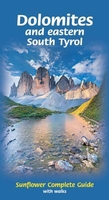
Dolomites & Eastern South Tyrol

This comprehensive guide, covers all aspects of the area - history, legends, customs, food, art and architecture, transport and other practicalities. Detailed plans of the major towns and villages include locations of places to stay and eat; separate index entries list over 150 recommended restaurants. Each chapter covers a specific area, with detailed information about the various towns and villages - from the `sights` to lift opening times and prices.The 24 main walks are described in the same chapters, with topo maps. But the book also describes dozens of other walking and cycling route in detail. In addition to the eastern Dolomites (east of the A22 motorway) rising in the provinces of South Tyrol, Trento and Belluno, the book covers an area outside the Dolomites - the
eastern part of South Tyrol. The bordering cities of Bozen/Bolzano, Brixen/Bressanone and Bruneck/Brunico are also described, with town plans. (The book does not take in the Brenta Dolomites west of the A22 motorway.)
RIP - This product is no longer available on our network. It was last seen on 25.09.2019

This page now acts as a permanent archive for this product. Add more information using the comments box below to ensure it can still be found by future generations.

Use our search facility to see if it is available from an alternative contributor.
  • Availability: Out Of Stock
  • Supplier: Stanfords
  • SKU: 9781856914789
Availability: In Stock
£14.99

Product Description

This comprehensive guide, covers all aspects of the area
- history, legends, customs, food, art & architecture, transport & other practicalities. Detailed plans of the major towns & villages include locations of places to stay & eat; separate index entries list over 150 recommended restaurants. Each chapter covers a specific area, with detailed information about the various towns & villages
- from the `sights` to lift opening times & prices. The 24 main walks are described in the same chapters, with topo maps. But the book also describes dozens of other walking & cycling route in detail. In addition to the eastern Dolomites (east of the A22 motorway) rising in the provinces of South Tyrol, Trento & Belluno, the book covers an area outside the Dolomites
- the eastern part of South Tyrol. The bordering cities of Bozen/ Bolzano, Brixen/ Bressanone & Bruneck/ Brunico are also described, with town plans. (The book does not take in the Brenta Dolomites west of the A22 motorway.)

Reviews/Comments

Add New

Intelligent Comparison

Oooops!
We couldn't find anything!
Perhaps this product's unique.... Or perhaps we are still looking for comparisons!
Click to bump this page and we'll hurry up.

Price History

Vouchers

No voucher codes found.
Do you know a voucher code for this product or supplier? Add it to Insights for others to use.

Facebook

Jargon Buster

History - Anything that happens in the past. An acedemic subject.
Transport - Something that carries people or goods.

Supplier Information

Stanfords
Stanfords was established in 1853 and opened their iconic Covent Garden flagship store in 1901. They have become the top retailer of maps, travel books and accessories in the UK and arguably offer the largest selection of maps and travel books worldwide. Famous names such as Captain Robert Falcon Scott, Ranulph Fiennes and Michael Palin have purchased from Stanfords. They now have a shop in Bristol and both stores together with other venues operate a calendar of events including talks, book signings and exhibitions. As a specialist map retailer, the map selection is comprehensive and includes road maps, street maps and walking maps from worldwide destinations, as well as a selection of world atlases and wall maps. Books include travel guides and travel literature. Stanfords also stock globes, from miniatures made of blue marble to magnificent floor-standing globes. The website features a selection of interesting articles on travel topics.
Page Updated: 2023-11-12 20:15:36

Community Generated Product Tags

Oh No! The productWIKI community hasn't generated any tags for this product yet!
Menu