
 United Kingdom
 France
 Germany
 Netherlands
 Sweden
 USA
USA
 Italy
Italy
 Spain
Spain
More From Contributor


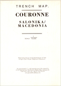
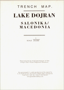
World War I Macedonian Front: Couronne
Couronne, one of two maps covering the site of the Battle of Doiran between British and Greek troops against Bulgarian forces on the Macedonian Front during World War I. Both maps are reproductions by G.H. Smith & Son of the original British Army trench maps at approximately 7/10th of the original scale"ed against each title.This title, the Couronne map at 1:10, 000 provides an enlargement of the northern part of the Lake Dorjan map, covering the area north-east of the town of Dorjan and showing positions as on 20th August 1918. Its companion map, Lake Dorjan, is at 1:20, 000 and covers the south and south-eastern shore of the lake with the trenches up to 26th June 1917. Both maps have on the reverse extensive notes on Macedonian Front and the involvement of the King’s Own
Royal Lancaster Regiment in the Salonikan Campaign of 1915 to 1919.PLEASE NOTE: the publishers, G. H. Smith & Son, also produce a wide range of similar maps for the main battlefields of the Western Front, all listed on our website under France and Belgium.
Royal Lancaster Regiment in the Salonikan Campaign of 1915 to 1919.PLEASE NOTE: the publishers, G. H. Smith & Son, also produce a wide range of similar maps for the main battlefields of the Western Front, all listed on our website under France and Belgium.

Product Description
Reviews/Comments
Add New
Intelligent Comparison
Archived Product
World War I Macedonian Front: Lake Dorjan Stanfords
£3.50
Vouchers
No voucher codes found.
Do you know a voucher code for this product or supplier? Add it to Insights for others to use.
Do you know a voucher code for this product or supplier? Add it to Insights for others to use.
 Denmark