More From Contributor

£14.99
Crete Senesi 1
- Val d` Arbia at 1:25, 000 in a series of hiking maps from Edizioni Multigraphic covering Tuscany, parts of Umbria,
...
Archived Product
£2.99
The easternmost part of the northern section of the South West Coast Path National Trail between Minehead & Watermouth on an exceptionally detailed contoured map at 1:15, 000 from Croydecycle printed on light, waterproof & tear-resistant paper. Included in this title are street plans of Porlock, Lynton & Combe Martin. Each of the publishers’ three handy size, 50 x 30cm maps covering the SWCP trail along the northern coast of Devon with the adjoining sections in Somerset & Cornwall presents the coast in five or six wide strips to enable exploration further inland & access to the path from local roads. Topography is indicated by contours at 10m intervals, enhanced by graphics and/or colouring for different types of terrain (high or low cliffs, step slopes, burrows, dunes, scree, salt marshes, etc) & vegetation (woodlands, gorse, scrub, etc). The maps also show the high tide level & classify beaches as s&, shingle, pebbles or rock. Where appropriate, the paths or the terrain are annotated with comments providing useful advice for hikers.. An overprint indicates the course of the South West Coast Path with its variants, & shows other footpaths, permissive paths & small permissive paths, plus private roads with access on foot, as well as byways & bridleways. On roads which are part of the National Cycle Network route numbers are marked. Both the maps & the street plans have symbols highlighting campsites & other accommodation, pubs, cafes, restaurants, shops & other local facilities, etc. For GPS users each section has the lines of the National Grid coordinates. Also provided are details of local public transport, etc. The three maps of the South West Coast Path National Trail are part of a series of cycling & hiking maps of Devon at various scales from Croydecycle – please click on the link above to see the full list of titles. ...
Archived Product
£6.95
South-Central Region of Russia, between Moscow, Kursk & Kharkiv/ Kharkov in eastern Ukraine, at 1:700, 000 in a series of detailed touring road maps from Merkury, covering the central part of European Russia & the adjoining regions of its western neighbours. All place names are in the Cyrillic alphabet only. Roads are graded into 13 different types according to their width & official administrative status. Fuel or car repairs stations as well as weight/dimension checkpoints are clearly marked. Driving distances are shown on most small local roads. The map also

Includes::
the railway network, shows locations of regional airports & sea ports, & indicates administrative boundaries of the constituent republics. Picturesque towns are highlighted & other places of interest are marked. The terrain is indicated only by colouring for forested areas & graphics for swamps
- no relief information or geographical coordinates are provided. The maps are not indexed. Map legend

Includes::
English. To see other titles in this series please click on the series link.IMPORTANT
- PLEASE NOTE: Supplies of all maps published in Russia are very irregular & we cannot guarantee a definite delivery time for titles not in stock. If a title is currently out of stock, it may be advisable to choose an alternative publication.


...
Archived Product
£14.99
Sold in packs of three, the Cahier is a light notebook which has evolved from the original Moleskine design. It has a heavy-duty cardboard cover & visible stitching on the spine. Squared pages. This version is covered in black kraft paper & measures 19cm x 25cm, with 120 pages, the last 16 of which are detachable. ...
Archived Product
£9.99
Caribbean Destination Map from the National Geographic presenting the region at 1:2, 000, 000 spread over both sides of a waterproof & tear-resistant sheet, with street plans of selected towns, a list of national parks, descriptions of popular islands, etc. On one side are the Bahamas with a plan of central Nassau, Cuba with a plan of Havana’s Old Town, Cayman Islands with a plan of George Town, Jamaica, & the Turks & Caicos Islands. Coverage also

Includes::
southern Florida & the coast of Mayan Riviera in Mexico, & a separate inset shows the main embarkation ports in USA for Caribbean cruises. On the reverse are the remaining islands: the Greater & the Lesser Antilles with Trinidad & Tobago & the coast of Venezuela. Street plans show Old San Juan on Puerto Rico & Charlotte Amalie in the US Virgin Islands. On the individual islands, as allowed by their size, the map shows the network of main roads & prominently highlights national parks & other protected areas which are also listed in a separate table for each side of the map. International airports are presented with their full names & domestic airports are also marked. Symbols indicate cruise ports, beaches & surfing or diving sites, casinos, etc. Both on the land & on the sea bed relief is shown by shading & altitude/depth colouring. The map

Includes::
brief descriptions of popular tourist destinations illustrated with colour photos, travellers tips & general tourist advice.


...
Archived Product
£11.99
Champagne: Reims
- the Aisne Valley area in a series of cycling maps from Sportoena covering Belgium & the adjoining regions of
...
Archived Product
£6.95
This revised & updated edition of ” Culture Smart! Ukraine” reveals a country in the throes of change. The euphoria of the famous Orange Revolution has vanished. The momentum for reform has been checked & the forces of authoritarianism have returned. Even so, modernization continues apace & people are eager to be seen as European. The recent political instability highlights the contradictions of Ukrainian society. Ukrainians are proud of their roots, & reticent about the traumas of their past; the country participates in international space programs & produces the world`s largest aircraft, but still lives in a world of superstitions. The Ukrainian way of life is intertwined with ancient customs, the old Soviet legacy, & the search for a new European identity. What strikes visitors to this fascinating & important country is the heady mix of ancient history & youthful energy, the resilience of the people, & their generosity of spirit. For the twentieth anniversary of its independence, Ukraine received quite a present--hosting the key matches of Euro 2012. Now it has a game of its own: to show the world that it is a serious player. This new edition of ” Culture Smart! Ukraine” will enable you to visit the country with open eyes. It describes the history that has shaped the Ukrainian psyche, explains present-day values & attitudes, & offers practical advice on what to expect & how to behave. It aims to make you feel at ease, whether you are shopping in a market, dining out, or attending a business meeting. ...
Archived Product
£9.99
Western Crete at 1:100, 000 on an indexed, GPS compatible road map from Terrain Editions, printed on light, waterproof & tear-resistant plastic paper, with a street plan of central Chania. This title is part of a series which covers Crete in three sheets. The maps have contours at 100m intervals, enhanced by relief shading with spot heights & plenty of names of topographic features such as peaks, mountain ranges, etc. All place names are in both Greek & Latin alphabet. Road network differentiates between smooth & rough surface local roads, shows driving distances on most local roads, & indicates locations of petrol stations & tyre repair workshops. Scenic routes are highlighted. Ferry connections, both along Crete’s southern coast & with the rest of Greece, are also marked. For outdoor activities the maps show selected local footpaths, including the course of E4 long-distance trail, climbing crags, canyoning routes & scuba-diving centres. A range of symbols highlight other places of interest campsites, mountain refuges, archaeological sites, monasteries, etc. The maps have a 5km UTM grid for GPS. The index shows names of towns & villages in both scripts &

Includes::
separate lists of monasteries & archaeological sites. On the reverse is a street plan of the main town in the region, highlighting places of interest, various facilities & selected accommodation. Names of larger streets are in both alphabets; smaller streets are in Greek only. Map legends for both the main map & the street plan include English.

...
Archived Product
£3.50
Couronne, one of two maps covering the site of the Battle of Doiran between British & Greek troops against Bulgarian forces on the Macedonian Front during World War I. Both maps are reproductions by G.H. Smith & Son of the original British Army trench maps at Approx. 7/10th of the original scale"ed against each title. This title, the Couronne map at 1:10, 000 provides an enlargement of the northern part of the Lake Dorjan map, covering the area north-east of the town of Dorjan & showing positions as on 20th August 1918. Its companion map, Lake Dorjan, is at 1:20, 000 & covers the south & south-eastern shore of the lake with the trenches up to 26th June 1917. Both maps have on the reverse extensive notes on Macedonian Front & the involvement of the King’s Own Royal Lancaster Regiment in the Salonikan Campaign of 1915 to 1919.PLEASE NOTE: the publishers, G. H. Smith & Son, also produce a wide range of similar maps for the main battlefields of the Western Front, all listed on our website under France & Belgium. ...
Archived Product
£8.99
Pablo Simo`s life is a mess. His career as an architect is at a dead-end; reduced to designing soulless office buildings desecrating the heart of Buenos Aires. His marriage seems to be one endless argument with his wife over the theatrics of their rebellious teenage daughter. Everything changes with the unexpected appearance of Leonor, a beautiful young woman living in the apartment of Nelso Jara, a blackmailer murdered & buried in the foundations of a building finished twenty years before. Pineiro once again demonstrates her capacity to reveal the things hidden behind the facades of our existence; human relationships based on habit & cowardice, rather than love; on excessive ambition & personal gain, rather than morality. ...
Archived Product

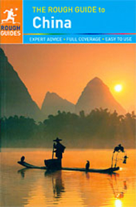
The Rough Guide To China

The Rough Guide to China is the definitive guide to this fascinating nation, with precise maps and detailed coverage of all the country`s best attractions. This book will help you delve into China`s greatest treasures, whether you`re climbing mountains in Tibet, exploring ancient temples in Xi`an or clubbing in Shanghai. Find detailed practical advice on the best things to see and do, with up-to-date descriptions of the top hotels, restaurants and shops for all budgets. The Rough Guide to China also includes in-depth background on China`s history and culture, and a language section to help you get in touch with the people. China is one of the world`s oldest civilizations, and its newest great power; this book will help you understand and explore this extraordinary destination. Make
the most of your time with The Rough Guide to China.
RIP - This product is no longer available on our network. It was last seen on 25.09.2019

This page now acts as a permanent archive for this product. Add more information using the comments box below to ensure it can still be found by future generations.

Use our search facility to see if it is available from an alternative contributor.
  • Availability: Out Of Stock
  • Supplier: Stanfords
  • SKU: 9781409341819
Availability: In Stock
£20.99

Product Description

The Rough Guide to China is the definitive guide to this fascinating nation, with precise maps & detailed coverage of all the country`s best attractions. This book will help you delve into China`s greatest treasures, whether you`re climbing mountains in Tibet, exploring ancient temples in Xi`an or clubbing in Shanghai. Find detailed practical advice on the best things to see & do, with up-to-date descriptions of the top hotels, restaurants & shops for all budgets. The Rough Guide to China also

Includes::
in-depth background on China`s history & culture, & a language section to help you get in touch with the people. China is one of the world`s oldest civilizations, & its newest great power; this book will help you understand & explore this extraordinary destination. Make the most of your time with The Rough Guide to China.

Reviews/Comments

Add New

Intelligent Comparison

Oooops!
We couldn't find anything!
Perhaps this product's unique.... Or perhaps we are still looking for comparisons!
Click to bump this page and we'll hurry up.

Price History

Vouchers

No voucher codes found.
Do you know a voucher code for this product or supplier? Add it to Insights for others to use.

Facebook

Jargon Buster

Date - A day on a calendar
Date - A social activity whith a current or potential partner
History - Anything that happens in the past. An acedemic subject.
World - A physical grouping, commonly used to describe earth and everything associated with ti
Language - the method of communication used in different areas. Humans and computers have many different languages.
Precise - A measurement on the accuracy of something
Practical - Weather a task is easy to carry out and realistically succeed.
Language - The way humans communicate either written and spoken.

Supplier Information

Stanfords
Stanfords was established in 1853 and opened their iconic Covent Garden flagship store in 1901. They have become the top retailer of maps, travel books and accessories in the UK and arguably offer the largest selection of maps and travel books worldwide. Famous names such as Captain Robert Falcon Scott, Ranulph Fiennes and Michael Palin have purchased from Stanfords. They now have a shop in Bristol and both stores together with other venues operate a calendar of events including talks, book signings and exhibitions. As a specialist map retailer, the map selection is comprehensive and includes road maps, street maps and walking maps from worldwide destinations, as well as a selection of world atlases and wall maps. Books include travel guides and travel literature. Stanfords also stock globes, from miniatures made of blue marble to magnificent floor-standing globes. The website features a selection of interesting articles on travel topics.
Page Updated: 2023-11-12 20:15:36

Community Generated Product Tags

Oh No! The productWIKI community hasn't generated any tags for this product yet!
Menu