More From Contributor

£14.95
World Conflicts Chart 2011 is a political map of the world overprinted with information showing areas of major international conflicts, plus several panels providing additional information on current conflicts & their history, etc. The map shows international boundaries with country names & capitals, with colouring indicating different types of armed conflicts & their status as at November 2010 (active, medium intensity, dormant, non-insurgent unrest, cease-fire/amnesty & peace accord), dates of past conflicts & death figures, peace support operations or interventions, sanctions, maritime piracy, drug routes, etc. Surrounding the map are panels showing: Enlargements of the main map showing in greater detail the Middle East, Caucasus, Central Africa & the Great Lakes, & Afghanistan with Pakistan. The Conflict in Afghanistan: history since 1973 plus graphs of fatality figures since 1878. Several panels providing information about the Pakistani tribal areas. Panels with information on: Internally Displaced Persons (IDPs) in selected conflicts 2001
- 2009; Global total of IDPs 2001
- 2009; Civilian refuges in selected conflicts 2000

...
Archived Product
£23.50
World Conflicts Chart 2015 published by the International Institute of Strategic Studies is a political map of the world overprinted with information showing areas of major international or domestic conflicts, plus several additional panels providing more related information. The map shows international boundaries with country names & capitals, with colouring indicating different types of armed conflicts & their status as at December 2014: high/medium/low intensity, non-insurgent unrest, ceasefire/amnesty, & peace accord. Also marked are locations of transnational terrorist attacks (significant or selected unsuccessful), plus dates of past international or internal conflicts & terrorist campaigns, both with death figures, UN or other multinational peace support operations, sanctions under UN Chapter VII, & regions of maritime piracy. Enlargements show in greater detail the Middle East, Central Africa & the Great Lakes region including South Sudan, the Caucasus, plus Afghanistan & Pakistan. The 2015 edition also

Includes::
panels covering: migration of Syrian Refuges to January 2015; Violence & Displacement in Central America; a diagram showing countries with the largest number of internally displaced persons (Top Ten in 2013); numbers of refugees by host nation (Top Ten in 2014); number of refugees per 1, 000 inhabitants in 2014 for Lebanon, Jordan, Chad, Djibouti & South Sudan; plus information on asylum seekers in 2013.

...
Archived Product
£35.00
' What Jimmy Cornell doesn't know about cruising isn't worth knowing'
- Yachting World One of the most influential cruising yachtsmen
...
Archived Product
£45.00
` What Jimmy Cornell doesn`t know about cruising isn`t worth knowing`
- Yachting World One of the most influential cruising yachtsmen
...
Archived Product
£45.00
World Cruising Routes is a reference book detailing 1, 000 long-distance cruise routes from the South Seas to the Arctic, geared specifically to the needs of cruising sailors & containing essential information on winds, currents, regional & seasonal weather as well as optimum times for individual routes. Author Jimmy Cornell has circumnavigated the globe three times & much of the information provided in the book has been compiled on his ocean voyages. The latest edition of World Cruising Routes assesses the effects of global warming on cruising routes & the behaviour of tropical storms. 6, 000 waypoints are provided to assist skippers in planning particular routes & main ports of entry & landfall information are given with each route. ...
Archived Product
£25.00
This survey on world cruising compares the trends & changes that have taken place in the world cruising scene & provides practical advice & information for long-distance cruisers. It examines the sizes & types of boat cruisers now in use, the routes chosen & why, electrical & electronic gear installed, communications with the shore, formalities worldwide & the human aspects of cruising. There is also a section of answers to frequently-asked questions. ...
Archived Product
£4.99
New for 2007, this double-sided desk map has been specially created for use in the classroom or at home. The map is encapsulated, making it both durable & suitable for write-on/wipe-off with water-soluble marker pens or chinagraph crayons by students. Side 1 shows the World in outline at a scale of 1:90 000 000 (1 cm on the map = 900 km on the ground), enabling students to use their knowledge to identify & mark on the map the names of countries & islands, as well as towns & cities, simply by recognizing their shape & location. Larger-scale outline maps are also provided on Side 1 for the crowded regions of Europe & the Caribbean (each at a scale of 1:48 000 000), & there are additional outline maps of the Arctic Ocean & Antarctica (each at a scale of 1:120 000 000). Side 2 provides the same maps in political colours, complete with place names in clear lettering, & symbols for easy reference. Individual countries are picked out in bright distinctive colours to aid identification, with major towns & cities marked, as well as major rivers. Main map projection: Hammer Equal Area. ...
Archived Product
£15.99
* World development is an increasingly important aspect of A-level studies in Geography & growing numbers of students are taking it as an A-level course in its own right. * There is, however, no standalone core textbook offering an introduction to all the key issues in World Development
- this book fills that void & will be invaluable to all Geography teachers. * The book functions as a core textbook introducing the key topics but each chapter also

Includes::
case studies, which will be supplemented with updated case studies on a dedicated website. * Attractively & colourfully designed, the book benefits from the long experience of New Internationalist magazine
- a regular & invaluable resource for Geography teachers for three decades
- in making complex world issues easily understood, using clear & colourful charts & graphs.


...
Archived Product
£10.99
The world upside down as seen from the Down Under: a map of the world from the Australian publishers UBD Gregory’s showing on one side a political version & on the reverse a physical map. Both maps are Pacific centred, so Australia & New Zealand are on top & in the centre. On one side is a political map of the world in nice pastel colours. On the reverse, the less often seen & much more interesting physical version of the “upside down” presentation provides even greater contrast to the usual view of the world with the north on top. ...
Archived Product
£9.99
Political map of the world from the Ordnance Survey, size 123.5 x 91.5 cm / 48” x 36” approx, ideal for schools, with an Eckert IV equal area projection & a panel explaining how it works, flags & country facts, laminated surface suitable for marking, etc. The main map presents the world on an equal area projection so that all the countries are shown in the correct proportion to their true area. Political colouring by country is supplemented by relief shading to show mountain ranges & names of main physical features are included. All place names are in their English versions. Latitude & longitude lines are drawn at 15° intervals. Four insets present the northern & southern hemispheres with colouring by continents & climate/vegetation; another inset presents the world Pacific-centred. Country flags are accompanied by details of area & population. The map also

Includes::
notes & illustrations explaining how projections & show either equal areas or correct shapes of the continents.LAMINATED & ENCAPSULATED WALL MAPS:- LAMINATED wall maps have a thin layer of plastic usually applied to the printed side only. They can be written on with suitable marker pens without any damage to the map but, unless laminated on both sides, they are not damp-proof.- ENCAPSULATED wall maps are sealed between two sheets of plastic. They are more rigid & heavier than laminated maps of the same size. They are damp-proof & do not crinkle in humid conditions. Encapsulation gives the map a shiny surface, similar to being displayed behind glass.- PLEASE NOTE: many publishers & retailers often use these two terms interchangeably. Our map titles & descriptions follow the definitions provided above.

...
Archived Product

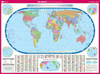
World Cruising Routes: 1000 Sailing Routes In All Oceans Of The World

Long established as the bible for long-distance cruisers and a bestseller for more than 25 years, World Cruising Routes is the indispensable planning guide to nearly 1, 000 sailing routes covering all the oceans of the world from the tropical South Seas to the high latitudes of the Arctic and Antarctic, geared specifically to the needs of cruising sailors. It contains information on the winds, currents, regional and seasonal weather, as well as suggestions about optimum times for individual routes. The 7th edition assesses the effects of global warming on cruising routes and provides over 6, 000 waypoints to assist skippers in planning individual routes. It is the perfect one-stop reference for planning a cruise anywhere in the world. `The most important book for long-distance
voyagers to come along in decades.` Cruising World
RIP - This product is no longer available on our network. It was last seen on 25.09.2019

This page now acts as a permanent archive for this product. Add more information using the comments box below to ensure it can still be found by future generations.

Use our search facility to see if it is available from an alternative contributor.
  • Availability: Out Of Stock
  • Supplier: Stanfords
  • SKU: 9781472947819
Availability: In Stock
£60.00

Product Description

Long established as the bible for long-distance cruisers & a bestseller for more than 25 years, World Cruising Routes is the indispensable planning guide to nearly 1, 000 sailing routes covering all the oceans of the world from the tropical South Seas to the high latitudes of the Arctic & Antarctic, geared specifically to the needs of cruising sailors. It contains information on the winds, currents, regional & seasonal weather, as well as suggestions about optimum times for individual routes. The 7th edition assesses the effects of global warming on cruising routes & provides over 6, 000 waypoints to assist skippers in planning individual routes. It is the perfect one-stop reference for planning a cruise anywhere in the world. ` The most important book for long-distance voyagers to come along in decades.` Cruising World

Reviews/Comments

Add New

Intelligent Comparison

Oooops!
We couldn't find anything!
Perhaps this product's unique.... Or perhaps we are still looking for comparisons!
Click to bump this page and we'll hurry up.

Price History

Vouchers

No voucher codes found.
Do you know a voucher code for this product or supplier? Add it to Insights for others to use.

Facebook

Jargon Buster

World - A physical grouping, commonly used to describe earth and everything associated with ti
Weather - is the change of an atmospheres conditions.
Tropical - Coming fro the work "tropics" a hot and humid area of the world.
Regional - An adjective to describe a set geographic area.
Reference - To prove evidence with a back up source.
Individual - A single separate item or person.

Supplier Information

Stanfords
Stanfords was established in 1853 and opened their iconic Covent Garden flagship store in 1901. They have become the top retailer of maps, travel books and accessories in the UK and arguably offer the largest selection of maps and travel books worldwide. Famous names such as Captain Robert Falcon Scott, Ranulph Fiennes and Michael Palin have purchased from Stanfords. They now have a shop in Bristol and both stores together with other venues operate a calendar of events including talks, book signings and exhibitions. As a specialist map retailer, the map selection is comprehensive and includes road maps, street maps and walking maps from worldwide destinations, as well as a selection of world atlases and wall maps. Books include travel guides and travel literature. Stanfords also stock globes, from miniatures made of blue marble to magnificent floor-standing globes. The website features a selection of interesting articles on travel topics.
Page Updated: 2023-11-12 20:15:36

Community Generated Product Tags

Oh No! The productWIKI community hasn't generated any tags for this product yet!
Menu