
 United Kingdom
 France
 Germany
 Netherlands
 Sweden
 USA
USA
 Italy
Italy
 Spain
Spain
More From Contributor


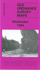


Wimborne Minster 1900
Wimborne Minster in 1900 in a fascinating series of reproductions of old Ordnance Survey plans in the Alan Godfrey Editions, ideal for anyone interested in the history of their neighbourhood or family. The map is double-sided to provide maximum coverage. The main map covers the area from Little Pamphill eastward to the town centre, and beyond that to St Johns Hill and Avenue Road; also from Walford Bridge southward to Poole Road. Features include the Minster church, Julian Brewery, East Brook, Town Brewery, Westfield, West Borough, Wimborne & Cranborne Workhouse, East Street, cemetery, Rowlands, Knobcrook, Walford Bridge, Stone Lane, St Margaret`s Almshouses, Julian`s Bridge, River Stour, Stone Park, Farrs, Netherwood Mead, Gillingham`s Almshouses, etc. On reverse is
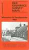
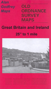
more than half of adjacent map 35.05 which covers railway station, Cattle Market, Leigh, Green Close Dairy, Leigh Common and Leigh Vinery.About the Alan Godfrey Editions of the 25” OS SeriesSelected towns in Great Britain and Ireland are covered by maps showing the extent of urban development in the last decades of the 19th and early 20th century. The plans have been taken from the Ordnance Survey mapping and reprinted at about 15 inches to one mile (1:4, 340). On the reverse most maps have historical notes and many also include extracts from contemporary directories. Most maps cover about one mile (1.6kms) north/south, one and a half miles (2.4kms) across; adjoining sheets can be combined to provide wider coverage.FOR MORE INFORMATION AND A COMPLETE LIST OF ALL AVAILABLE TITLES
PLEASE CLICK ON THE SERIES LINK.

Product Description
Reviews/Comments
Add New
Vouchers
No voucher codes found.
Do you know a voucher code for this product or supplier? Add it to Insights for others to use.
Do you know a voucher code for this product or supplier? Add it to Insights for others to use.
 Denmark