More From Contributor
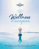
£8.50
Wellington Visitor Map from Kiwimaps, an indexed street plan with coverage of Lower & Upper Hutt, Porirua & Wainuiomata, town centre enlargements, detailed maps of road access to the Interislander Ferry Terminal, etc. The map provides coverage of Wellington & the neighbouring towns, as indicated on our coverage image. The plans show one way streets, railway lines with stations, ferry terminals, public buildings, etc. & have a comprehensive street index. Also shown are boundaries of postal districts & postcodes. An unusual feature of the map is an unobtrusive circular radius grid showing distance from central Wellington. An enlargement presents central Wellington in greater detail, indicating one way streets. Town centres of Upper Hutt, Lower Hutt, Johnsonville & Porirua are also shown on enlargements. Also provided is a detailed plan of road access to the Interislander Ferry Terminal & brief descriptions of Wellington’s main sights. ...
Archived Product
£18.50
Wellington, Palmerston North, Napier & Hastings Compact Street Directory in a handy A5 spiral-bound format, with 116 pages & all the sections clearly colour-coded for easy reference. Central Wellington is shown at 1:16, 000, with all other plans at 1:32, 000. Where appropriate, e.g. for Hastings, Napier, Palmerston North, etc. enlargements are provided at mote detailed scales. Also included are plans showing campus grounds of the region’s nine academic institutions & overview maps of the whole region at 1:917, 000. The atlas has comprehensive 32 page index of streets, roads & suburbs. Locations covered include Greater Wellington with Hutt Valley & Kapiti Coast suburbs, Ashhurst, Bay View, Bulls, Bunnythorpe, Carterton, Clive, Dannevirke, East Clive, Eketahuna, Featherstone, Feilding, Flaxmere, Foxton, Foxton Beach, Greytown, Halcombe, Hastings, Haumoana, Havelock North, Himatangi Beach, Hokio Beach, Kairakau Beach, Kimbolton, Levin, Linton Camp Village, Longburn, Makotuku, Manakau, Martinborough, Masterton, Napier, Norsewood, Ohau, Ormondville, Otaki, Otaki Beach, Otane, Pahiatua, Palmerston North, Pongaroa, Poraiti, Rongotea, Sanson, Shannon, Takapau, Tangimoana, Te Awanga, Te Horo Beach, Tokomaru, Waikawa Beach, Waipawe, Waipukurau, Waitarere, Whakatu & Woodville. ...
Archived Product
£9.99
Street plan of the Wellington conurbation, including Johnsonville, the Hutt Valley, Porirua & the Kapiti Coast, with enlargements for city centres & the Picton Ferry Terminal, plus a comprehensive street index. The main plan covers the whole area at 1:35, 000, showing names of various suburbs & clearly indicating main traffic arteries. One way streets, car parks, railway lines with stations, ferry terminals, public buildings, etc. are marked. The enlargement at 1:15, 000 shows Wellington’s town centre in greater detail. Also included are enlargements, at varying scales, for the Picton Ferry Terminal & the centres of Johnsonville, Lower Hutt, Upper Hutt, Porirua, Pukerua Bay, Masterton with the UCOL Wairarapa Campus, Waikanae, Paraparaumu, Kapiti Village, Levin & Otaki. The plans show boundaries of postal districts & postcodes. An unusual feature of the map is an unobtrusive circular radius grid showing distance from the centre of Wellington. ...
Archived Product
£19.99
The Duke of Wellington described the Battle of Waterloo as `the most desperate business I ever was in.. I was never so near being beat`. The courage of British troops that day has been rightly praised ever since, but the fact that one-third of the forces which gave him his narrow victory were subjects, not of George III, but of the King of the Netherlands, has been almost completely ignored. This book seeks to correct a grave injustice through the study of Dutch sources
- both primary & secondary
- the majority of which have never been used by English-speaking historians. The Dutch-Belgians have been variously described as inexperienced, incompetent & cowardly, a rogue element in the otherwise disciplined Allied Army. It is only now being tentatively acknowledged that they alone saved Wellington from disaster at Quatre Bras. He had committed a strategic error in that, as Napoleon advanced, his own troops were scattered over a hundred kilometres of southern Belgium. Outnumbered three to one, the Netherlanders gave him time to concentrate his forces, & save Brussels from French occupation. At Waterloo itself, on at least three occasions when the fate of the battle `hung upon the cusp` their engagement with the enemy aided British recovery. Their commander
- the Prince of Orange
- is viciously described as an arrogant fool, `a disaster waiting to happen` & even a dangerous lunatic. According to the assessment of the Duke himself, he was a reliable & courageous subordinate. The Dutch material in this book reveals a new dimension for familiar events in the Campaign, &

Includes::
many unseen illustrations. For the first time, a full assessment is made from the challenge which Willem I faced as King of a country hastily cobbled together by the Congress of Vienna, & of his achievement in assembling, equipping & training thirty thousand men from scratch in eighteen months. This is a timely reassessment in the two hundredth anniversary year of the battle of Waterloo. The veneration which the Duke of Wellington justifiably enjoyed after the Waterloo Campaign should not be allowed to forgive his lifelong lack of acknowledgment of the debt he owed the Netherlanders. As he once said himself, `there should be glory enough for all`, & it is high time that they are allowed to claim their share.


...
Archived Product
£13.95
Wellness Cycle Tour, a 478km cycle route across the spa towns & recreational facilities of the Teutoburger Forest in a guide from Verlag Esterbauer. Detailed maps show the route & its variants & extensive information is conveyed by symbols, indicating road surface, campsites & other accommodation, repair workshops, recreational facilities, places of interest, etc. A list of various types of accommodation facilities is included.IMPORTANT
- PLEASE NOTE BEFORE ORDERING: ALL THE TEXT IN THIS TITLE IS GERMAN ONLY. MAP LEGEND

Includes::
ENGLISH; please see our sample image, & the information provided on the maps is sufficient to use this title without any knowledge of German, particularly in the absence of a similar product in English from other publishers. There is currently no English edition of this title available in this series. About the series: All the titles have been meticulously researched & are highly regarded in their native Germany. Most titles, as indicated in their individual descriptions, also include a separate section listing selected accommodation, from hotels to campsites, youth hostels & rooms in private houses, all with addresses, telephone numbers & price range. Information on towns along each route

Includes::
a list of places of interest, with opening hours, etc. Several of the guides also have street plans.


...
Archived Product
£3.50
Wells in 1902 in a fascinating series of reproductions of old Ordnance Survey plans in the Alan Godfrey Editions, ideal for anyone interested in the history of their neighbourhood or family. The map provides good coverage of the Cathedral City of Wells, showing Keward to the west & stretching east to Tor Hill Quarry. Features include Wells Union Workhouse, the Cathedral, St Cuthbert`s Church, Hospital (for infectious diseases), Engineering Works & Gas Works. Wells had a complicated railway history & the map

Includes::
both GWR & Somerset & Dorset stations & engine sheds, with details of sidings, turntables etc. An extract from Kelly`s Directory of Somerset is on the reverse. About the Alan Godfrey Editions of the 25” OS Series Selected towns in Great Britain & Ireland are covered by maps showing the extent of urban development in the last decades of the 19th & early 20th century. The plans have been taken from the Ordnance Survey mapping & reprinted at about 15 inches to one mile (1:4, 340). On the reverse most maps have historical notes & many also include extracts from contemporary directories. Most maps cover about one mile (1.6kms) north/south, one & a half miles (2.4kms) across; adjoining sheets can be combined to provide wider coverage.FOR MORE INFORMATION & A COMPLETE LIST OF ALL AVAILABLE TITLES PLEASE CLICK ON THE SERIES LINK.

...
Archived Product
£9.99
Wells Gray
- Murtle Lake at 1:250, 000 & 1:50, 000 in a series of topographic survey maps of selected areas of British Columbia
...
Archived Product
£17.99
This product is most effective when used in conjunction with the corresponding double CD.
- You can purchase the book & double
...
Archived Product
£7.99
Welsh Borders in the Landmark Visitor Guides series, exploring a range of places in Britain, Europe & the Caribbean, with a particular expertise in UK destinations. Each guide presents the reader with detailed, wide-ranging & accessible overview of the region or area, with a particular focus on history & culture, notable local attractions, the landscape, local events & family activities. A series of recommended walks & guided car tours exploring the region are also included in each title. The guides are arranged geographically by region & are ideal both for short & longer breaks, with practical guidance on recommended routes & tourist attractions, in addition to insightful inset boxes into local history, culture & traditions. Information on accommodation, restaurants & day-to-day information are more limited, though a compact Directory at the end of each guide provides basic listings of recommended accommodation & restaurants, as well as tourist information contacts & regional event calendars. International destinations also carry climate & country facts, basic phrases & other general travel practical guidance for travelling to the region. The British titles in the Landmark Visitor Guides series are highly recommended, covering titles that are rarely available from other publishers. ...
Archived Product
£15.99
Welsh Canoe Classics is an illustrated guide to some of the finest tours of Wales` waterways. Scenic lakes, broad estuaries & whitewater rivers, as they can only be seen from canoe or kayak. Eddie, Adam & Wilf have chosen the best inland touring routes which are described in great detail & illustrated with numerous colour photos & maps. The selected routes are suitable for open canoes, sit-on-tops & touring kayaks, & include seven whitewater trips. Many of them can be tackled as a single voyage, others as a series of day trips with campsites en route. The journeys are all accessible but highly varied, travelling along lakes, estuaries, rivers & canals. This is a wonderful book for planning voyages & inspiring dreams or sharing your experiences with others. ...
Archived Product

Wellness Escapes

Discover the world`s most energising, inspiring and relaxing wellbeing retreats. From yoga, t`ai chi and meditation to mindfulness, spa treatments and creative writing, we present our favourite retreats and spas around the world to help replenish the mind, body and soul.Wellness Escapes includes nearly 200 destinations and is organised into five themes: Calm, Active, Healthy, Inspired and Indulged - making it easy to find the perfect getaway whether you`re in the mood for a seaweed bath in Ireland or surfing in Morocco, meditation in Bali or a Finnish sauna.We tell you what makes each retreat so special, what you can do, what`s on its doorstep, and provide booking details to help you find out more or book a visit. Throughout, our wellness authors reveal the health benefits of
each activity, while you`ll also find out about the world`s top ten wellness festivals, yoga and meditation techniques, and healthy smoothie recipes to try at home.About Lonely Planet: Lonely Planet is a leading travel media company and the world`s number one travel guidebook brand, providing both inspiring and trustworthy information for every kind of traveller since 1973. Over the past four decades, we`ve printed over 145 million guidebooks and grown a dedicated, passionate global community of travellers. You`ll also find our content online, on mobile, video and in 14 languages, 12 international magazines, armchair and lifestyle books, ebooks, and more.
RIP - This product is no longer available on our network. It was last seen on 25.09.2019

This page now acts as a permanent archive for this product. Add more information using the comments box below to ensure it can still be found by future generations.

Use our search facility to see if it is available from an alternative contributor.
  • External links may include paid for promotion
  • Availability: Out Of Stock
  • Supplier: Stanfords
  • SKU: 9781787016972
Availability: In Stock
£12.99

Product Description

Discover the world`s most energising, inspiring & relaxing wellbeing retreats. From yoga, t`ai chi & meditation to mindfulness, spa treatments & creative writing, we present our favourite retreats & spas around the world to help replenish the mind, body & soul. Wellness Escapes

Includes::
nearly 200 destinations & is organised into five themes: Calm, Active, Healthy, Inspired & Indulged
- making it easy to find the perfect getaway whether you`re in the mood for a seaweed bath in Ireland or surfing in Morocco, meditation in Bali or a Finnish sauna. We tell you what makes each retreat so special, what you can do, what`s on its doorstep, & provide booking details to help you find out more or book a visit. Throughout, our wellness authors reveal the health benefits of each activity, while you`ll also find out about the world`s top ten wellness festivals, yoga & meditation techniques, & healthy smoothie recipes to try at home. About Lonely Planet: Lonely Planet is a leading travel media company & the world`s number one travel guidebook br&, providing both inspiring & trustworthy information for every kind of traveller since 1973. Over the past four decades, we`ve printed over 145 million guidebooks & grown a dedicated, passionate global community of travellers. You`ll also find our content online, on mobile, video & in 14 languages, 12 international magazines, armchair & lifestyle books, ebooks, & more.

Reviews/Comments

Add New

Intelligent Comparison

Oooops!
We couldn't find anything!
Perhaps this product's unique.... Or perhaps we are still looking for comparisons!
Click to bump this page and we'll hurry up.

Price History

Vouchers

No voucher codes found.
Do you know a voucher code for this product or supplier? Add it to Insights for others to use.

Facebook

Jargon Buster

AI - Artificial Intelligence - the perceived intelligence of a computer
World - A physical grouping, commonly used to describe earth and everything associated with ti
Home - A place of permanent residence for families.

Supplier Information

Stanfords
Stanfords was established in 1853 and opened their iconic Covent Garden flagship store in 1901. They have become the top retailer of maps, travel books and accessories in the UK and arguably offer the largest selection of maps and travel books worldwide. Famous names such as Captain Robert Falcon Scott, Ranulph Fiennes and Michael Palin have purchased from Stanfords. They now have a shop in Bristol and both stores together with other venues operate a calendar of events including talks, book signings and exhibitions. As a specialist map retailer, the map selection is comprehensive and includes road maps, street maps and walking maps from worldwide destinations, as well as a selection of world atlases and wall maps. Books include travel guides and travel literature. Stanfords also stock globes, from miniatures made of blue marble to magnificent floor-standing globes. The website features a selection of interesting articles on travel topics.
Page Updated: 2023-11-12 20:15:36

Community Generated Product Tags

Oh No! The productWIKI community hasn't generated any tags for this product yet!
Menu