More From Contributor
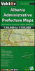
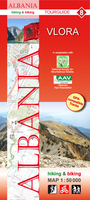
£9.99
Vlasina Lake & its environs at 1:30, 000 on a detailed, GPS compatible map from the Belgrade based Geokarta highlighting tourist facilities, with on the reverse extensive notes about the area in English. The map is centred on the lake & shows locations of campsites & other tourist accommodation. Local roads indicate locations of petrol stations. Topography of the area is shown by contours 10m intervals. Boundary of the protected area around the late is marked. All place names are in the Latin alphabet only. The map has latitude & longitude lines at intervals of 5’. On the reverse are extensive notes about various aspects of the area illustrated with colour photos. Map legend & all the text include English. ...
Archived Product
£6.95
Map No. 138, Vlasmisko, in a series of GPS compatible topographic maps of the Czech Republic at 1:75.000 from Shocart highlighting both signposted cycling routes & other local cycling paths, with route profiles & additional tourist information. Relief is shown by contour lines, spot heights, & subtle hill-shading. The maps show roads, tracks, railways, cable cars, chairlifts, & a range of natural landscape features & landmarks. Coloured symbols depict plenty of additional tourist features e.g. information centres, places of interest, antiquities, shelters, campsites, accommodation, bicycle services etc. An overprint highlights both signposted routes & other recommended routes which have no terrain markers. For all bike routes intermediate distances are shown. Hiking paths are also highlighted. Latitude & longitude margin ticks are at 5' intervals. Each map is accompanied by a booklet containing general information on the Czech cycle route network, elevation profile diagram for selected routes, plus an index for locations of historical & geographical interest, bicycle service workshops, information centres, & tourist attractions. Map legend & text are in English, German & Czech. ...
Archived Product
£8.99
Vlieland Island in the Dutch Frisian Islands in a series of walking & cycling maps at 1:25, 000 – 1:35, 000, published by Falk BV in cooperation with Staatsbosbeheer – Dutch government’s organization for forestry & the management of nature reserves. Colouring indicates different types of vegetation or terrain: woodl&, pastures, heath or sand dunes. Given the topography of most of the country, the maps have no contour lines. The maps show local hiking trails, indicating their waymarking & include cycle paths & horse riding. Many local crossroads are annotated with the numbers of ANWB signposts & ‘mushrooms’ – a useful aid when navigating in Dutch countryside. Symbols indicate various tourist facilities & places of interest, including different types of accommodation, cafes, windmills, etc. The maps have no geographical coordinates. Map legend is in Dutch only. On the reverse each title has supplementary information, in Dutch only, about the region`s attractions. To see other titles in this series please click on the series link. ...
Archived Product
£17.99
Kadaster, Holland`s national survey organization, produces one of the most attractive topographic surveys in Europe. The maps are very colourful, with their characteristic patchwork of polders & an unusually large amount of land use information: meadows, arable l&, different types of forest, marshes, sand dunes, etc. Contours are shown at 5-metre intervals with numerous spot heights &, with such a large part of the country below the sea level, ”spot depths”. Each map covers an area of Approx. 25 x 20 km / 15 x 12 miles, with some sheets slightly larger. The maps have a 1-km Dutch national grid, plus latitude & longitude at intervals of 1`. Map legend

Includes::
English.IMPORTANT
- PLEASE NOTE BEFORE ORDERING: both the west (W) & the east (O) sheet of each number has the same name, although the town after which the two maps are named appears only on one of the sheets. For example: maps 41W & 41O are both called Arnhem, although the city of Arnhem appears only on sheet 40W, etc. To see the list of titles available in this series please click on the series link.


...
Archived Product
£9.99
The entire island of Vlieland is featured on this two-sided GPS compatible walking map at 1:25, 000 in a series of maps with extensive overprint for long-distance & local walking routes. This map is printed on environmentally friendly paper & is waterproof & tear-resistant. Varied colouring show different types of landscape. Symbols indicate various facilities. Maps have the lines of the Dutch National Grid for measuring distances & for determining location using GPS device. In Dutch but legend contains English translation. ...
Archived Product
£9.99
Vlora Prefecture at 1:150, 000 in a series of handy size, waterproof & tear-resistant, contoured & GPS compatible road maps from the Tirana-based publishers Vektor. Landscape is presented by altitude colouring & contours lines at 100m intervals, with spot heights & a few more names of topographic features than found on Vektor’s 200K road maps of the country. National parks & nature reserves are prominently highlighted. The prefecture maps appear to show the same small local dirt roads as in the 200K series, but given the increase in scale do so with greater clarity & also provide more detailed GPS coordinates (latitude & longitude lines are drawn at 5’ intervals), useful when travelling across the more remote parts of the country. Railway lines are included & local airports are marked. Symbols highlight campsites, beaches, archaeological & historical sites, caves, etc. The maps also show subdivisions of prefectures & names of the communes, & indicate administrative status of towns. Map legend

Includes::
English. Please note: border crossings are prominently marked but beyond topographic colouring no road or other information is provided outside the country’s borders.

...
Archived Product
£10.99
A5 size, 72-page guide-booklet for use in navigating the Vltava river between Borova Lada & Hluboka. The route is covered by 13 1:50, 000 scale maps. All text is in Czech only, but the map legend

Includes::
English translation. Detail

Includes::
locks, bridges, distance indicators, water guages, marinas, rapids, danger points, facilities eg. hostels, grocers & campsites, as well as roads, landmarks & attractions. Lock & weir diagrams are also included.


...
Archived Product
£17.50
Vtava (Moldau) Cycle Route, a 480-km long trail from Želazná Ruda in the Šumava National Park along the Cech border with Germany & Austria to the Lipno Reservoir & then along the Vltava across the beautiful historic town of Ceský Krumlov & Ceské Budejovice to Prague, & beyond it to Melník to join the cycle route along the Elbe. The Vltava route is presented by the Verlag Esterbauer in guide with maps at 1:50, 000 showing the route & its variants. Extensive information is conveyed by symbols, indicating road surface, campsites & other accommodation, repair workshops, recreational facilities, places of interest, etc. A list of various types of accommodation facilities is included.IMPORTANT
- PLEASE NOTE BEFORE ORDERING
- ALL THE TEXT IN THIS TITLE IS GERMAN ONLY. MAP LEGEND

Includes::
ENGLISH (please see our sample image) & the information provided on the maps is sufficient to use this title without any knowledge of German.ABOUT THE BIKELINE SERIES: all the titles have been meticulously researched & are highly regarded in their native Germany. Most titles, as indicated in their individual descriptions, also include a separate section listing selected accommodation, from hotels to campsites, youth hostels & rooms in private houses, all with addresses, telephone numbers & price range. Information on towns along each route

Includes::
a list of places of interest, with opening hours, etc. Several of the guides also have street plans. To see the list of other titles in the Bikeline series please click on the series link.


...
Archived Product
£6.99
A taut & shocking story of vengeance, bloodshed & love, set over 100 days of bitter Russian winter! from the bestselling author of Messiah. Moscow, December 1991. Chaos reigns after the fall of communism. Muscovites are used to queues & empty shelves, but now they have to cope with a dangerous power vacuum -- & a war between brutal mafiya gangs for control of the city. So when a child`s body is found beneath the ice of the Moscow river it attracts little attention to begin with. Then a second body is found. & a third. At the heart of the gathering storm is Red October, Russia`s most famous vodka distillery. Alice Liddell, an American banker, has come to Moscow to oversee its privatization
- an unpopular move. Alice wants to get going, but faced with the charismatic, ruthless Lev
- distiller director & head of one of the warring mafia gangs
- a very difficult job is starting to look impossible. Lev`s arch-enemy has vowed revenge on him & it seems that the bizarre child killings might be part of this. The last thing he needs is a determined young woman in the heart of his criminal empire. But will Lev & Alice be enemies or allies? & when the storm has passed, who will be left standing?


...
Archived Product
£14.99
Russia is famous for its vodka, & its culture of extreme intoxication. But just as vodka is central to the lives of many Russians, it is also central to understanding Russian history & politics. In Vodka Politics, Mark Lawrence Schrad argues that debilitating societal alcoholism is not hard-wired into Russians` genetic code, but rather their autocratic political system, which has long wielded vodka as a tool of statecraft. Through a series of historical investigations stretching from Ivan the Terrible through Vladimir Putin, Vodka Politics presents the secret history of the Russian state itself-a history that is drenched in liquor. Scrutinizing (rather than dismissing) the role of alcohol in Russian politics yields a more nuanced understanding of Russian history itself: from palace intrigues under the tsars to the drunken antics of Soviet & post-Soviet leadership, vodka is there in abundance. Beyond vivid anecdotes, Schrad scours original documents & archival evidence to answer provocative historical questions. How have Russia`s rulers used alcohol to solidify their autocratic rule? What role did alcohol play in tsarist coups? Was Nicholas II`s ill-fated prohibition a catalyst for the Bolshevik Revolution? Could the Soviet Union have become a world power without liquor? How did vodka politics contribute to the collapse of both communism & public health in the 1990s? How can the Kremlin overcome vodka`s hurdles to produce greater social well-being, prosperity, & democracy into the future? Viewing Russian history through the bottom of the vodka bottle helps us to understand why the ”liquor question” remains important to Russian high politics even today-almost a century after the issue had been put to bed in most every other modern state. Indeed, recognizing & confronting vodka`s devastating political legacies may be the greatest political challenge for this generation of Russia`s leadership, as well as the next. ...
Archived Product

Vlora And Environs

Vlora and Environs area of southern Albania at 1:50, 000 in a series of GPS compatible contoured maps from Huber Verlag showing hiking and cycling routes, climbing sites, tourist accommodation, etc. Descriptions cover eight cycling routes and five hiking trails, most with route profiles.Maps in this series, prepared in cooperation with the Albanian Alps Associations and the National Society for Mountainous Studies, have contours at 50m intervals, with spot heights, graphic relief for exposed rocky areas and colouring showing woodlands. Recommended hiking and cycling routes are prominently marked and cross-referenced to descriptions on the reverse side. Interesting towns and villages are highlighted and symbols indicate hotels and other tourist accommodation, sites for climbing
and/or kayaking, museums, archaeological remains, medical facilities, etc. The maps have a 1-km UTM grid. On the reverse are detailed descriptions of the recommended hiking and cycling trails accompanied in some titles by route profiles. Map legend and all the text include English.To see other titles in this series please click on the series link.
RIP - This product is no longer available on our network. It was last seen on 25.09.2019

This page now acts as a permanent archive for this product. Add more information using the comments box below to ensure it can still be found by future generations.

Use our search facility to see if it is available from an alternative contributor.
  • External links may include paid for promotion
  • Availability: Out Of Stock
  • Supplier: Stanfords
  • SKU: 9783943752144
Availability: In Stock
£11.99

Product Description

Vlora & Environs area of southern Albania at 1:50, 000 in a series of GPS compatible contoured maps from Huber Verlag showing hiking & cycling routes, climbing sites, tourist accommodation, etc. Descriptions cover eight cycling routes & five hiking trails, most with route profiles. Maps in this series, prepared in cooperation with the Albanian Alps Associations & the National Society for Mountainous Studies, have contours at 50m intervals, with spot heights, graphic relief for exposed rocky areas & colouring showing woodlands. Recommended hiking & cycling routes are prominently marked & cross-referenced to descriptions on the reverse side. Interesting towns & villages are highlighted & symbols indicate hotels & other tourist accommodation, sites for climbing and/or kayaking, museums, archaeological remains, medical facilities, etc. The maps have a 1-km UTM grid. On the reverse are detailed descriptions of the recommended hiking & cycling trails accompanied in some titles by route profiles. Map legend & all the text include English. To see other titles in this series please click on the series link.

Reviews/Comments

Add New

Intelligent Comparison

Oooops!
We couldn't find anything!
Perhaps this product's unique.... Or perhaps we are still looking for comparisons!
Click to bump this page and we'll hurry up.

Price History

Vouchers

No voucher codes found.
Do you know a voucher code for this product or supplier? Add it to Insights for others to use.

Facebook

Jargon Buster

GPS - Global Positioning System - Global position using satellites
Hiking - An outdoor activity envolving walking in nature
Km - Kilometre. A unit of measurement equal to 1000 metres.
Accommodation - A room in which someone can live in, for example in a hotel

Supplier Information

Stanfords
Stanfords was established in 1853 and opened their iconic Covent Garden flagship store in 1901. They have become the top retailer of maps, travel books and accessories in the UK and arguably offer the largest selection of maps and travel books worldwide. Famous names such as Captain Robert Falcon Scott, Ranulph Fiennes and Michael Palin have purchased from Stanfords. They now have a shop in Bristol and both stores together with other venues operate a calendar of events including talks, book signings and exhibitions. As a specialist map retailer, the map selection is comprehensive and includes road maps, street maps and walking maps from worldwide destinations, as well as a selection of world atlases and wall maps. Books include travel guides and travel literature. Stanfords also stock globes, from miniatures made of blue marble to magnificent floor-standing globes. The website features a selection of interesting articles on travel topics.
Page Updated: 2023-11-12 20:15:36

Community Generated Product Tags

Oh No! The productWIKI community hasn't generated any tags for this product yet!
Menu