More From Contributor

£12.99
Cornwall has a rich & diverse history stretching from prehistoric times to the Norman Conquest & beyond, including the turbulent Tudor period, the English Civil War & the First & Second World Wars. Neolithic settlements & Bronze Age dwellings have been found at Carn Brea in Redruth & Rough Tour at Camelford, & many standing stones are scattered across the l&. An ancient forest lies beneath the waters between Marazion & the legendary St Michael`s Mount, which dates back thousands of years. The area is steeped in legend & Tintagel has mythical connections with King Arthur, although the present castle was probably constructed by Richard, Earl of Cornwall (brother to King Henry III), who owned the site from about 1234. Tales of the Devil, giants, minions & other imps abound in the county. Many of Daphne Du Maurier`s books are set in Cornwall including Jamaica Inn & Frenchman`s Creek. Virginia Woolf`s novel To the Lighthouse was based on holidays at St Ives, Cornwall, where her family took her every summer until 1895. The lighthouse at Godrevy gives inspiration to the title. Various battles & conflicts as well as the diverse & fascinating history of Cornwall are all featured within the pages of this book, which also

Includes::
many of the well-known people who have greatly influenced the area over the years.

...
Archived Product
£12.99
South Devon is steeped in history from prehistoric settlements, standing stones & Roman occupation, to the sites of Civil War battles & the various departure points of troops leaving for D-Day during the Second World War. Woolly rhinoceroses & woolly mammoths, as well as prehistoric deer & lion once roamed the area now known as Plymouth, while at Sidmouth, on the Jurassic coast, jaw bones & teeth from carnivorous reptiles that pre-date the dinosaurs have been discovered. During its diverse history, Sir Francis Drake played bowls on the Hoe as the Armada arrived, the Pilgrim Fathers left from the Barbican in Plymouth & headed to the new world in America & prisoners during the Napoleonic Wars lived freely with the residents of Ashburton. Famous residents have included Sir Francis Drake, Sir Walter Raleigh, Vice-Admiral Sir Thomas Masterman Hardy, Sir Arthur Conan Doyle, Nancy Astor & Agatha Christie. The area is home to the notorious Dartmoor prison, as well as home to well-known institutions such as Buckfast Abbey & Dartmouth Royal Naval College. This book covers a period from prehistoric times, & the earliest discovery of human remains in the UK, to the numerous conflicts & battles that have taken place in the area, as well as discussing the many people who have influenced South Devon over the years. ...
Archived Product
£14.99
Many writers have written about the delights of the former kingdom of the South Saxons, its Downs, villages, countryside, people & their ways but _ Visitors` Historic Britain
- West Sussex_ is the first book to take readers on a tour of discovery of each of the county`s historic eras in turn. Starting with prehistoric Sussex, we explore West Sussex from west to east, investigating both little-known & well-visited sites that tell the story of our ancestors` past. We encounter wild warriors, formidable founders of the county, indefatigable industrialists, excitable eccentrics & the lives of Sussex inhabitants & invaders. Sussex is a country celebrated by writers, painters, royalty, artists & the millions who have enjoyed its changing coastline & verdant villages. Visitors` Historic Britain provides a unique series of journeys for those who are inquisitive about this quirky & history-changing part of the South-East.
...
Archived Product
£18.99
Visp area, map No. 274T, at 1:50, 000 in a special hiking edition of the country’s topographic survey, published by Swisstopo in cooperation with the Swiss Hiking Federation. Coverage extends southwards from the Rhone Valley & Brig to include the lower part of the Mattertal beyond Grächen & St. Niklaus, the lower part of the Saastal & the Simplon Pass. Cartography, identical to the standard version of the survey, is highly regarded for its superb use of graphic relief & hill shading to provide an almost 3-D picture of Switzerland`s mountainous terrain. Contours are at 20m intervals. An overprint highlights routes maintained by the SHF, distinguishing between hiking routes, mountain routes requiring proper footwear, & alpine routes where equipment is needed. Paths which are part of the national or regional network of long-distance hiking routes are specially marked & in the more recent editions are annotated with their official numbers. The maps show mountain huts, refuges & in remote areas also inns, plus roads with bus service & the positions of bus stops. All the maps have a 1-km grid of the Swiss national coordinates. For a list of all the titles in this series, please click on the series link. ...
Archived Product
£19.99
The new Supertrail Maps show the best singletrails in Europe’s hottest mountain bike spots. These unique topographic maps make the knowledge of locals available to other mountain bikers. Consistent difficulty rating & useful additional information prevent the user from critical situations on the trails. The best singletrails in the best mountain bike spots throughout Europe
- this is the convincing formula of the brand new Supertrail Maps. For the first time ever, these unique topographic maps make the knowledge of locals available to others. All the trails on a map have been biked & rated in five difficulty levels for up- & downhill separately by specially trained authors. This consistent rating facilitates tour planning & spares a user from getting into sketchy situations on the trails. In addition to the difficulty rating, extraordinary nice trails are marked with a «highlight»-pictogram. The maps in a scale of 1:50 000 show all information required for tour planning & orienting oneself on the trails, such as: difficulty, highlight-trails, mountain railways with mountain bike transport, mountain bike shuttles, dangerous falls, restaurants, bike shops, emergency numbers & touristic infopoints. Thanks to the especially chosen map section, one map covers the whole area. The Supertrail Maps are printed on tear- & waterproof foil which makes them very sturdy. On the back of any map, additional information about the area & the use of a Supertrail Map are presented in two languages. Folded

Dimensions of 10x 15cm allow the map to fit into any pocket without squeezing.


...
Archived Product
£22.99
Detailed ski map at 1:50, 000 from Swisstopo, the country’s national survey organization, showing routes for skiing and/or snowboarding, access by public transport, recommended itineraries, lists of mountain huts, etc. The series uses the cartography of Switzerland’s topographic survey, with additional colouring to show slopes steeper than 30°. An overprint highlights ski routes, indicating suggested direction, difficult passages & sections which must be covered on foot. Also marked are areas where it is forbidden to leave the routes shown on the map. The maps also highlight roads with bus routes, indicating individual bus stops, show ski lifts & funiculars, plus mark locations of refuges or other mountain accommodation. Each title has the Swiss national grid at intervals of 1km, plus latitude & longitude margin ticks at 1’. Some titles cover a larger area, with a part of an adjoining sheet printed on the reverse of the main map as indicated on our series grid. Where appropriate, ski information extends across the border to France & Italy. On the reverse are itineraries of routes recommended by the Swiss Alpine Club, indicating the degree of difficulty, plus lists of alpine huts with contact details. Map legend for the overprint

Includes::
English. The text about the routes & accommodation is in the main language of the area covered by the map. To see the list of all the titles in this series please click on the series link.

...
Archived Product
£12.99
Map No. 1307, Vissoie, in the topographic survey of Switzerland at 1:25, 000 from Bundesamt für Landestopographie (swisstopo), covering the whole country on 247 small format sheets, with special larger maps published for popular regions including some titles now available in hiking versions. Highly regarded for their superb use of graphic relief & hill shading, the maps give an almost 3-D picture of Switzerland`s mountainous terrain. Contours are at 10 m intervals, with 20m intervals in the mountainous areas. All the maps have a 1-km grid for Swiss national coordinates (datum CH 1903). * Small format sheets (Nos. 1011
- 1374)* Map legend in the language of the area covered by the map. Additional margin ticks show latitude & longitude in steps of 2`. The area covered by each map is 17 x 12 km (11 x 7 miles approx). * Special larger sheets (Nos. from 2501 onwards) – STANDARD editions:* No map legend is included but a separate leaflet can be provided instead. The area covered by each map is 25 x 17 km (15 x 11 miles approx).* Special larger sheets (Nos. from 2501 onwards) – HIKING editions:* An overprint highlights hiking, mountain & alpine paths, including regional & national long-distance trails. The maps also show bus routes with bus stops, plus inns in remote locations. The area covered by each map is 25 x 17 km (15 x 11 miles approx).
...
Archived Product
£23.99
Map No. 10114, Vistfjellan, in the new topographic survey of Norway at 1:50, 000 covering the country on 195 double-sided sheets & first published by Nordeca in 2011
- 2012; fully GPS compatible, indicating waymarked footpaths, campsites, tourist huts, illuminated ski runs, etc. The maps, now published by Nordeca, the successors to Statens Kartverk & its subsequent owners the Ugland Group, are printed on light, waterproof & tear-resistant synthetic paper. Each map covers an area of 62x 45 kilometres (39 x 28 miles approx.), with a 2-km overlap between the sheets. The maps have contours at 20m intervals (10m glacier contours), plus colouring & graphics to show cultivated areas, bogs, forests, etc. In addition to all the information expected of topographic mapping at this scale the maps distinguish between waymarked & unmarked footpaths & show campsites, tourist huts (serviced/self service/no supplies), country hotels & restaurants, & illuminated ski trails. The series uses EUREF89 (WGS84) datum & the maps have a 1-km UTM grid. Map legend is in Norwegian & English. Each title comes in a sturdy protective card envelope.
...
Archived Product
£16.99
Topographic survey of Sweden at 1:100, 000, the Vägkartan, from the Lantmäteriet, covering most of the country in 79 double-sided maps. Please note: the mountainous regions of central & northern Sweden are not covered by this series but presented in a separate “ Fjällkartan
- Mountain Map” series also listed on our website. Each 1:100, 000 topographic survey map covers an area of 75 x 80km. The maps have contours at 10 metre intervals, plus relief shading & colouring for different types of landscape: open l&, forests, alvar, marshes, etc. Boundaries of national parks & nature reserves, areas prohibited to cross-country vehicles, & restricted entry military zones are marked. The maps indicate privately maintained local roads, cycle paths with wind shelters, footpaths, etc, & include all other information expected of topographic survey at this scale. The maps have a 2-km UTM grid, plus latitude & longitude lines 10’ intervals. Map legend

Includes::
English. For coverage of the country’s most visited hiking areas in central & northern Sweden please see Lantmäteriet’s Mountain Map series, listed separately on our website.


...
Archived Product
£80.00
In a rich blend of cartography & photography, National Geographic Visual Atlas of the World celebrates the diverse natural & cultural treasures of the world, through photographic coverage of UNESCO's World Heritage Sites, that correlates to beautiful, informative, & accurate maps. In addition to hundreds of brilliant photographs, these newly compiled & designed map spreads provide accompanying textual descriptions. From the vast plains of the Serengeti to historic cities such as Vienna, Lima, & Kyoto; from the prehistoric rock art on the Iberian Peninsula to the statue of Liberty; from the Kasbah of Algiers to the Imperial Palace in Beijing
- all of these places, as varied as they are, have one thing in common. All are World Heritage sites of outstanding cultural or natural value to humanity & are worthy of protection for future generations to know & enjoy. World thematic maps reflect fresh, dynamic compilations with the most accurate data available. These skillfully edited maps provide invaluable reference to the trends & characteristics of the critical issues of today: energy, population, religion, economy & trade, natural disasters, conflicts, & climate change. The atlas is organized by a succinct how-to-use section, an extensive world thematic section covering more than 30 natural & human topics, & the seven continents: North America, South America, Europe, Asia, Africa, Australia & Oceania, & Antarctica. All of the continents include regional map coverage, continental physical & political maps at the same scale, & continental thematic maps
- all at the same scale for effective comparative views
- that speak to population density, energy consumption, economies, climate, natural events & water availability. Following the continents are the remaining divisions of the atlas: Oceans, Space, an appendix of national flags, country facts & tables, & finally an enhanced, easy-to-use, comprehensive place-name index filled with over 50, 000 entries, that grounds the atlas as an essential, practical, world reference tool.


...
Archived Product

Visp Swisstopo 274

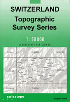
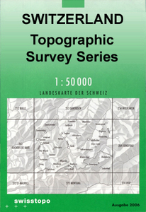
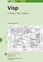
Visp, map No. 274, in the standard topographic survey of Switzerland at 1:50, 000 from Swisstopo, i.e. without the special overprint highlighting walking trails, local bus stops, etc, presented in Swisstopo’s hiking editions of the 50K survey. Coverage extends southwards from the Rhone Valley and Brig to include the lower part of the Mattertal beyond Grächen and St. Niklaus, the lower part of the Saastal and the Simplon Pass.Highly regarded for their superb use of graphic relief and hill shading, the maps give an almost 3-D picture of Switzerland`s mountainous terrain. Contours are at 20m intervals. All the maps have a 1-km grid with the Swiss national coordinates. This standard version of the 50K survey covers the whole country on 78 small format sheets, with special larger
format maps published for several popular tourist destinations. Small format sheets cover an area of 35 x 24 km (21 x 15 miles approx) and have map legend in the language of the area covered by the map. The special larger sheets cover 50 x 35 km (31 x 22 miles approx) and have no map legend, but a separate leaflet can be provided instead.PLEASE NOTE: the hiking editions of the 1:50, 000 Swisstopo survey are listed on our website in a separate series.
RIP - This product is no longer available on our network. It was last seen on 25.09.2019

This page now acts as a permanent archive for this product. Add more information using the comments box below to ensure it can still be found by future generations.

Use our search facility to see if it is available from an alternative contributor.
  • Availability: Out Of Stock
  • Supplier: Stanfords
  • SKU: 9783302002743
Availability: In Stock
£12.99

Product Description

Visp, map No. 274, in the standard topographic survey of Switzerland at 1:50, 000 from Swisstopo, i.e. without the special overprint highlighting walking trails, local bus stops, etc, presented in Swisstopo’s hiking editions of the 50K survey. Coverage extends southwards from the Rhone Valley & Brig to include the lower part of the Mattertal beyond Grächen & St. Niklaus, the lower part of the Saastal & the Simplon Pass. Highly regarded for their superb use of graphic relief & hill shading, the maps give an almost 3-D picture of Switzerland`s mountainous terrain. Contours are at 20m intervals. All the maps have a 1-km grid with the Swiss national coordinates. This standard version of the 50K survey covers the whole country on 78 small format sheets, with special larger format maps published for several popular tourist destinations. Small format sheets cover an area of 35 x 24 km (21 x 15 miles approx) & have map legend in the language of the area covered by the map. The special larger sheets cover 50 x 35 km (31 x 22 miles approx) & have no map legend, but a separate leaflet can be provided instead.PLEASE NOTE: the hiking editions of the 1:50, 000 Swisstopo survey are listed on our website in a separate series.

Reviews/Comments

Add New

Price History

Vouchers

No voucher codes found.
Do you know a voucher code for this product or supplier? Add it to Insights for others to use.

Facebook

Jargon Buster

Hiking - An outdoor activity envolving walking in nature
swiss - Short for Switzerland, one of the richest countries in the world
switzerland - A landlocked country in western Europe. One of the richest countries in the world
Language - the method of communication used in different areas. Humans and computers have many different languages.
Km - Kilometre. A unit of measurement equal to 1000 metres.
Small - something that takes up less space than normal.
Popular - Something that is admired and liked by many people.
Language - The way humans communicate either written and spoken.

Supplier Information

Stanfords
Stanfords was established in 1853 and opened their iconic Covent Garden flagship store in 1901. They have become the top retailer of maps, travel books and accessories in the UK and arguably offer the largest selection of maps and travel books worldwide. Famous names such as Captain Robert Falcon Scott, Ranulph Fiennes and Michael Palin have purchased from Stanfords. They now have a shop in Bristol and both stores together with other venues operate a calendar of events including talks, book signings and exhibitions. As a specialist map retailer, the map selection is comprehensive and includes road maps, street maps and walking maps from worldwide destinations, as well as a selection of world atlases and wall maps. Books include travel guides and travel literature. Stanfords also stock globes, from miniatures made of blue marble to magnificent floor-standing globes. The website features a selection of interesting articles on travel topics.
Page Updated: 2023-11-12 20:15:36

Community Generated Product Tags

Oh No! The productWIKI community hasn't generated any tags for this product yet!
Menu