More From Contributor

£11.50
Topographic survey of France at 1:25, 000 in IGN`s excellent TOP25 / Série Bleue series. All the maps are GPS compatible, with a 1km UTM grid plus latitude & longitude lines at 5’ intervals. Contours are at 5m intervals except for mountainous areas where the maps have contours at 10m intervals, vividly enhanced by hill shading & graphics for rocky terrain. Colouring with graphics indicates different types of vegetation or land use (deciduous or coniferous forests, moors, orchards, vineyards, etc). PLEASE NOTE: coverage of France at this scale is currently being revised – the format & the presentation of each title are indicated by the letters at the end of its Sheet Reference number (e.g. 0416ET, 3531ETR, 1923SB, etc.)MAPS WITH FULL TOURIST OVERPRINT & AN ENGLISH MAP LEGEND: all TOP25 maps & the SB editions of Série Bleue have an overprint highlighting waymarked walking trails including long-distance GR routes &, where appropriate, ski routes. Symbols indicate campsites, gîtes d’etape, refuges, equestrian centres & other recreational facilities or sites, tourist information centres, cultural heritage, etc. Towns & locations of particular interest are highlighted.- ET or OT = single-sided TOP25 map covering approx. 29x 21 km / 18x 13 miles.- ETR or OTR = waterproof & tear resistant TOP25 map covering the same area as the corresponding ET or OT number, but double-sided, printed on a smaller size sheet with a good overlap between the sides.- SB = Série Bleue map with full tourist overprint; these maps, first introduced in summer 2014, each cover approx. 29x 24km / 18x 15 miles.SÉRIE BLEUE maps with numbers ending in E (Est) or O (Ouest): most editions now indicate the GR routes, but do not show any other tourist information. Map legend is in French only. Each map covers approx. 14x 20km / 9x 12 miles. ...
Archived Product
£9.50
One of the titles in a series of double-sided topographic maps with hiking routes & tourist information. Cartography is identical to the standard topographic survey of Germany, with contours at 10m intervals. Extensive overprint highlights numerous local footpaths & long-distance hiking routes, indicating waymarking. Cycling routes, mountain bike centres & trails, & cross-country ski routes are also marked. Extensive range of symbols highlight sport & leisure facilities, various types of accommodation, places of interest, tourist railways, etc. Boundaries of national parks & nature reserves are marked. The maps have a 2km UTM grid. Map legend

Includes::
English. The maps also have lists of contact details of various organizations & facilities within the region, plus brief descriptions in German only.

...
Archived Product
£6.95
Topographic coverage of mainland Spain at 1:50, 000 in the MTN50 (Mapa Topográfico Nacional) series from the Centro Nacional de Información Geografica, the country’s civilian survey organization. The maps have contours at 20m intervals, enhanced by relief shading, plus colouring and/or graphics to show different types of terrain, vegetation or land use. Boundaries of national parks & other protected areas are marked. In addition to all the usual information featured on topographic mapping at this scale, detailed presentation of the road & rail networks, rural tracks & paths, etc, the maps also show campsites & mountain refuges. On more recent editions some GRs, the official long-distance hiking routes, are also marked (although not as clearly as on hiking maps from other publishers). Each map covers 29.5x 18.5 km (with adjustments in the border or coastal areas). The maps have a 1-km UTM grid, plus margin ticks for latitude & longitude at 1` intervals. Map legend is in Spanish only.HOW TO CHOOSE THE RIGHT 50K MAP: all the titles in CNIG’s 200K Provincial Road Maps series at 1:200, 000 are overprinted with the grid for the 1:50, 000 maps & can be used to see the area covered by each 50K title. TO SEE THE LIST OF TITLES IN THIS SERIES PLEASE CLICK ON THE SERIES LINK.PLEASE NOTE
- MAP TITLES: the grids shown on our website serve both the civilian & the military 1:50, 000 topographic series. Although the areas covered by maps in both series are identical (apart from some border or coastal sheets), occasionally map titles differ – only one title is shown on the grid, usually the military one. In Galicia, the Basque country & in the Catalan speaking areas the tendency now is to use local place names rather than the often better known Castilian ones. Where possible, both versions are included in our titles. Map titles listed on our website are based on information received by us at the time of publication, but sometimes maps arrive showing a completely different title! As long as the map number is as ordered, the correct map has been supplied.
...
Archived Product
£15.99
Vilnius – A Guide through the City is a Lithuanian produced guide written in English. Akin to a Dorling Kindersley Eyewitness title in scope & delivery, the book is illustrated with a useful & wide selection of colour photographs & site/attraction plans & maps. A large focus of the guide is on historical Vilnius & the UNESCO Old Town, with a comprehensive overview of the city’s 6 quarters being provided. 11 historical themes of the city are fore grounded, from paganism to the present day, with the most powerful families & famous inhabitants profiled. Detailed descriptions of over 100 visitor sites are given, as well as a calendar of annual events & the expected useful information such as lists of places of accommodation, restaurants & entertainment/attraction options as well as a selection of practical facts & advice. Useable maps are provided amongst the pages including a basic city map, maps of individual quarters & a public transport map. ...
Archived Product
£4.99
Vilnius in New Holland’s “ Best of…” series; comprising a range of pocket-sized guides exploring a variety of cities worldwide. Designed to be practical, informative & user-friendly, each title in the series presents the highlights of the city concisely, providing a directory of the best places to stay, eat, shop & relax. An overview section provides a brief summary of the l&, history, government & economy, people & the arts. Each guide is designed to make essential information easy to access, with individual sections on the city’s main tourist attractions (‘highlights’), in addition to dedicated sections on sightseeing, activities, shopping, accommodation, eating out, entertainment & excursions. There is also a travel tips chapter with practical advice on getting there & around, when to go, communications, emergencies, health, insurance, safety, embassies, money, tipping, electricity, time, toilets & some basic vocabulary. ...
Archived Product
£9.95
Vilnius & Environs in a series of contoured maps at 1:50, 000 from the Vilnius based publishers Briedis covering Lithuania’s popular regions & highlighting each area’s recreational possibilities, tourist facilities, various places of interest, etc. Maps in this series are contoured & have colouring and/or graphics to indicate different types of terrain & vegetation, e.g. peat bogs, marshl&, forests, cultivated areas, etc. Road network indicates gravel roads & shows locations of petrol stations & car repair workshops. Also marked are field & forest paths. Railway lines are shown with stations. An overprint highlights waymarked hiking paths, cycling routes & kayaking/canoeing routes over the lakes & rivers. Symbols indicate various tourist facilities (hotels, rest houses, farmhouse accommodation, campsites, etc), cafes, viewpoints, churches & historical buildings, archaeological sites, etc. The maps have no geographical coordinates. Map legend

Includes::
English. The reverse side provides additional tourist information. Unless indicated to the contrary in the individual description the text, cross-referenced to the map itself, is in Lithuanian only.

...
Archived Product
£12.99
Vilnius & Trakai is a guide to two ancient cities connected by the history of the formation & thriving of the Lithuanian State. The cities historical streets, remarkable buildings & the most spectacular sites are described in detail, & the guide contains the basic practical information for a tourist. The guide is illustrated with 56 colour photos & city plans marking the location of the sites mentioned in the text. ...
Archived Product
£6.99
This is the savvy city breakers' pocket guide to seeing & doing more in Vilnius
- with a fun-seeking & cost-conscious slant. It
...
Archived Product
£9.99
Vilnius street plan at 1:12, 000 from Freytag & Berntdt, covering the city with its outer suburbs on a large, single-sided map clearly showing access to the centre from the airport & the motorways connecting it with the rest of Lithuania. The plan highlights main traffic routes across the city & indicates locations of car parks. Various public buildings & institutions are marked, including churches, academic & cultural establishments, monuments, sport facilities, etc. * Map legend

Includes::
English.* Street index is on the reverse of the map.

...
Archived Product
£4.99
Central Vilnius at 1:10, 000 on a pocket-size, indexed street plan from the Riga-based publishers Jana Seta with brief descriptions of the city’s main sights, plus on the reverse a map of the capital with its outer districts at 1:50, 000. The town centre street plan has streets annotated with selected house numbers for easier identification of addresses. Important buildings are highlighted & symbols indicate various facilities including selected hotels & foreign embassies, markets, etc. On the reverse is a map at 1:50, 000 showing the city with its outer districts including the international airport. Map legend & the descriptions include English. ...
Archived Product

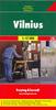
Vilnius And Environs

Vilnius and Environs at 1:100, 000 in a series GPS compatible regional maps of Lithuania from Alma Littera prominently highlighting each area’s best sights and showing a wide range of other places of interest including campsites. Main roads are graded according to the speed limit; regional and local roads indicate asphalted or gravel routes. Driving distances are marked on main and selected regional routes, and locations of petrol stations and border crossings are marked. Railway lines are shown with stations. Important sights are prominently highlighted and a very wide range of symbols indicate various places of interest, including campsites, historical and industrial heritage, archaeological and natural sites, etc.The maps also indicate hiking, cycling and kayaking routes.
Topography is shown by contours and spot heights, plus colouring and/or graphics for different types of the terrain and vegetation, e.g. swamps, peat bog, orchards, forests, etc. The maps have latitude and longitude lines at 5’ and 10’ respectively. Map legend includes English.Each title comes with a booklet attached to the map cover providing descriptions of places of interest, but the text here is in Lithuanian only.
RIP - This product is no longer available on our network. It was last seen on 25.09.2019

This page now acts as a permanent archive for this product. Add more information using the comments box below to ensure it can still be found by future generations.

Use our search facility to see if it is available from an alternative contributor.
  • External links may include paid for promotion
  • Availability: Out Of Stock
  • Supplier: Stanfords
  • SKU: 9786090103807
Availability: In Stock
£9.95

Product Description

Vilnius & Environs at 1:100, 000 in a series GPS compatible regional maps of Lithuania from Alma Littera prominently highlighting each area’s best sights & showing a wide range of other places of interest including campsites. Main roads are graded according to the speed limit; regional & local roads indicate asphalted or gravel routes. Driving distances are marked on main & selected regional routes, & locations of petrol stations & border crossings are marked. Railway lines are shown with stations. Important sights are prominently highlighted & a very wide range of symbols indicate various places of interest, including campsites, historical & industrial heritage, archaeological & natural sites, etc. The maps also indicate hiking, cycling & kayaking routes. Topography is shown by contours & spot heights, plus colouring and/or graphics for different types of the terrain & vegetation, e.g. swamps, peat bog, orchards, forests, etc. The maps have latitude & longitude lines at 5’ & 10’ respectively. Map legend

Includes::
English. Each title comes with a booklet attached to the map cover providing descriptions of places of interest, but the text here is in Lithuanian only.

Reviews/Comments

Add New

Intelligent Comparison

Oooops!
We couldn't find anything!
Perhaps this product's unique.... Or perhaps we are still looking for comparisons!
Click to bump this page and we'll hurry up.

Price History

Vouchers

No voucher codes found.
Do you know a voucher code for this product or supplier? Add it to Insights for others to use.

Facebook

Jargon Buster

GPS - Global Positioning System - Global position using satellites
Hiking - An outdoor activity envolving walking in nature
Graphics - A general term for visual aspects of an item/display
Gravel - A size of rock between 2mm and 64mm
speed - A measurement of how fast an object travels between two points
Natural - not manmade
Wide - Something with a large width.
Regional - An adjective to describe a set geographic area.

Supplier Information

Stanfords
Stanfords was established in 1853 and opened their iconic Covent Garden flagship store in 1901. They have become the top retailer of maps, travel books and accessories in the UK and arguably offer the largest selection of maps and travel books worldwide. Famous names such as Captain Robert Falcon Scott, Ranulph Fiennes and Michael Palin have purchased from Stanfords. They now have a shop in Bristol and both stores together with other venues operate a calendar of events including talks, book signings and exhibitions. As a specialist map retailer, the map selection is comprehensive and includes road maps, street maps and walking maps from worldwide destinations, as well as a selection of world atlases and wall maps. Books include travel guides and travel literature. Stanfords also stock globes, from miniatures made of blue marble to magnificent floor-standing globes. The website features a selection of interesting articles on travel topics.
Page Updated: 2023-11-12 20:15:36

Community Generated Product Tags

Oh No! The productWIKI community hasn't generated any tags for this product yet!
Menu