More From Contributor
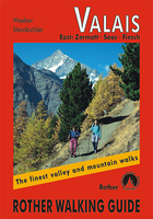
£19.99
The mountains of the Swiss canton of Valais / Wallis on a contoured & GPS compatible map at 1:120, 000 from Kümmerly + Frey, useful for planning walking holidays by indicating access to hiking trails by public transport. Coverage

Includes::
the Mattertal with Zermatt, Randa & St. Niklaus, the Saastal with Saas-Fee, also Arolla, Evolène, etc. The map shows the Tour of Monte Rosa, the western part of the Alpine Pass Route, the local section of Via Francigena, & several other long-distance footpaths. Maps in Kümmerly + Frey‘s Holiday Series have contours at 100-metre intervals, enhanced by shading & graphic relief to provide a vivid presentation of the terrain. An overprint highlighting walking trails distinguishes between hiking paths, more strenuous mountain routes & alpine sections. Symbols indicate locations of mountain huts, Friends of Nature houses, youth hostels, campsites & selected isolated inns, interesting natural curiosities, etc. Picturesque towns or villages are prominently highlighted & the maps also show roads with public transport facilities plus, of course, railways & all forms of mountain transport (cable cars, chair lifts, etc). The maps have Swiss national grid lines at 5km intervals. Map legend

Includes::
English. To see the list of titles in this series please click on the series list.


...
Archived Product
£8.99
Beautiful panorama drawing of the canton, viewed looking southwards from the peaks of the Bernese Oberland across the Rhone Valley towards the highest part of the Swiss Alps, with the Italian & French Alps in the background. Each valley & mountain is clearly visible. Names & altitude are indicated for numerous peaks. The map also shows the railway network, with towns & villages. Excellent for planning or retracing journeys across this wonderful landscape. ...
Archived Product
£20.99
Swiss canton of Valais / Wallis on a Swiss topographic survey map at 1:100, 000. Coverage extends from Chamonix & Mont Blanc eastwards to include many of the most popular destinations in the Swiss Alps: the Mattertal with Zermatt, Randa & St. Niklaus, Saas Fee, Verbier, Crans-Montana, the peaks of Matterhorn, Dom with the Michabel range, Monte Rosa, Simplon Pass, etc. Current 2015 edition of this title has the lines of the Swiss National Grid at 1km intervals. Maps in the Swiss topographic survey at 1:100, 000 from Swisstopo are highly regarded for their superb use of graphic relief & hill shading, presenting an almost 3-D picture of the country`s mountainous terrain. Coverage is available either as small size standard sheets – Nos 26 to 48, each covering 70 x 48 km / 43 x 30 miles approx, or as larger size maps
- Nos. 101 onwards, each covering 100 x 70 km / 62 x 43 miles approx. Both formats have identical cartography, with contours at 50-metres intervals. Standard sheets include margin ticks showing latitude & longitude in steps of 10`, & both formats have an overprint showing the Swiss national grid lines at 10km intervals; latest editions of the larger sheets now have the Swiss grid lines at 1km intervals. Standard sheets have a map legend in the language of the area covered by the map. The larger sheets have no legend but a separate “ Conventional Signs” leaflet, in English, can be provided with the map. To see the list of titles in this series please click on the series link.
...
Archived Product
£19.50
Selected climbs in the western part of the Valais Alps, where there are many peaks between 3000-4000m & some, like the Matterhorn, over 4000m. Routes described are of all grades, from easy to extremely difficult, on snow, ice & rock.

Includes::
97 photographs of mountains with routes overlaid. This volume replaces Collomb's Pennine Alps west (1979) & part of his Pennine Alps Central (1975). About this series: Compact & portable mountain climbing guides. Each guide is organized by mountain group, with individual ascents described & graded by difficulty. Photographs are included, with recommended routes superimposed. General information is also included about the local area. Vinyl covered for durability.

...
Archived Product
£19.99
The new Supertrail Maps show the best singletrails in Europe’s hottest mountain bike spots. These unique topographic maps make the knowledge of locals available to other mountain bikers. Consistent difficulty rating & useful additional information prevent the user from critical situations on the trails. The best singletrails in the best mountain bike spots throughout Europe
- this is the convincing formula of the brand new Supertrail Maps. For the first time ever, these unique topographic maps make the knowledge of locals available to others. All the trails on a map have been biked & rated in five difficulty levels for up- & downhill separately by specially trained authors. This consistent rating facilitates tour planning & spares a user from getting into sketchy situations on the trails. In addition to the difficulty rating, extraordinary nice trails are marked with a «highlight»-pictogram. The maps in a scale of 1:50 000 show all information required for tour planning & orienting oneself on the trails, such as: difficulty, highlight-trails, mountain railways with mountain bike transport, mountain bike shuttles, dangerous falls, restaurants, bike shops, emergency numbers & touristic infopoints. Thanks to the especially chosen map section, one map covers the whole area. The Supertrail Maps are printed on tear- & waterproof foil which makes them very sturdy. On the back of any map, additional information about the area & the use of a Supertrail Map are presented in two languages. Folded

Dimensions of 10x 15cm allow the map to fit into any pocket without squeezing.


...
Archived Product
£17.95
The Pennine Alps in the Valais region of Switzerland contain more 4000m peaks than anywhere else in Western Europe & some of the greats: the Matterhorn, Monte Rosa, Dent Blanche & Grand Combin, all surrounded by idyllic valleys & hillsides dotted with chalets, hay barns & hardy little alpine flowers as well as pristine snowfields & glaciers. This guide describes 111 day walks & 10 multi-day, long-distance treks, exploring this whole area & suitable for a wide range of abilities. The network of walking trails in this popular region is excellent but the infrastructure is unbeatable, with excellent public transport & a wide range of good-quality accommodation from simple mountain huts to grand hotels in bases such as Saas Fee, Zermatt & Arolla. Walks are arranged valley by valley & accompanied by full information about the valley bases, mountain huts, access & facilities as well as practical information for walkers new to trekking or walking in Switzerl&. ...
Archived Product
£12.99
The Valais guide gives a new view of the unknown & unusual Canton of Valais Switzerl&. Most people have heard of the famous resorts of Zermatt, Verbier, Saas-Fee & Crans Montana, but few know about the rest. Besides the best Swiss wines & alpine cheeses, it has black & white goats, mineral deposits, masked wild beast carnival costumes & a strong link with the British who conquered every peak in sight in the 19th century, Cultural activities include exhibitions at Pierre Gianadda foundation, treasures at St. Maurice Abbey, music festivals & museums in Sion, the oldest town in Switzerl&. This guide is aimed at families & shows the affordable side of Switzerl&. ...
Archived Product
£18.95
Map No. 105, Valais/ Wallis, in the Swiss topographic survey at 1:100, 000 published in 23 standard sheets (Nos. 26
- 48),
...
Archived Product
£13.99
Map No. 92, Chiavenna
- Val Bregaglia, from Kompass printed on sturdy waterproof & tear-resistant synthetic paper in a series
...
Archived Product
£6.95
Topographic coverage of mainland Spain at 1:50, 000 in the MTN50 (Mapa Topográfico Nacional) series from the Centro Nacional de Información Geografica, the country’s civilian survey organization. The maps have contours at 20m intervals, enhanced by relief shading, plus colouring and/or graphics to show different types of terrain, vegetation or land use. Boundaries of national parks & other protected areas are marked. In addition to all the usual information featured on topographic mapping at this scale, detailed presentation of the road & rail networks, rural tracks & paths, etc, the maps also show campsites & mountain refuges. On more recent editions some GRs, the official long-distance hiking routes, are also marked (although not as clearly as on hiking maps from other publishers). Each map covers 29.5x 18.5 km (with adjustments in the border or coastal areas). The maps have a 1-km UTM grid, plus margin ticks for latitude & longitude at 1` intervals. Map legend is in Spanish only.HOW TO CHOOSE THE RIGHT 50K MAP: all the titles in CNIG’s 200K Provincial Road Maps series at 1:200, 000 are overprinted with the grid for the 1:50, 000 maps & can be used to see the area covered by each 50K title. TO SEE THE LIST OF TITLES IN THIS SERIES PLEASE CLICK ON THE SERIES LINK.PLEASE NOTE
- MAP TITLES: the grids shown on our website serve both the civilian & the military 1:50, 000 topographic series. Although the areas covered by maps in both series are identical (apart from some border or coastal sheets), occasionally map titles differ – only one title is shown on the grid, usually the military one. In Galicia, the Basque country & in the Catalan speaking areas the tendency now is to use local place names rather than the often better known Castilian ones. Where possible, both versions are included in our titles. Map titles listed on our website are based on information received by us at the time of publication, but sometimes maps arrive showing a completely different title! As long as the map number is as ordered, the correct map has been supplied.
...
Archived Product

Valais East

About this series:Rother Walking Guides were first published in 1920- since then Bergverlag Rother have continued to produce these comprehensive guides to “the finest valley and mountain walks”.Each book has a detailed description of walks, small walking maps and many tips on combining the walks, places of interest, accommodation and public transport; the guides are all in full colour with varying scales and types of cartography - the walks themselves vary from day-long hikes to mountain and valley walks, with varying levels of ease and difficulty indicated.Small enough to fit in your pocket, comprehensive enough to take you everywhere; the books are printed in paperback but with a polytex-laminated cover, making them extremely durable too.
RIP - This product is no longer available on our network. It was last seen on 25.09.2019

This page now acts as a permanent archive for this product. Add more information using the comments box below to ensure it can still be found by future generations.

Use our search facility to see if it is available from an alternative contributor.
  • External links may include paid for promotion
  • Availability: Out Of Stock
  • Supplier: Stanfords
  • SKU: 9783763348060
Availability: In Stock
£15.99

Product Description

About this series: Rother Walking Guides were first published in 1920- since then Bergverlag Rother have continued to produce these comprehensive guides to “the finest valley & mountain walks”. Each book has a detailed description of walks, small walking maps & many tips on combining the walks, places of interest, accommodation & public transport; the guides are all in full colour with varying scales & types of cartography
- the walks themselves vary from day-long hikes to mountain & valley walks, with varying levels of ease & difficulty indicated. Small enough to fit in your pocket, comprehensive enough to take you everywhere; the books are printed in paperback but with a polytex-laminated cover, making them extremely durable too.

Reviews/Comments

Add New

Intelligent Comparison

Oooops!
We couldn't find anything!
Perhaps this product's unique.... Or perhaps we are still looking for comparisons!
Click to bump this page and we'll hurry up.

Price History

Vouchers

No voucher codes found.
Do you know a voucher code for this product or supplier? Add it to Insights for others to use.

Facebook

Jargon Buster

Colour - The categorised spectrum of light visable to humans
Day - The time it takes a planet or other space objects to complete one rotation.
Small - something that takes up less space than normal.
Accommodation - A room in which someone can live in, for example in a hotel
Pocket - A bag shaped insert in clothing used to carry items
Laminated - A thin layer of plastic that gives a coating and shine to a material.
Transport - Something that carries people or goods.

Supplier Information

Stanfords
Stanfords was established in 1853 and opened their iconic Covent Garden flagship store in 1901. They have become the top retailer of maps, travel books and accessories in the UK and arguably offer the largest selection of maps and travel books worldwide. Famous names such as Captain Robert Falcon Scott, Ranulph Fiennes and Michael Palin have purchased from Stanfords. They now have a shop in Bristol and both stores together with other venues operate a calendar of events including talks, book signings and exhibitions. As a specialist map retailer, the map selection is comprehensive and includes road maps, street maps and walking maps from worldwide destinations, as well as a selection of world atlases and wall maps. Books include travel guides and travel literature. Stanfords also stock globes, from miniatures made of blue marble to magnificent floor-standing globes. The website features a selection of interesting articles on travel topics.
Page Updated: 2023-11-12 20:15:36

Community Generated Product Tags

Oh No! The productWIKI community hasn't generated any tags for this product yet!
Menu