
 United Kingdom
 France
 Germany
 Netherlands
 Sweden
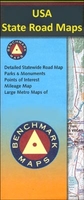
 USA
USA
 Italy
Italy
 Spain
Spain
More From Contributor
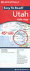

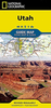

Utah Recreational Map
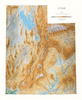
Utah at 1:730, 000 in a series of very detailed state maps of the western states of USA from Benchmark Maps designed to highlight national/state parks or forests and other protected areas, and to provide information on recreational possibilities, campgrounds and RV parks, etc.The base map is derived from satellite imagery to show the topography, with plenty of names of individual mountain ranges, peaks, valleys, etc. Colouring is used to distinguish between various types of protected areas and land in public ownership, from BLM (Bureau of Land Management) lands to wilderness or wildlife areas. Indian Reservations and military zones are also marked. Some titles also provide additional information such as the numbering of hunting zones, etc.Road network indicates tracks requiring
high clearance or 4WD vehicles. A very wide range of symbols identifies recreational possibilities and indicates locations of campgrounds and RV parks, trailheads, various places of interest, etc. The maps have no geographical coordinates.IN THIS TITLE: on the reverse is an enlargement of Salt Lake City and Vicinity, an index of towns and cities, plus the following with contact details:- an extensive list campgrounds- lists of protected areas and recreational possibilities including state/national parks and monuments, forests and wildlife areas, ski areas and snowparks, boating and fishing locations- lists of other useful organizations
high clearance or 4WD vehicles. A very wide range of symbols identifies recreational possibilities and indicates locations of campgrounds and RV parks, trailheads, various places of interest, etc. The maps have no geographical coordinates.IN THIS TITLE: on the reverse is an enlargement of Salt Lake City and Vicinity, an index of towns and cities, plus the following with contact details:- an extensive list campgrounds- lists of protected areas and recreational possibilities including state/national parks and monuments, forests and wildlife areas, ski areas and snowparks, boating and fishing locations- lists of other useful organizations
Product Description
Reviews/Comments
Add New
Intelligent Comparison
Archived Product

Utah Recreational Map Stanfords
£9.99
Archived Product

Utah Recreational Map Stanfords
£6.99
Archived Product
Idaho Recreational Map Stanfords
£11.95
Archived Product
Idaho Recreational Map Stanfords
£9.99
Archived Product
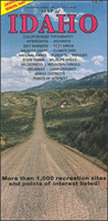
Idaho Recreational Map Stanfords
£6.25
Archived Product
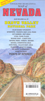
Nevada Recreational Map Stanfords
£6.99
Archived Product
Arizona Recreational Map Stanfords
£6.99
Archived Product
Colorado Recreational Map Stanfords
£6.99
Vouchers
No voucher codes found.
Do you know a voucher code for this product or supplier? Add it to Insights for others to use.
Do you know a voucher code for this product or supplier? Add it to Insights for others to use.
 Denmark