
 United Kingdom
 France
 Germany
 Netherlands
 Sweden
 USA
USA
 Italy
Italy
 Spain
Spain
More From Contributor

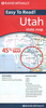

Utah NGS Guide Map
National Geographic`s Utah Guide Map is designed to meet the needs of all travelers with by combining a detailed and accurate road map with and an expertly researched travel guide. Find your destination quickly using the user friendly index of cities and towns. Then plan your route on the comprehensive road map, complete with road designations, mileage markers and pinpointed national and state parks, national forests, campsites, ski areas, hospitals, airports and other points of interest.Inset maps of Ogden, Logan, Salt Lake City, Provo provide additional detail of these popular cities. While inset maps and travel information are given for Utah 12 Scenic Byway and Zion, Arches and Bryce Canyon National Parks. An overview of popular points of interest, a calendar of events and a
national park service chart are all provided along with relevant contact information.Every State Guide Map is printed on durable synthetic paper, making them waterproof, tear-resistant and tough — capable of withstanding the rigors of any kind of travel.
national park service chart are all provided along with relevant contact information.Every State Guide Map is printed on durable synthetic paper, making them waterproof, tear-resistant and tough — capable of withstanding the rigors of any kind of travel.

Product Description
Reviews/Comments
Add New
Vouchers
No voucher codes found.
Do you know a voucher code for this product or supplier? Add it to Insights for others to use.
Do you know a voucher code for this product or supplier? Add it to Insights for others to use.
 Denmark