
 United Kingdom
 France
 Germany
 Netherlands
 Sweden
 USA
USA
 Italy
Italy
 Spain
Spain
More From Contributor


Ushuaia Trekking Map
Detailed topographic map of the environs of Ushuaia, including the Tierra del Fuego National Park, with a street plan of Ushuaia and an enlargement for the nearby ski circuit.The map uses satellite imagery as its base, overprinted with contours at 40m intervals, plus hill shading, spot heights and names of local peaks, valleys, etc. Coverage extends from the Beagle Channel in the south to Lago Fagnano in the north, and from the Chile/Argentina border in the west to Sierra Alvear and Sierra Sorondo in the east.Roads, tracks and trekking trails are clearly marked, and tourist railways, cable lifts and airstrips are also shown. National park boundaries and other restricted areas are indicated, and various symbols mark campsites, piers, ranger stations, lighthouses, ski areas,
etc. Latitude and longitude lines are drawn at 2` and 3` intervals respectively. Map legend includes English.Also included is street plan of Ushuaia and an enlargement at 1:7, 000 showing a nearby cross-country Francisco Jerman ski circuit with a profile of the route.
etc. Latitude and longitude lines are drawn at 2` and 3` intervals respectively. Map legend includes English.Also included is street plan of Ushuaia and an enlargement at 1:7, 000 showing a nearby cross-country Francisco Jerman ski circuit with a profile of the route.

Product Description
Reviews/Comments
Add New
Intelligent Comparison
Archived Product
Patagonia Trekking Map Stanfords
£14.99
Archived Product
Bhutan Himalaya Trekking Map Stanfords
£13.25
Archived Product
Bhutan Himalaya Trekking Map Stanfords
£17.50
Archived Product
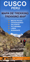
Cusco Trekking Map Stanfords
£12.99
Archived Product

Tsum Valley Trekking Map Stanfords
£9.99
Vouchers
No voucher codes found.
Do you know a voucher code for this product or supplier? Add it to Insights for others to use.
Do you know a voucher code for this product or supplier? Add it to Insights for others to use.
 Denmark