More From Contributor
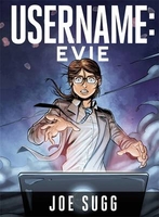
£6.95
Topographic coverage of mainland Spain at 1:50, 000 in the MTN50 (Mapa Topográfico Nacional) series from the Centro Nacional de Información Geografica, the country’s civilian survey organization. The maps have contours at 20m intervals, enhanced by relief shading, plus colouring and/or graphics to show different types of terrain, vegetation or land use. Boundaries of national parks & other protected areas are marked. In addition to all the usual information featured on topographic mapping at this scale, detailed presentation of the road & rail networks, rural tracks & paths, etc, the maps also show campsites & mountain refuges. On more recent editions some GRs, the official long-distance hiking routes, are also marked (although not as clearly as on hiking maps from other publishers). Each map covers 29.5x 18.5 km (with adjustments in the border or coastal areas). The maps have a 1-km UTM grid, plus margin ticks for latitude & longitude at 1` intervals. Map legend is in Spanish only.HOW TO CHOOSE THE RIGHT 50K MAP: all the titles in CNIG’s 200K Provincial Road Maps series at 1:200, 000 are overprinted with the grid for the 1:50, 000 maps & can be used to see the area covered by each 50K title. TO SEE THE LIST OF TITLES IN THIS SERIES PLEASE CLICK ON THE SERIES LINK.PLEASE NOTE
- MAP TITLES: the grids shown on our website serve both the civilian & the military 1:50, 000 topographic series. Although the areas covered by maps in both series are identical (apart from some border or coastal sheets), occasionally map titles differ – only one title is shown on the grid, usually the military one. In Galicia, the Basque country & in the Catalan speaking areas the tendency now is to use local place names rather than the often better known Castilian ones. Where possible, both versions are included in our titles. Map titles listed on our website are based on information received by us at the time of publication, but sometimes maps arrive showing a completely different title! As long as the map number is as ordered, the correct map has been supplied.
...
Archived Product
£10.99
Usedom
- Stettiner Haff on a waterproof, tear-resistant, GPS compatible cycling map at 1:100, 000 from the ADFC (Allgemeiner
...
Archived Product
£13.99
The islands of Usedom & Wolin on a double-sided, detailed, contoured & GPS compatible map at 1:50, 000 from Kompass with local & long-distance footpaths, cycling routes, accommodation, etc. printed on durable, waterproof & tear-resistant synthetic paper. The map

Includes::
street plans of the German resorts of Zinnowitz, Bansin, Heringsdort & Alhbeck, plus of the Polish town of Swinoujscie.KOMPASS HIKING & RECREATIONAL MAPS: this title is part of an extensive series covering Austria, much of Germany & the Slovenian Alps – TO SEE OTHER TITLES IN THIS SERIES PLEASE CLICK ON THE SERIES LINK. Kompass are Europe’s largest publishers of hiking maps; their mapping of other countries, including expanding coverage of Italy, is listed on our website separately.CARTOGRAPHY: the maps are contoured with additional shading, graphic relief & colouring to provide a more detailed picture of the terrain, vegetation and/or land use. Contour interval varies from 10m in the coastal areas of Northern Germany to 40 or 50 metres in the mountainous regions. All the maps highlight local & long-distance waymarked footpaths, including climbing trails. Most titles also show cycling routes, mountain bike trails, &, the in mountainous areas, ski routes. The maps indicate various types of accommodation (selected inns & hotels, youth hostels, campsites, mountain refuges), as well as recreational facilities, places of interest, etc. Latest editions also show access by public transport with bus stops and/or Park+ Ride facilities.GEOGRAPHICAL COORDINATES: unless indicated to the contrary in the individual description, the maps have a UTM grid for GPS users. MAP LEGEND: most maps now include full English legend, particularly titles covering the Alpine areas. Some maps covering mainly eastern Austria or the less popular parts of Germany may still have a legend in German only.OTHER

Features:
selected titles include on the reverse panorama drawings of their area with names of villages, peaks, valleys, etc. and/or have a booklet with pictures of local wild flowers with their Latin names. Many titles are now published as competitively priced sets of two or more maps, offering a wider coverage.BOOKLETS: PLEASE NOTE BEFORE ORDERING
- many titles come with a booklet describing the area and/or various hiking routes. Unless indicated in the individual description that the booklet

Includes::
English, these booklets are IN GERMAN only. The booklets are not necessary to use the maps since, as stated above, full English language map legend is provided.


...
Archived Product
£8.95
Map No. 738, Usedom & Wolin, in a series of hiking maps from Kompass providing extensive coverage of Austria & Germany plus the Slovenian Alps, with hiking routes on a topographic base, various types of accommodation, recreational facilities, places of interest, etc. Many titles are now published as competitively priced sets of two or more maps, offering a wider coverage. Kompass are Europe ...
Archived Product
£12.99
Usedom Island on the Baltic coast of Germany at 1:50, 000 from Kümmerly+ Frey in a series GPS compatible, double-sided maps printed on durable, waterproof & tear-resistant plastic paper; contoured, with hiking & cycle routes, other recreational activities, etc. An inset extends coverage to the Wolin Island in Pol&. Maps in this series are at a scale of either 1:50, 000 or 1:35, 000. Contour interval varies from 10m to 40m according to the area &, where appropriate, the maps have finely drawn additional graphic relief to provide an excellent representation of the terrain, with plenty of names of peaks, valleys, etc, national parks or other protected areas, plus colouring/graphics indicating different types of vegetation. An overprint, graded according to the difficulty of the route, highlights hiking trails indicating their waymarking. Also marked are local & long-distance cycle routes, plus a selection of mountain-bike trails, cross-country & alpine ski routes & horse-riding paths. A wide range of symbols indicate locations for other outdoor activities: climbing, paragliding, toboggan runs, sailing or surfing, etc. Also marked are various sport facilities, different types of accommodations including alpine huts, campsites, youth hostels, sites of botanical or cultural interest, etc. For access the maps show local bus stops, car parks/park+ride facilities, roads with entry restrictions, etc. The maps have a 1km UTM grid. Map legend

Includes::
English. Each title also provides a road map of the region around the area covered by it. To see the complete list of titles in this series please click on the series link.

...
Archived Product
£9.95
Barisakho
- Roshka
- Juta
- Asa Gorge area at 1:50, 000 in a series of detailed, double-sided, GPS compatible, contoured


...
Archived Product
£9.99
Ushguli
- Lashkheti
- Mt. Shkhara area of the Caucasus Mountains in Georgia at 1:50, 000 on a double-sided, contoured & GPS

...
Archived Product
£10.99
This map is intended as a souvenir log map for visitors to Antarctica, starting off from Ushuaia. Approx. centred on Drakes Passage, it covers Tierra del Fuego at the southern end of South America, the Falkland Islands, the South Sandwich Islands, South Georgia, & the Antarctic Peninsula as far south as 70°. Latitude & longitude lines are drawn at 10° & 15° intervals respectively, subdivided with further margin ticks at 6’ intervals. This is not a navigational chart but is partially derived from hydrographic data & shows depth soundings over much of the expanse of ocean. Decorative symbols highlight whaling stations, shipwrecks, scientific stations & museums, & small photos depict ships associated with expeditions in the region. ...
Archived Product
£12.99
Detailed topographic map of the environs of Ushuaia, including the Tierra del Fuego National Park, with a street plan of Ushuaia & an enlargement for the nearby ski circuit. The map uses satellite imagery as its base, overprinted with contours at 40m intervals, plus hill shading, spot heights & names of local peaks, valleys, etc. Coverage extends from the Beagle Channel in the south to Lago Fagnano in the north, & from the Chile/ Argentina border in the west to Sierra Alvear & Sierra Sorondo in the east. Roads, tracks & trekking trails are clearly marked, & tourist railways, cable lifts & airstrips are also shown. National park boundaries & other restricted areas are indicated, & various symbols mark campsites, piers, ranger stations, lighthouses, ski areas, etc. Latitude & longitude lines are drawn at 2` & 3` intervals respectively. Map legend

Includes::
English. Also included is street plan of Ushuaia & an enlargement at 1:7, 000 showing a nearby cross-country Francisco Jerman ski circuit with a profile of the route.

...
Archived Product
£11.50
Topographic survey of France at 1:25, 000 in IGN`s excellent TOP25 / Série Bleue series. All the maps are GPS compatible, with a 1km UTM grid plus latitude & longitude lines at 5’ intervals. Contours are at 5m intervals except for mountainous areas where the maps have contours at 10m intervals, vividly enhanced by hill shading & graphics for rocky terrain. Colouring with graphics indicates different types of vegetation or land use (deciduous or coniferous forests, moors, orchards, vineyards, etc). PLEASE NOTE: coverage of France at this scale is currently being revised – the format & the presentation of each title are indicated by the letters at the end of its Sheet Reference number (e.g. 0416ET, 3531ETR, 1923SB, etc.)MAPS WITH FULL TOURIST OVERPRINT & AN ENGLISH MAP LEGEND: all TOP25 maps & the SB editions of Série Bleue have an overprint highlighting waymarked walking trails including long-distance GR routes &, where appropriate, ski routes. Symbols indicate campsites, gîtes d’etape, refuges, equestrian centres & other recreational facilities or sites, tourist information centres, cultural heritage, etc. Towns & locations of particular interest are highlighted.- ET or OT = single-sided TOP25 map covering approx. 29x 21 km / 18x 13 miles.- ETR or OTR = waterproof & tear resistant TOP25 map covering the same area as the corresponding ET or OT number, but double-sided, printed on a smaller size sheet with a good overlap between the sides.- SB = Série Bleue map with full tourist overprint; these maps, first introduced in summer 2014, each cover approx. 29x 24km / 18x 15 miles.SÉRIE BLEUE maps with numbers ending in E (Est) or O (Ouest): most editions now indicate the GR routes, but do not show any other tourist information. Map legend is in French only. Each map covers approx. 14x 20km / 9x 12 miles. ...
Archived Product

Username: Evie

Like anyone who feels as though they just don`t fit in, Evie dreams of a place of safety. When times are tough, all she wants is a chance to escape from reality and be herself. Despite his failing health, Evie`s father comes close to creating such a virtual idyll. Passing away before it`s finished, he leaves her the key in the form of an app, and Evie finds herself transported to a world where the population is influenced by her personality. Everyone shines in her presence, until her devious cousin, Mallory, discovers the app...and the power to cause trouble in paradise.
RIP - This product is no longer available on our network. It was last seen on 25.09.2019

This page now acts as a permanent archive for this product. Add more information using the comments box below to ensure it can still be found by future generations.

Use our search facility to see if it is available from an alternative contributor.
  • External links may include paid for promotion
  • Availability: Out Of Stock
  • Supplier: Stanfords
  • SKU: 9781473619135
Availability: In Stock
£14.99

Product Description

Like anyone who feels as though they just don`t fit in, Evie dreams of a place of safety. When times are tough, all she wants is a chance to escape from reality & be herself. Despite his failing health, Evie`s father comes close to creating such a virtual idyll. Passing away before it`s finished, he leaves her the key in the form of an app, & Evie finds herself transported to a world where the population is influenced by her personality. Everyone shines in her presence, until her devious cousin, Mallory, discovers the app...and the power to cause trouble in paradise.

Reviews/Comments

Add New

Intelligent Comparison

Oooops!
We couldn't find anything!
Perhaps this product's unique.... Or perhaps we are still looking for comparisons!
Click to bump this page and we'll hurry up.

Price History

Vouchers

No voucher codes found.
Do you know a voucher code for this product or supplier? Add it to Insights for others to use.

Facebook

Jargon Buster

Key - A physical or virtual device or code used for opening something
World - A physical grouping, commonly used to describe earth and everything associated with ti
Safety - prevents damage being caused.

Supplier Information

Stanfords
Stanfords was established in 1853 and opened their iconic Covent Garden flagship store in 1901. They have become the top retailer of maps, travel books and accessories in the UK and arguably offer the largest selection of maps and travel books worldwide. Famous names such as Captain Robert Falcon Scott, Ranulph Fiennes and Michael Palin have purchased from Stanfords. They now have a shop in Bristol and both stores together with other venues operate a calendar of events including talks, book signings and exhibitions. As a specialist map retailer, the map selection is comprehensive and includes road maps, street maps and walking maps from worldwide destinations, as well as a selection of world atlases and wall maps. Books include travel guides and travel literature. Stanfords also stock globes, from miniatures made of blue marble to magnificent floor-standing globes. The website features a selection of interesting articles on travel topics.
Page Updated: 2023-11-12 20:15:36

Community Generated Product Tags

Oh No! The productWIKI community hasn't generated any tags for this product yet!
Menu