
 United Kingdom
 France
 Germany
 Netherlands
 Sweden
 USA
USA
 Italy
Italy
 Spain
Spain
More From Contributor


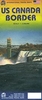

US Rocky Mountains ITMB
Rocky Mountains in the USA on an indexed, double-sided map from ITMB at 1:1, 000, 000 with altitude colouring to show the topography. Coverage extends from the Canadian border across most of Idaho and parts of Montana, Wyoming, Utah and Colorado to Albuquerque in New Mexico. Peak heights are given in feet.The map shows the region’s road network with highlighting for national/state parks and forests, Indian Reservations and restricted entry military zones. Symbols indicate various facilities and places of interest, including local airports, campsites and ranger stations, Spanish missions, etc. Latitude and longitude lines are drawn at 1º intervalsTo see other regional maps of USA from ITMB please click on the series link

Product Description
Reviews/Comments
Add New
Vouchers
No voucher codes found.
Do you know a voucher code for this product or supplier? Add it to Insights for others to use.
Do you know a voucher code for this product or supplier? Add it to Insights for others to use.
 Denmark