
 United Kingdom
 France
 Germany
 Netherlands
 Sweden
 USA
USA
 Italy
Italy
 Spain
Spain
More From Contributor


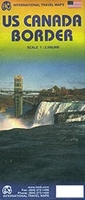
US/Canada Border ITMB
The regions adjoining border between USA and Canada on a double-sided, indexed road map from ITBM with street plans of downtown Vancouver and Victoria, plus enlargements for the Seattle conurbation, Sault Ste. Marie region, Toronto, Chicago, the environs of Boston, and New York City.The map is double-sided, with a good overlap between the sides, and shows on one side the border along the 49th parallel, extending north within Canada to include most of the Jasper National Park, Edmonton and Lake Winnipeg. Coverage within USA stretches south to roughly Portland, OR and the southern border of North Dakota. Insets here show street plans of downtown Vancouver and Victoria on the Vancouver Island, plus an enlargement showing main traffic arteries within the Seattle conurbation.On the
reverse are the Great Lakes with the southern part of Quebec province along the St. Lawrence and the whole of New England extending south to New York City. Insets present the Sault Ste. Marie region, the environs of Boston and NYC with the adjoining parts of New Jersey, plus main traffic arteries across Toronto and Chicago. The main map presents the region’s road network, highlighting main highways and indicating toll roads, and clearly mark border crossing points. Each side of the map has a separate index.To see other regional titles from ITMB covering USA please click on the series link.
reverse are the Great Lakes with the southern part of Quebec province along the St. Lawrence and the whole of New England extending south to New York City. Insets present the Sault Ste. Marie region, the environs of Boston and NYC with the adjoining parts of New Jersey, plus main traffic arteries across Toronto and Chicago. The main map presents the region’s road network, highlighting main highways and indicating toll roads, and clearly mark border crossing points. Each side of the map has a separate index.To see other regional titles from ITMB covering USA please click on the series link.

Product Description
Reviews/Comments
Add New
Vouchers
No voucher codes found.
Do you know a voucher code for this product or supplier? Add it to Insights for others to use.
Do you know a voucher code for this product or supplier? Add it to Insights for others to use.
 Denmark